

48-Hour Rainfall Ending Nov. 2
The National Weather Service (NWS) office in Birmingham tweeted this graphic which quite nicely shows the rain that has fallen over Alabama during the last several days.
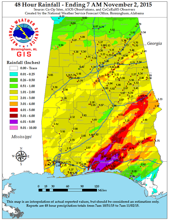
The graphic illustrates two important items. First, ALL of the state of Alabama has had rain – some more than others. Looks like the northwest corner was a little short changed in the amount of rain they recorded.
Second, this really illustrates how narrow the bands of highest rainfall can be. Note in the map that there is a band of 3 to 4 inch rain running from eastern Bibb County northeastward to the northeast corner of Calhoun County. That band does not appear to be more 5 to 6 miles wide. A second and heavier band of rain shows up in the Florida Panhandle and stretches across portions of Southeast Alabama. The band starts as fairly broad, but splits into two heavy bands with more than 4 inches across Southeast Alabama. Each of those prongs is very narrow, maybe 10 to 12 miles. I think this clearly illustrates how difficult it is to forecast the exact location of heavy rain – or heavy snow.
Special thanks to the folks at the NWS in Birmingham for creating and sharing the graphic.
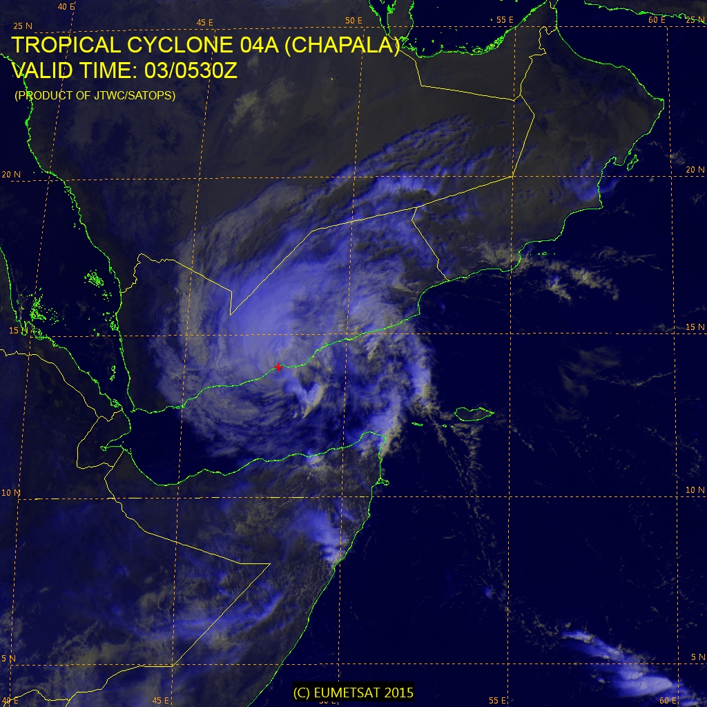
And for those who may have been following the record setting typhoon on the other side of the world, Chapala came ashore overnight on the coast of Yemen. Chapala is forecast to diminish fairly rapidly over the next 12 to 18 hours, but it will bring record rain to the western half of Yemen.
-Brian-
Category: Alabama's Weather, Tropical
About the Author (Author Profile)
Brian Peters is one of the television meteorologists at ABC3340 in Birmingham and a retired NWS Warning Coordination Meteorologist. He handles the weekend Weather Xtreme Videos and forecast discussion and is the Webmaster for the popular WeatherBrains podcast.Subscribe
If you enjoyed this article, subscribe to receive more just like it.


