

Clouds, Showers Hang Tough
Clouds are still thick across Central Alabama on this Sunday afternoon.
Oh, the sun isn’t far away. In fact, you quickly went to completely sunny just driving between Tupelo and New Albany along I-22 or between Decatur and Lewisburg, Tennessee late this morning.
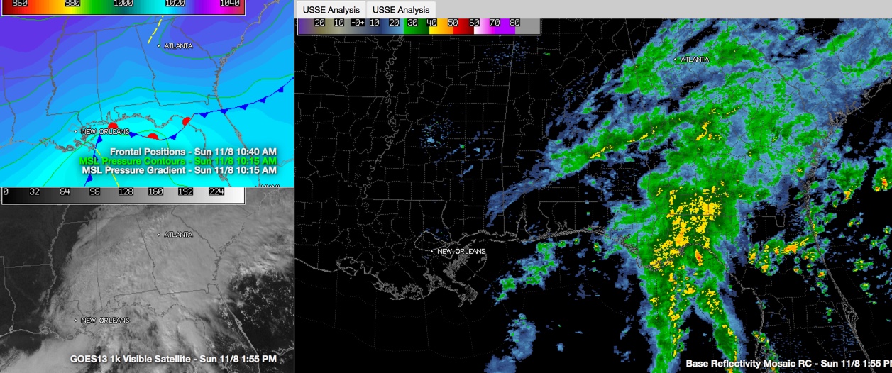
Clouds have been thinner north of I-20, but skies will probably remain mostly cloudy for much of the day. In fact, clouds are increasing this morning and rain is actually lifting back north out of South Central Alabama thanks to a minor surface low south of Pensacola. That surface low has no where to go, blocked by a huge surface high that is sprawling from the Ohio Valley all the way into the Atlantic.
The low will move slowly east northeast, pushing rain back over much of North and Central Alabama later today and tonight. The heaviest rain will stay over Southeast Alabama and will move into Georgia though, but rainfall amounts across Central Alabama will range from less than one quarter of an inch over West Alabama to over an inch near Auburn.
A flash flood watch is in effect over much of the Peach State, where 2-4 inches of rain could fall.
WHEN WILL IT END? The rain should start to diminish after midnight tonight, lifting out to the northeast. There will be a few leftover showers across the area on Monday, and it will be raw, with temperatures holding in the 50s all day no sunshine until late in the day.
Category: Alabama's Weather
About the Author (Author Profile)
Bill Murray is the President of The Weather Factory. He is the site's official weather historian and a weekend forecaster. He also anchors the site's severe weather coverage. Bill Murray is the proud holder of National Weather Association Digital Seal #0001 @wxhistorianSubscribe
If you enjoyed this article, subscribe to receive more just like it.


