

Could We Have Kate Tomorrow?
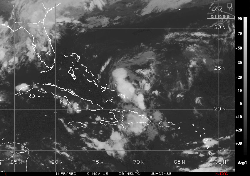
The National Hurricane Center (NHC) is watching an area of showers and thunderstorms associated with a small low pressure area located just east of the southern Bahama Islands. This area has shown some signs of becoming better organized since this morning, and forecasters have pegged the chance of formation through the next 48 hours at 80 percent. According to the Tropical Weather Outlook from NHC, it will not take much more organization for it to become a tropical depression or perhaps a tropical storm. Should it gain enough strength to become a storm, it would be given the name Kate.
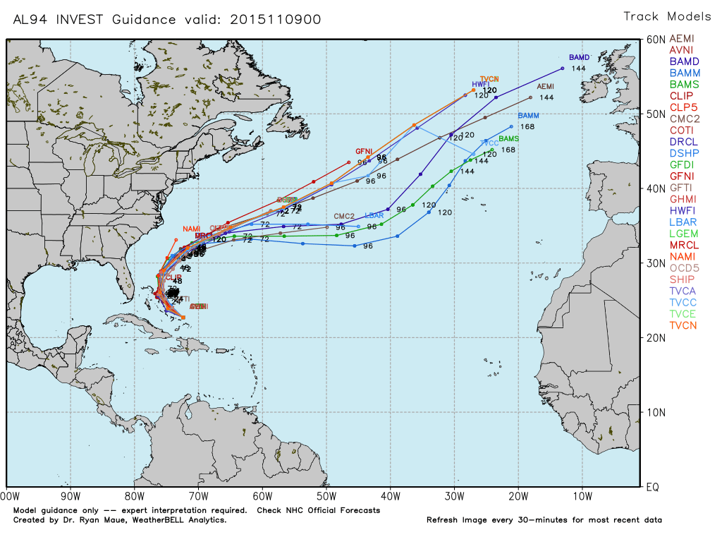
No matter what happens to it, heavy rainfall and gusty wind can be expected over portions of the Bahamas. An Air Force Reserve Hurricane Hunter aircraft is scheduled to investigate the system on Monday morning. The various computer model guidance, second graphic below, shows the disturbance is likely to move northwestward for the next day or so before beginning to recurve away from the US coast and out into the Atlantic where it would be a problem for shipping interests as well as the folks in Bermuda.
-Brian-
* * * U P D A T E * * *
At 9:00 pm CST, the National Hurricane Center issued an advisory on Tropical Depression 12. Thunderstorm activity has increased over the eastern portion of the circulation which has been enough to classify the system as a depression. A Hurricane Hunter aircraft will investigate the storm Monday morning providing NHC with much better information on the cyclone’s intensity. Initial NHC forecasts indicate that the system is likely to become a tropical storm in the next 24 hours.
Category: Tropical
About the Author (Author Profile)
Brian Peters is one of the television meteorologists at ABC3340 in Birmingham and a retired NWS Warning Coordination Meteorologist. He handles the weekend Weather Xtreme Videos and forecast discussion and is the Webmaster for the popular WeatherBrains podcast.Subscribe
If you enjoyed this article, subscribe to receive more just like it.


