

Chilly but Dry for the Weekend
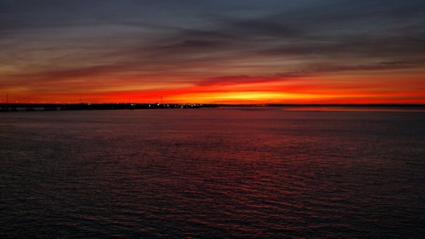
Alabamians are waking up to a clear, crisp morning with temperatures across North and Central Alabama in the mid 20s to the lower 30s. Our Skywatcher at Black Creek in Etowah County reported a low of 25 degrees and his temperature had been below freezing since 9 pm last night. The only clouds affecting Alabama could be seen in the morning sunrise from Mobile as seen in Jeffrey Middleton’s picture posted on Twitter.
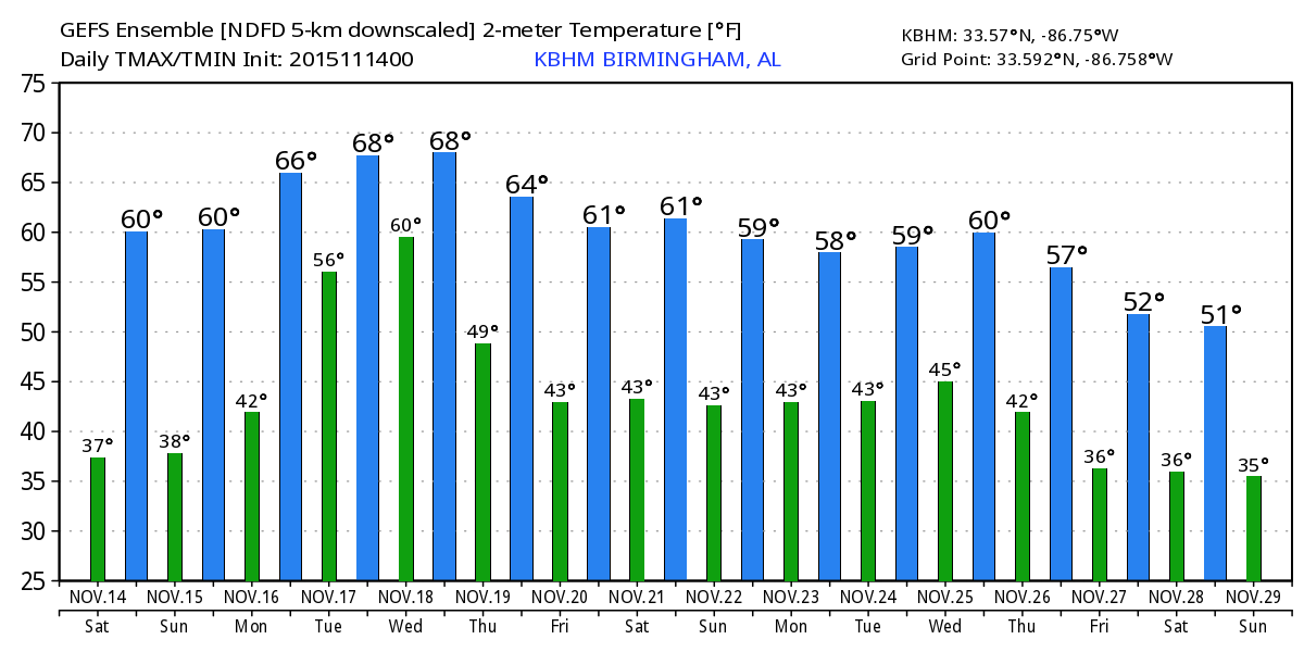
The sky will remain mostly clear today as Alabama enjoys another spectacular Fall day with highs climbing into the lower 60s across Central Alabama. The morning low in Birmingham is about 12 degrees below our 30-year average while our afternoon high is expected to be only about 3 to 4 degrees below the 30-year average.
This weather will be great for football. Auburn hosts Georgia at Jordan Hare Stadium with an 11:00 am CST kickoff; the sky will be sunny with temperatures rising from near 54 at kickoff to 58 by the final whistle. Alabama takes on Mississippi State in Starkville at Davis Wade Stadium at 2:30 pm; expect a sun filled sky with the temperature about 64 degrees at kickoff, but falling into the lower 50s by the fourth quarter.
The weather is also great for visiting the beach, though temperatures over the weekend will be a trifle cool. Look for sunny days, fair nights through the weekend and into the first of next week. Morning lows will dip to near 50 degrees over the weekend. See the complete Gulf Coast 7 Day Planner here. The Gulf Coast Beach Forecast is presented by Gulf Shores Plantation by Mandoki Hospitality Vacation Rentals. Escape to Gulf Shores Plantation where memories last a lifetime.
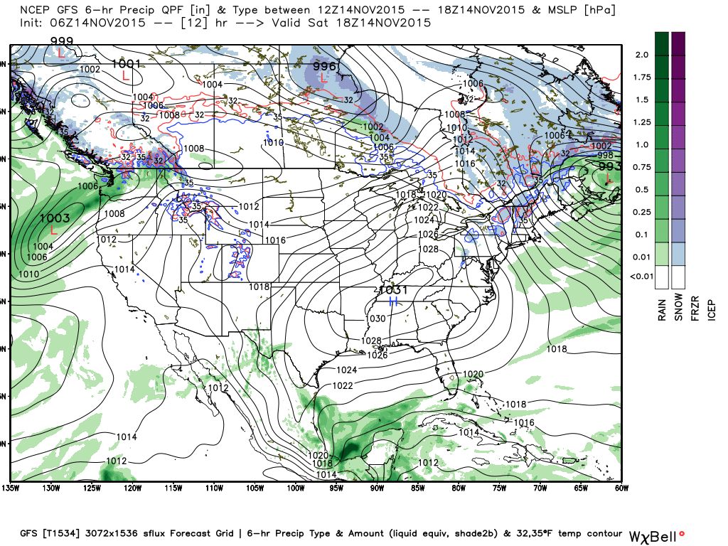
Tropical Atlantic remains tranquil today with no areas of concern to talk about. The main threat for severe weather appears to be the first of the week to our west. Much like the last system that came through, it appears likely that the next one will also come through Alabama during the early morning hours of Wednesday morning. This will be have the greatest potential for producing rain for Central Alabama with a gradient from northwest to southeast of about 1.5″ to 0.5″.
The weekend and the early portion of next week will be dry with a slow warming trend as the surface high pressure gradually slides eastward. Sunday morning will see another big chill with the calm wind as the high is directly over the Southeast US with good radiational cooling. Aloft, we stay under a ridge to start the week, but we’ll be watching the next big weather maker as a deep trough moves out of the Rockies into the Central US. This trough will move across the Mississippi Valley on Wednesday with a surface low well north of us near Lake Superior. A cold front will move through the Southeast US on Wednesday with a line of showers and perhaps some embedded thunderstorms. CAPE values with this system are expected to be at or below 400 j/kg for Central and North Alabama, so the likelihood of severe weather seems pretty low. Like the last system, coming through in the early part of the day when the atmosphere is the most stable should help to keep the threat down along with the greatest dynamics being well north of us.
The trough rotates by as the front moves into Georgia by early Thursday. We’ll cool down a little after this frontal passage, however, it won’t be as cold as the current pattern thanks to the next trough moving into the North Central US Friday and into Saturday. The upper flow over the Southeast US never goes northwesterly, so we’re not expecting a significant cold spell as temperatures drop back only a little.
But the next big system is expected around the 23rd/24th of November. The long range GFS progs show a strong trough that will bring another chill to Central Alabama with the potential for another frost with highs only in the 50s.
I’m going to be heading out for Sawyerville in Greene County for the Fall Festival. I’ll be available to program weather radios, talk about the weather, or just say hello. If you are in the neighborhood, stop by. I plan to have the next Weather Xtreme Video posted here before 8 am on Sunday morning. Enjoy the fabulous Fall weekend. Godspeed.
-Brian-
Category: Alabama's Weather
About the Author (Author Profile)
Brian Peters is one of the television meteorologists at ABC3340 in Birmingham and a retired NWS Warning Coordination Meteorologist. He handles the weekend Weather Xtreme Videos and forecast discussion and is the Webmaster for the popular WeatherBrains podcast.Subscribe
If you enjoyed this article, subscribe to receive more just like it.


