

Did I See Rain?
As you can clearly see on the visible satellite image, much of Alabama is seeing sunshine, but the clouds are a bit thicker over a sizable chunk of Central Alabama. This is even reflected in the temperatures reported at 11 am with lower and mid 60s across South Alabama, middle and upper 50s across the Tennessee River Valley, and generally lower 50s from Vernon and Fayette across the Birmingham area to the Anniston/Oxford area.
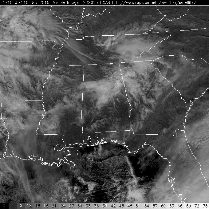
And you might also have noted what appeared to be some fuzzy clouds underneath that cloud deck. Well those fuzzy clouds were actually some light rain falling from a saturated layer into a much dryer layer which was evaporating the rain as it fell. It’s highly unlikely that anyone got rain at the ground, and if they did, it was only a few sprinkles. The upper air sounding taken at the Shelby County Airport this morning revealed the nearly saturated layer around 400 millibars with a very dry layer from just below 400 millibars all the way to the ground.
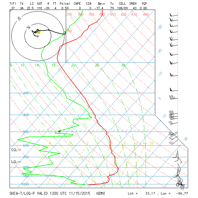
This fuzzy cloud created in this environment actually has a name – it is called virga. That word is derived from Latin and means “twig” or “branch.”
-Brian-
Category: Alabama's Weather
About the Author (Author Profile)
Brian Peters is one of the television meteorologists at ABC3340 in Birmingham and a retired NWS Warning Coordination Meteorologist. He handles the weekend Weather Xtreme Videos and forecast discussion and is the Webmaster for the popular WeatherBrains podcast.Subscribe
If you enjoyed this article, subscribe to receive more just like it.


