

Strong Indications of Tornado Heading Toward Starkville, Could Impact Marion/Lamar Soon.
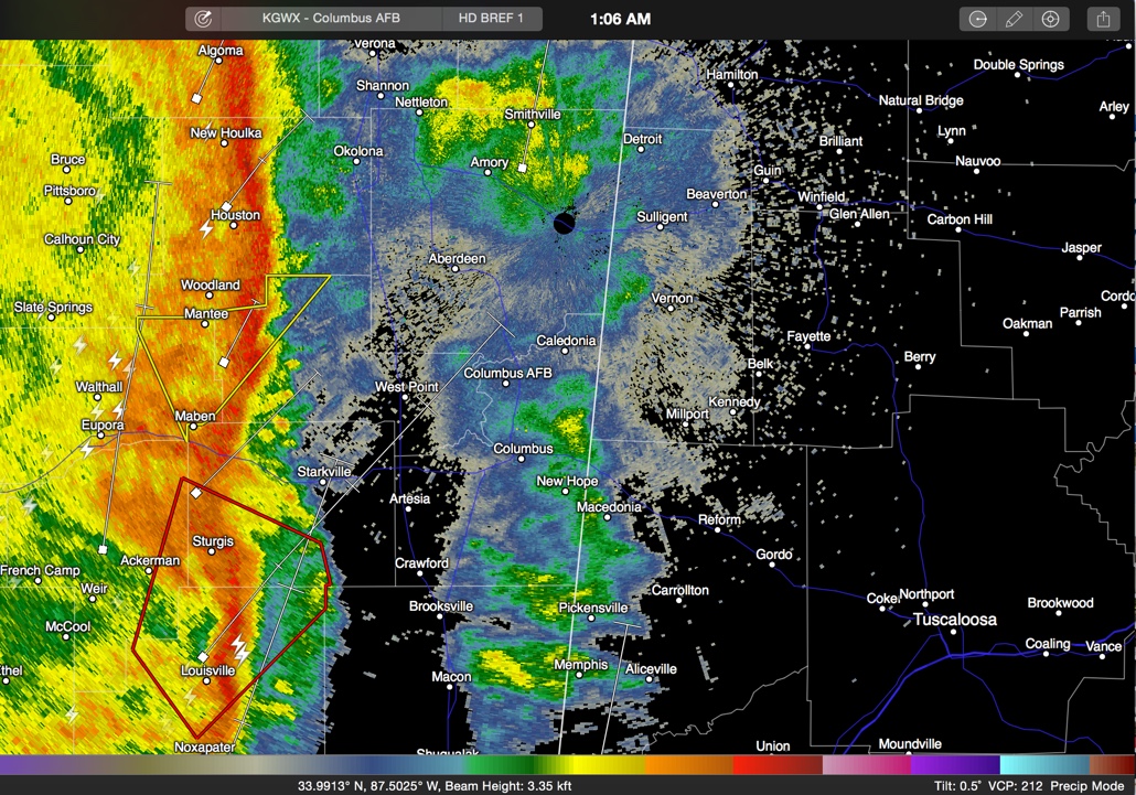
A distinct comma head feature is moving through northeastern Mississippi at this hour.
The thunderstorms associated with this feature have a history of producing possible tornado damage near Carthage around 12:10 a.m.
The possible tornado is north of Louisville and heading in the general direction of Starkville.
It will move toward West Point and Aberdeen and Amory and pass just west of Columbus MS. It could eventually target northern Lamar and western Marion Counties in Alabama. The ETA would be around 2:10-2:25 in northern Lamar County around Sulligent and Hamilton or Guin as early as 2:30-2:45.
It is a good time to be ready to move to a safe shelter in Lamar and Marion Counties on a moment’s notice, especially if you are in a mobile home. If you are in a well constructed home, think low, think inside and and get under something.
Alert your friends in the path in case they don’t have a way to get a warning and might be sleeping.
Category: Alabama's Weather, Severe Weather
About the Author (Author Profile)
Bill Murray is the President of The Weather Factory. He is the site's official weather historian and a weekend forecaster. He also anchors the site's severe weather coverage. Bill Murray is the proud holder of National Weather Association Digital Seal #0001 @wxhistorianSubscribe
If you enjoyed this article, subscribe to receive more just like it.


