

Possible Tornado Passing West of Tupelo
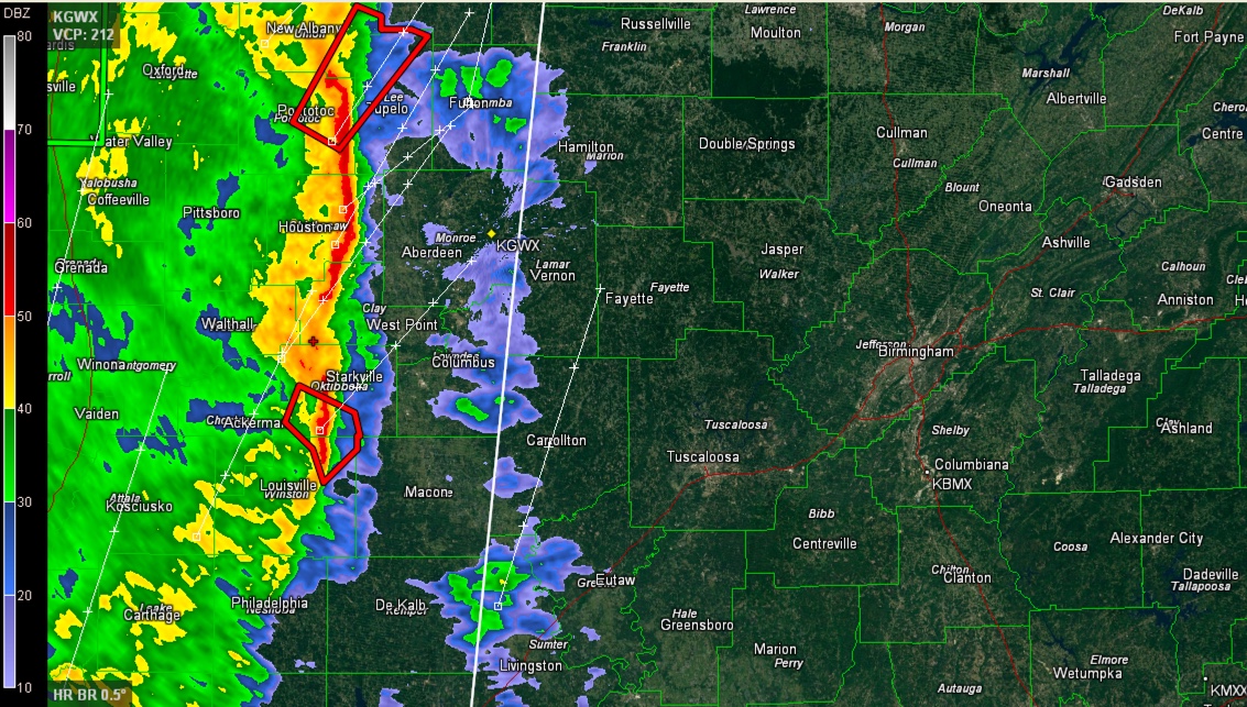
A new tornado warning has been issued by the NWS in Memphis for strong rotation NE of Pontotoc, headed toward Sherman, Guntwon, Baldwyn and on toward Booneville in NE Mississippi.
This storm should stay west of the Alabama border and remain on Mississippi.
The line of storms is pushing very slowly east at 15-20 mph. It is going to reach western Alabama’s Lamar and Marion Counties between 2-4 a.m., arriving first in Marion and Lamar Counties.
The rotation in the storm approaching Starkville has weakened and the NWS in Jackson will likely issue a severe thunderstorm warning next on that storm.
While instabilities are slowly decreasing, the wind shear is still very strong over Northeast Mississippi and increasing over Northwest Alabama, so additional spin up tornadoes and damaging winds are possible.
A new tornado watch may be issued for parts of Alabama soon.
Category: Alabama's Weather, Severe Weather
About the Author (Author Profile)
Bill Murray is the President of The Weather Factory. He is the site's official weather historian and a weekend forecaster. He also anchors the site's severe weather coverage. Bill Murray is the proud holder of National Weather Association Digital Seal #0001 @wxhistorianSubscribe
If you enjoyed this article, subscribe to receive more just like it.


