

Storms Push East, Watch Looks Less Likely For Now
The line of storms continues to push east at a snail’s pace this morning, it’s forward speed having slowed to 15 mph.
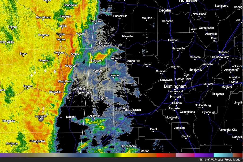
The leading edge of the line is just east of Boonville to west of Amory to West Point to Starkville and on to between Louisville and Macon at 2:25 a.m.
Areas south and east of New Orleans are under a tornado warning, but that is the only severe thunderstorm or tornado warning nationally.
Still waiting on word about whether a tornado watch is on the way for parts of Alabama, but the recent weakening trends are encouraging.
The intensity of the line continues to slowly decrease, which is great news. It will reach Lamar and Marion Counties just after 3 a.m. and is about 6-7 hours away from Birmingham, so an ETA tentatively is 8-9 a.m.
Hopefully, the event is transitioning into a non-severe weather event, although heavy rain remains a real threat. Once rain begins at your location later this morning, you will likely see 5-6 hours of steady rain. Flooding is not out of the question, as up to five inches of rain could fall before it is all said and done in some spots.
DAMAGE REPORTS
There are several reports of possible damage from the potential tornado that moved from near Carthage to Louisville and has us very concerned for time about Lamar and Marion Counties here in Alabama. It looks like the NWS in Jackson will be busy with damage surveys later today.
Category: Alabama's Weather, Severe Weather
About the Author (Author Profile)
Bill Murray is the President of The Weather Factory. He is the site's official weather historian and a weekend forecaster. He also anchors the site's severe weather coverage. Bill Murray is the proud holder of National Weather Association Digital Seal #0001 @wxhistorianSubscribe
If you enjoyed this article, subscribe to receive more just like it.


