

Two More Counties Cleared…And a Dot Dot Dot Update
The tornado watch has been canceled for Autauga and Lowndes in Alabama.
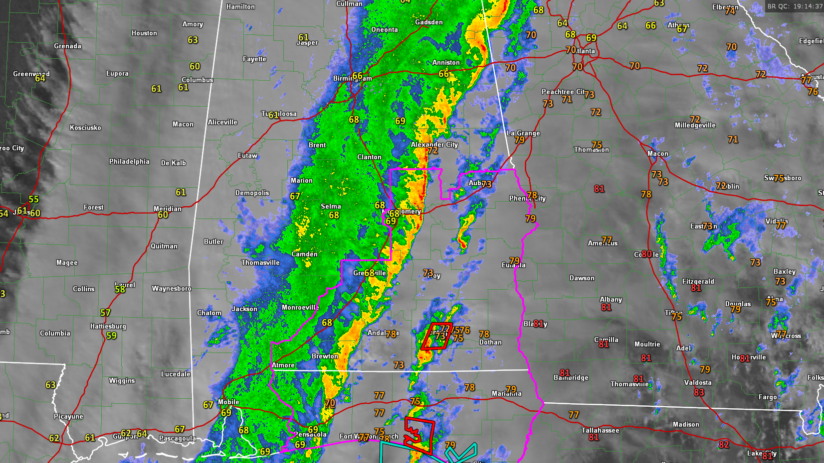
The watch continues for Barbour, Bullock, Elmore, Lee, Macon, Montgomery, Pike and Russell Counties till 4:00 PM CST.
The outline of the tornado watch is depicted in purple on the image.
Here is a look at the latest situation across the state in dot dot dot format as JB always said:
…The entire state is socked in with clouds, although some thnning is evident over NE Mississippi. They may see the sun in the Shoals before the afternoon is out.
…The back edge of the rain is through Culman and is now moving through the Birmingham, Brent and Marion areas.
…1.66 inches of rain at the Birmingham Airport as of 12:53. I have picked up 1.78 in Vestavia.
…Cooler air has moved in behind the front, which is now along US-43 n West Alabama. It is in the 50s in northern Mississippi, where clouds are hanging tough.
…Temperatures are in the 70s ahead of the main line. CAPE values are in the 500-1,500 j/kg range over SE Alabama and Northwest Florida.
…The heaviest rain extends from Heflin to Lineville to Alex City to east of Montgomery to east of Brewton.
…There are tornado warnngs in South Alabama for COffee and Geneva Counties. This storm has a history of producing tornado damage all the way back to the Okaloosa, Walton County line near Navarre. A tornado was sighted from US 331 north of Eglin AFB. and dual pol radar observed a tornado debris signature NE of Niceville.
…There was a waterspout that came ashore near Destin.
…A storm in Coffee County produced a funnel cloud and debris signature on Dual Pol near Elba.
Category: Alabama's Weather, Severe Weather
About the Author (Author Profile)
Subscribe
If you enjoyed this article, subscribe to receive more just like it.


