

Clouds and Rain Next Couple of Days
Clouds crept across Alabama overnight, and rain pushed closer to Central Alabama, however, rain on radar this morning remained mainly across North Alabama generally north of Interstate 20. But some off and on rain along with clouds will be our weather for the next several days until the upper trough can move by us.
So for today, the weather will be mostly cloudy with showers a possibility mainly along and north of I-20. Aloft, the closed low over the Central US will come out across the Great Lakes by Wednesday. With a southwesterly flow aloft over the Southeast, we will remain cloudy with periods of rain and showers through the first of the week.
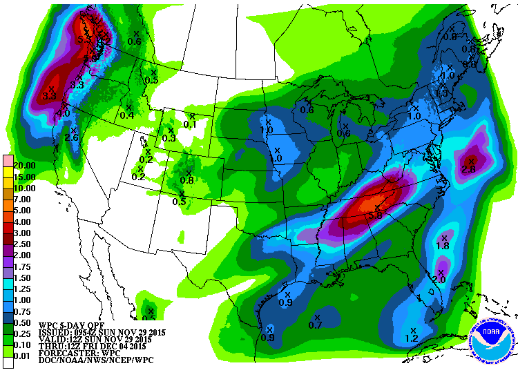
Rainfall will be quite heavy over the next five days with this slowly evolving pattern. Main focus for the heavy rain is expected to be from northern Mississippi across North Alabama and eastern Tennessee where 4 to 6 inches of rain will be possible.
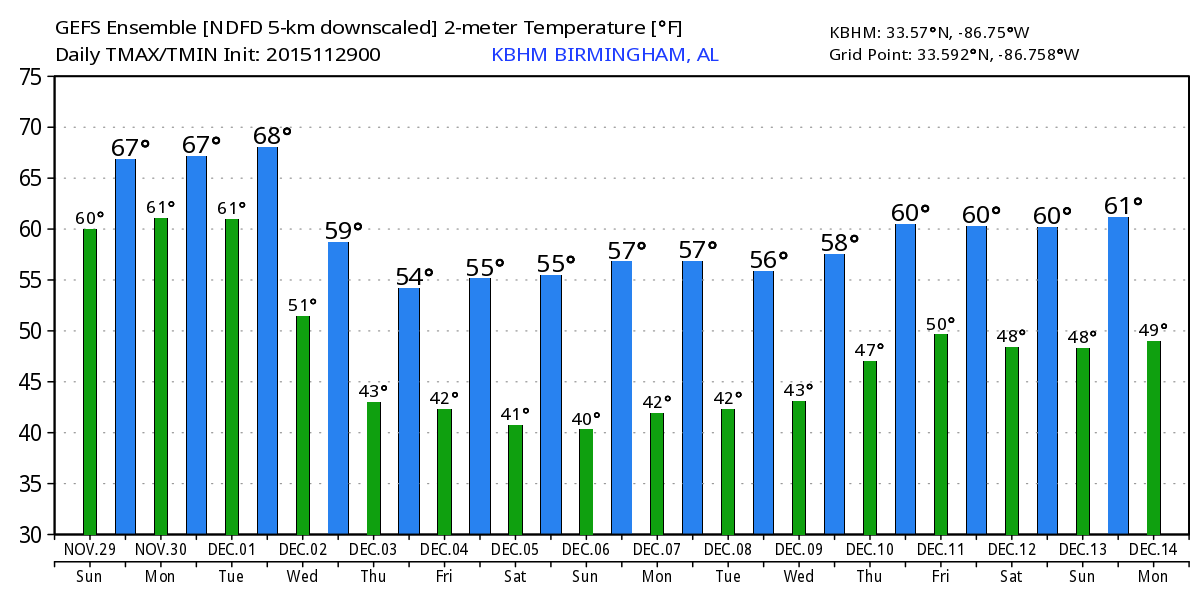
Rain chances drop for the end of the week as the big closed low moves out of the US, but we retain at least some cloudiness as a weak trough remains behind. That trough becomes a little stronger by Friday as it moves by us paving the way for an upper ridge and a surface high pressure system to take us into the weekend. While we will be colder for the latter half of the week ahead as compared to the first of the week, we should be at or just slightly colder than the 30-year averages for late November/early December. Those are highs around 60 and lows around 40.
For beachgoers, there will be great weather today, but rain will be a threat for the week ahead along with cooler temperatures later this week. See the complete Gulf Coast 7 Day Planner here. The Gulf Coast Beach Forecast is presented by Gulf Shores Plantation by Mandoki Hospitality Vacation Rentals. Escape to Gulf Shores Plantation where memories last a lifetime.
The longer range forecasts from the GFS stick with a fairly active weather pattern. A deep upper trough promises to provide a wet and cold start to Week 2. By Wednesday, another weak trough will be zipping by us followed by a ridge pattern that carries us into the middle of December with yet another closed low headed our way from the Southwest US.
Thanks for stopping by. James Spann will have the next Weather Xtreme Video on Monday morning. Godspeed.
-Brian-
Category: Alabama's Weather
About the Author (Author Profile)
Brian Peters is one of the television meteorologists at ABC3340 in Birmingham and a retired NWS Warning Coordination Meteorologist. He handles the weekend Weather Xtreme Videos and forecast discussion and is the Webmaster for the popular WeatherBrains podcast.Subscribe
If you enjoyed this article, subscribe to receive more just like it.


