

Mid-Morning Update
RADAR CHECK: A fairly large mass of rain and storms covers Alabama…
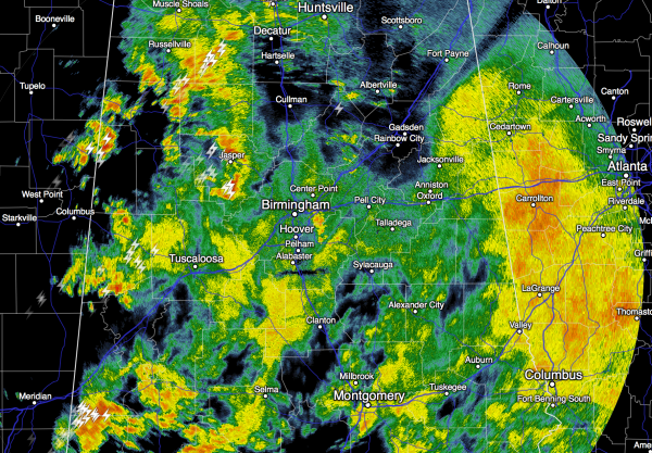
This activity will exit the state by early afternoon, leaving an unstable atmosphere, and with a dynamic system approaching, the door is open for a significant severe weather threat late this afternoon and tonight.
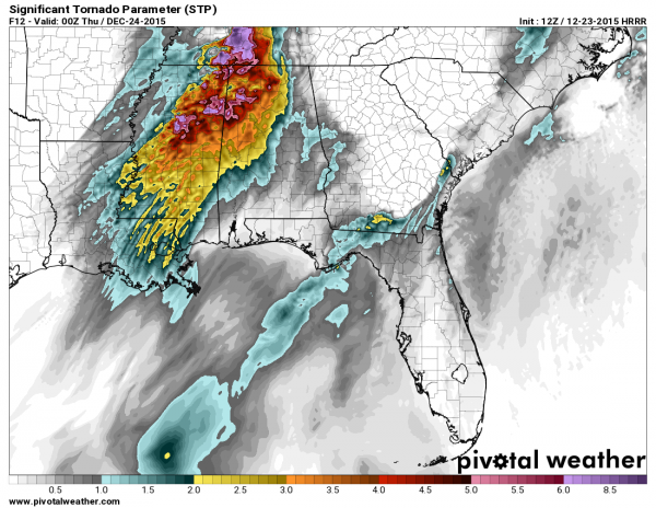
This is the STP (significant tornado parameter) valid at 6:00 p.m…
Severe storms should begin to fire over Northwest Alabama in the 3:00 to 5:00 p.m. time frame, slowly expanding to the south and east tonight.
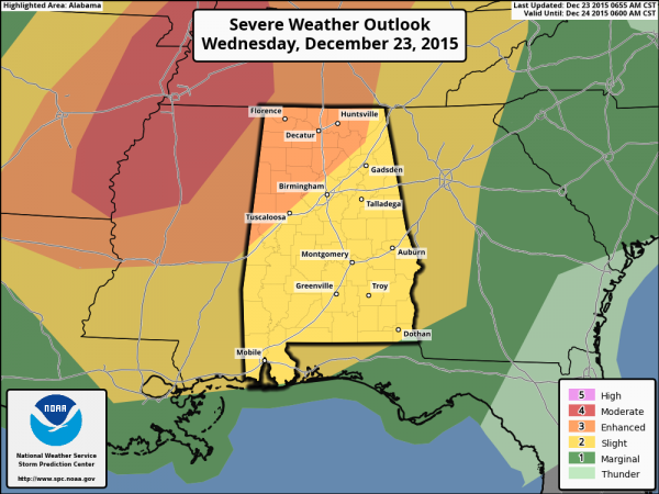
The highest risk of a strong tornado or two is over that part of the state, where SPC has an “enhanced” severe weather risk defined…
Please understand this is going to be a long duration threat… from about 3:00 p.m. today through 3:00 p.m. tomorrow. You will need a good way of getting tornado warnings during the night, and that way is not an outdoor siren. See this post for information about apps and other ways you can prepare.
Bill Murray will have a longer post coming shortly… stay tuned… and scroll down for my morning discussion if you missed it. Everything there is still valid.
Category: Alabama's Weather
About the Author (Author Profile)
James Spann is one of the most recognized and trusted television meteorologists in the industry. He holds the AMS CCM designation and television seals from the AMS and NWA. He is a past winner of the Broadcast Meteorologist of the Year from both professional organizations.Subscribe
If you enjoyed this article, subscribe to receive more just like it.


