

Cold Air Arrives
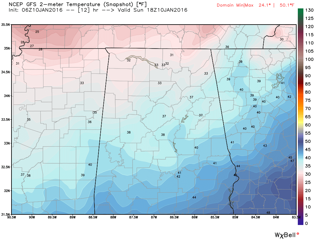
The rain moved out of Alabama last night as the cold front swept through the state dropping temperatures into the 30s this morning. A few snow flurries were being reported at scattered locations across the Tennessee River Valley, but this extremely light precipitation was not showing up on area radars. The clouds were hanging tough all the way back to Memphis, so most of Central and North Alabama is expected to remain cloudy today. There may be a few thin spots in the clouds as well as the potential for the clearing skies to reach western sections of Central Alabama late this afternoon. Cold air advection is firmly established, so we may not see temperatures climb out of the 30s for many locations across Central and North Alabama. A northwest wind at 10 to 15 mph will just make it feel that much colder.
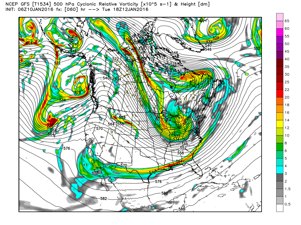
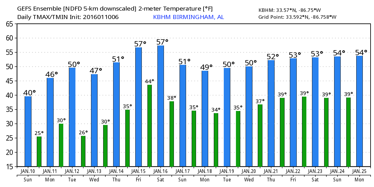
The combination of surface high pressure along with the upper trough over the eastern half of the country will keep us pretty chilly through Wednesday with lows each morning below freezing. Highs will be in the 40s. The upper trough moves eastward on Thursday as the upper flow over the Southeast US becomes more westerly in response to a short wave trough over the Southwest US. This modification should see temperatures warm a tad with highs in the 50s and lows in the 30s.
Yesterday we were dealing with some pretty significant model differences for the end of the week and into the weekend. Those differences have disappeared as the ECMWF as joined the GFS in bringing the short wave trough a little further south resulting in the surface low forming in the middle Gulf of Mexico. Yet another fast moving short wave dives out of the Rockies on Friday and that one is followed by another one on Saturday. That second trough moves by on Sunday. The GFS is trying to generate some scattered precipitation for the Southeast US for Friday and the weekend. Not sure there will be enough moisture to wring out much rain, so for now will include only slight chances for precipitation.
The GFS does indicate some light snow across Tennessee and points northeast as the surface low gets cranked up just off the Southeast US coast. The wrap around kind of moisture does not typically result in significant snow events. Central Alabama temperatures will likely be around 40 for lows with highs in the 50s.
Once again the screaming message from voodoo country is the active pattern. Short waves capable of bringing precipitation to Central Alabama will scoot by around the 19th and the 21st with another cold look to the pattern by the end of the period around the 25th.
Thanks for staying tuned to the blog. James Spann will have the next edition of the Weather Xtreme Video on Monday morning. I’m filling in for Meaghan Thomas this weekend, so you can catch the latest weather forecast on ABC 3340 at 5 and 10 pm this evening.
Stay warm and Godspeed.
-Brian-
Category: Alabama's Weather
About the Author (Author Profile)
Brian Peters is one of the television meteorologists at ABC3340 in Birmingham and a retired NWS Warning Coordination Meteorologist. He handles the weekend Weather Xtreme Videos and forecast discussion and is the Webmaster for the popular WeatherBrains podcast.Subscribe
If you enjoyed this article, subscribe to receive more just like it.


