

Rain Changing To Light Snow Today
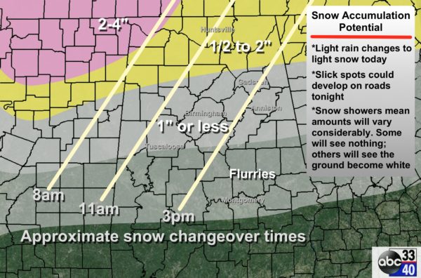
WINTER WEATHER ADVISORY: No changes in the “winter weather advisory” from the National Weather Service offices in Birmingham and Huntsville; it is in effect basically for areas north of a line from Tuscaloosa to Calera to Roanoke. Remember, for the Birmingham NWS office the criteria for an advisory is snow 1/4″ to 2″.
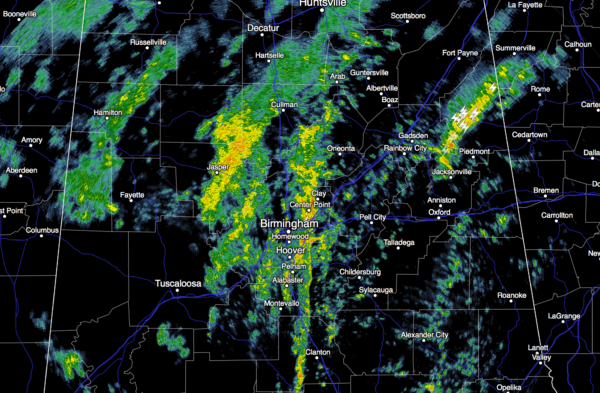
RIGHT NOW: Showers, and even a few thunderstorms, continue over Alabama at daybreak…
Temperatures are generally in the low 50s, and as we have discussed in recent days, they will go the wrong way today. We fall through the 40s, and wind up in the 30s this afternoon as cold air rushes into the state. Dynamic cooling from the very deep upper trough will also be a factor.
RAIN TO SNOW: We have adjusted the timing a bit on the projected change from rain to light snow based on radar trends; snow should begin to fall up in the Shoals area of far Northwest Alabama around 8:00 a.m. The rain/snow line will work eastward during the day as temperatures fall.
IMPORTANT NOTES….
*Temperatures are not expected to drop below freezing until tonight. Initially during the day, roads will be just wet with temperatures in the mid to upper 30s. The possible exception is far Northwest Alabama, where icy travel could begin around Muscle Shoals by afternoon. Slick spots are possible on roads tonight, especially after 9:00 (for places like Birmingham, Tuscaloosa, Anniston, and Gadsden).
*Slick spots/icy patches will remain possible through about mid-morning tomorrow; conditions will improve by midday tomorrow as temperatures rise into the mid to upper 30s.
*Much of the snow will come in the form of convective showers, much like rain showers on summer afternoons. This means the distribution will not be even, and snow amounts will vary greatly. Some will get nothing, others will see the ground go white very quickly. No way of resolving where the heavier snow showers develop. For most of North/Central Alabama, some will see 1 inch, others will see nothing, and most will see something in between.
*As the cold core upper trough swings through here late today and tonight, expect a surprise or two; these things are always interesting and can do things you don’t expect.
NORTHEAST OF ALABAMA: A major winter storm will unfold, with a blizzard warning up for the Washington/Baltimore area…
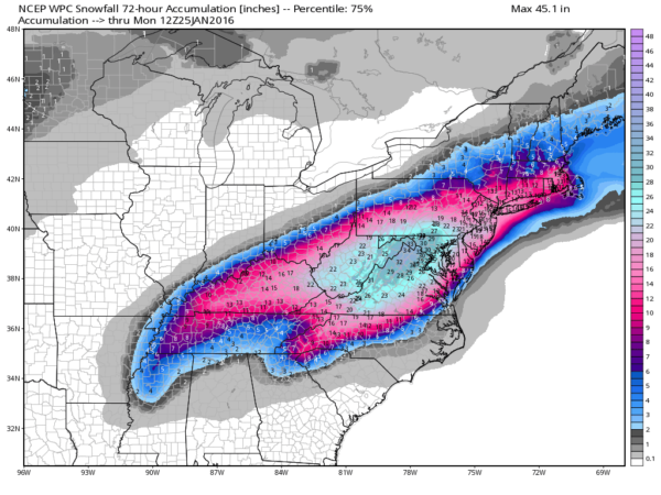
Travel will become difficult, and in many areas impossible, in the heavier snow zones later today and tonight.
THE ALABAMA WEEKEND: Tomorrow will be breezy and cold with a few lingering morning snow flurries; we won’t get of of the 30s. Sunday morning will be cold with a low in the lower 20s, but we rise to near 50 degrees by afternoon with a good supply of sunshine.
NEXT WEEK: Monday will be dry and warmer… some places could reach 60 degrees. Then, showers are possible Tuesday thanks to a passing cold front, followed by colder air Wednesday. See the Weather Xtreme video for maps, graphics, and more details.
WEATHER BRAINS: Don’t forget you can listen to our weekly 90 minute netcast anytime on the web, or on iTunes. This is the show all about weather featuring many familiar voices, including our meteorologists here at ABC 33/40.
CONNECT: You can find me on all of the major social networks…
Facebook
Twitter
Google Plus
Instagram
We will have frequent updates through the day on the blog… stay tuned!
Category: Alabama's Weather
About the Author (Author Profile)
James Spann is one of the most recognized and trusted television meteorologists in the industry. He holds the AMS CCM designation and television seals from the AMS and NWA. He is a past winner of the Broadcast Meteorologist of the Year from both professional organizations.Subscribe
If you enjoyed this article, subscribe to receive more just like it.


