

Operation Snow Watch
LATE NOTE:
All Jefferson County Schools will close at 1 p.m. today.
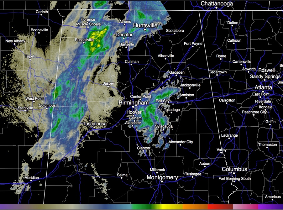
RADAR UPDATE
Precipitation echoes are starting to pick up again in a band of snow that is rotating eastward across Northwest and West Central Alabama late this morning.
The heavier snow will be across the Tennessee Valley of North Alabama. Places like Moulton, Decatur and Hartselle will see some of the best snow.
This band will push eastward, reaching Tuscaloosa before 11 a.m. and Birmingham around noon – 1 p.m.
Here are current temperatures:
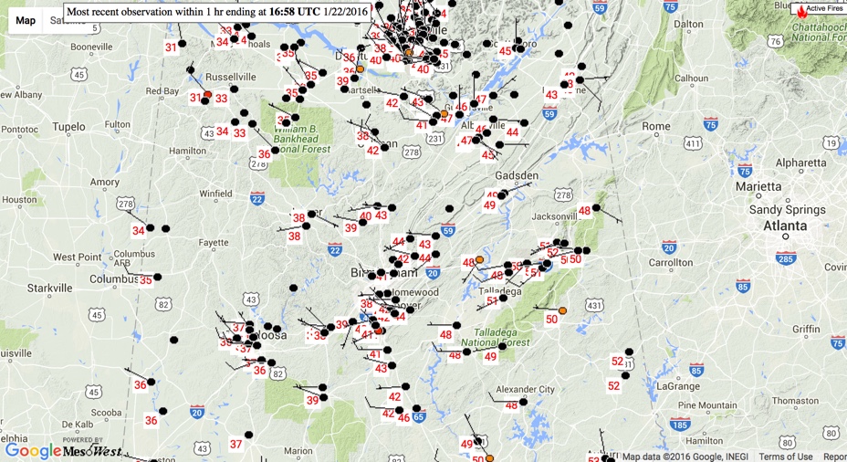
The ground is still warm and snow will melt faster than it falls unless you get in a heavier snow shower.
As the low ramps up tonight and turns northeast, more moisture will wrap into the North and East Central Alabama. There will be some dustings to 1.5 inch accumulations, especiallly east of I-65.
One of the fun parts of any winter storm event is tracking the snow report. Here are some late ones:
…Dusting in Russellville. Roofs are white.
…Big fluffy flakes at Vernon in Lamar County.
…Snow starting to fall at Sulligent in Lamar County.
…Snowflakes at Aliceville in Pickens County.
…Saw a Twitter report of snowflakes at St. Vincent’s in Birmingham.
Category: Alabama's Weather, Winter Weather
About the Author (Author Profile)
Bill Murray is the President of The Weather Factory. He is the site's official weather historian and a weekend forecaster. He also anchors the site's severe weather coverage. Bill Murray is the proud holder of National Weather Association Digital Seal #0001 @wxhistorianSubscribe
If you enjoyed this article, subscribe to receive more just like it.


