

Let the Warmup Begin
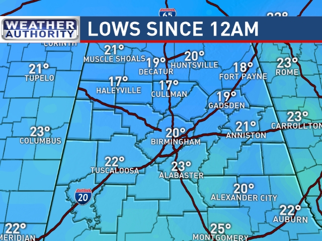
Starting out once again on a very chilly note with morning lows ranging from 17 to 22. But with a nice dose of sunshine today we should see our afternoon highs climb nicely into the upper 40s – that’s a good 10 degrees warmer than yesterday. For those south of the Birmingham area at places like Clanton, Alexander City, and Tuscaloosa, you could see highs top out at 50 to 52.
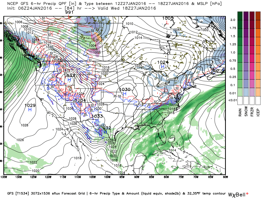
For Monday, we warm up even more. We’ll start the day with lows in the 28 to 32 range, but our afternoon highs should read the upper 50s. We’ll see the weather begin its transition to a wet weather with clouds increasing substantially during the afternoon and evening. Monday evening and Tuesday the cold front should enter Alabama from the northwest, but the upper flow is expected to go southwesterly with the trough aligned from the Great Lakes into Texas. This will slow the forward progress of the front with minor ripples along the front keeping us wet into midday Wednesday.
Wednesday afternoon into Thursday the southern portion of the trough is expected to move across the Southeast US, and this should push the front well southeast of us by Thursday afternoon. With the strong relatively low latitude upper trough, we’ll see another surface low generated just east of Florida, and the GFS really bombs this one out Thursday into Friday. Fortunately, it appears that it will be well offshore, so the effects to the US coast from South Carolina to New York won’t be as serious as the storm they just had. While not as serious from the point of view of snow, it will be causing some serious wind issues for the coast from the Carolinas to New England with the potential for serious coastal flooding.
For us in Alabama, temperatures will dip back once again with lows in the 28 to 32 range for Thursday and Friday and highs in the 40s. But a surface high settles in over the Southeast US for Friday and the weekend returning us into the 50s for highs. By Sunday the upper flow begins to become southwesterly and this will be bringing moisture out of the Pacific once again ahead of what could be a fairly powerful upper trough and closed low that will impact us around the first of February.
The powerful upper low around February 2nd is likely to produce a round of severe weather for the Lower Mississippi River Valley northward into the Ohio River Valley. At the same time, west of the upper low will see a significant round of winter weather. We’re getting into the early days of voodoo country, so no specifics. However, we are see consistency on this feature from the runs yesterday morning. Once that one goes by, we’ll have another strong trough around February 5th that promises some cold air once again for the Southeast US from the 5th to the 8th.
Headed out to Oak Mountain State Park later today for a program at the Alabama Wildlife Center on birds of prey. James Spann is expected back on Monday morning with the next edition of the Weather Xtreme Video. Enjoy the day as the warmup begins. Stay warm and Godspeed.
-Brian-
Category: Alabama's Weather
About the Author (Author Profile)
Brian Peters is one of the television meteorologists at ABC3340 in Birmingham and a retired NWS Warning Coordination Meteorologist. He handles the weekend Weather Xtreme Videos and forecast discussion and is the Webmaster for the popular WeatherBrains podcast.Subscribe
If you enjoyed this article, subscribe to receive more just like it.


