

Active Storm System Forming To The West
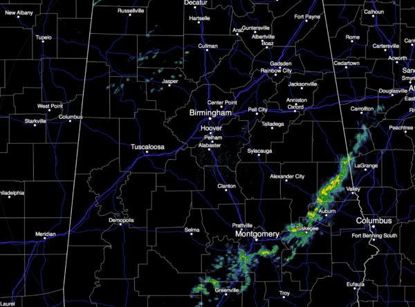
SPRING-LIKE: We are starting this day with temperatures in the low 60s at daybreak, and again today we will rise into the low 70s in many places this afternoon. The sky will be mostly cloudy, however, and a few scattered showers are possible. In fact, we have a few showers on radar at sunrise…
TO THE WEST: A major storm system is forming, and will produce big snow today for places like Denver and Albuquerque. Winter storm warnings are up from Denver to Green Bay, with blizzard warnings up for parts of Nebraska and Iowa, north of the surface low track.
OUR SEVERE WEATHER THREAT: That system will bring the threat of strong to severe thunderstorms to the southern U.S. tomorrow and tomorrow night. Best dynamic support will be a little north of Alabama, and lapse rates are somewhat marginal, but parameters are certainly sufficient for severe weather in our state. See the Weather Xtreme video for a meteorological discussion on the setup.
The SPC “enhanced” risk area has been playing the hokey pokey over the weekend… adjusting to the right and to the left; today the risk looks much like it did Friday. Here is the “Day Two” severe weather outlook, with projected “highest risk” times added by me.
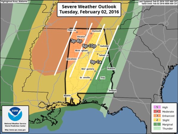
THREATS/PLACEMENT: The highest risk of a tornado or two will be in the “enhanced” risk area, which is along and west of a line from Huntsville to Tuscaloosa. Understand a tornado is possible in other parts of the state, but the threat is generally lower east of that “enhanced” risk. Tomorrow night the storms will evolve into a long squall line, and the greatest threat with the passage of that line will come from strong, perhaps damaging straight line winds. The line should weaken slowly east of I-65 as the upper dynamics lift away from the region, and the air become more stable.
We should mention a few storms could produce large hail as well.
TIMING: A few severe storms could form over far West and Northwest Alabama as early as 3:00 p.m. tomorrow, but for most places the core threat will come from 5:00 p.m. until 12:00 midnight.
RAIN: Rain amounts will approach one inch for most communities, not enough for flooding concerns.
CALL TO ACTION: As always, be sure you are in a position to hear warnings if they are needed, have a plan of action, and a readiness kit in your safe place. See this post I wrote before Christmas on specific things to do.
WEDNESDAY: Rain ends pretty early in the day; we will forecast gradual clearing with a high back in the 50s.
THURSDAY/FRIDAY: Cool and dry weather is the story on these two days with a good supply of sunshine; highs in the 50s, lows down around freezing.
THE ALABAMA WEEKEND: Saturday will stay mostly sunny with a high in the 50s; the GFS develops a low in the Gulf of Mexico Sunday that spreads rain up into South Alabama, for now we will leave the forecast dry for the northern half of the state. The high Sunday will be in the mid 50s.
NEXT WEEK: Seeing lots of support for the idea of much colder air digging down into the eastern half of the nation in 10 days or so…
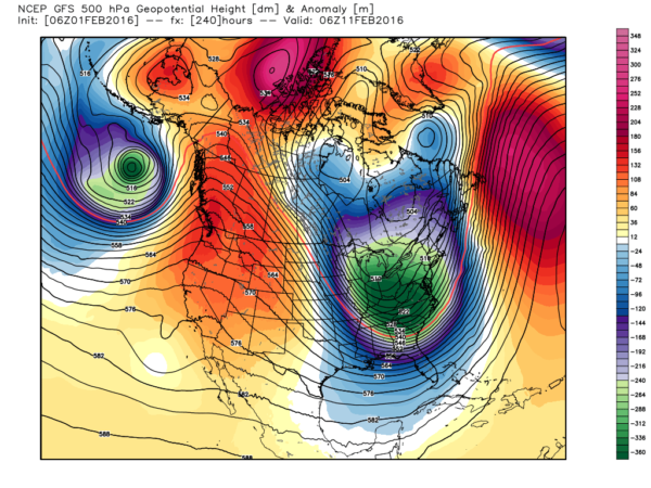
We do have a long way to go this winter. Again, see the Weather Xtreme video for maps, graphics, and more details.
WEATHER BRAINS: Don’t forget you can listen to our weekly 90 minute netcast anytime on the web, or on iTunes. This is the show all about weather featuring many familiar voices, including our meteorologists here at ABC 33/40. We will record this week’s show tonight at 8:30p CT… you can watch it live here.
CONNECT: You can find me on all of the major social networks…
Facebook
Twitter
Google Plus
Instagram
I have weather programs today at Vestavia Hills Cahaba Heights Elementary and Calera Elementary… look for the next Weather Xtreme video here by 4:00 this afternoon. Enjoy the day!
Category: Alabama's Weather
About the Author (Author Profile)
James Spann is one of the most recognized and trusted television meteorologists in the industry. He holds the AMS CCM designation and television seals from the AMS and NWA. He is a past winner of the Broadcast Meteorologist of the Year from both professional organizations.Subscribe
If you enjoyed this article, subscribe to receive more just like it.


