

Mainly Cloudy & Mild Saturday
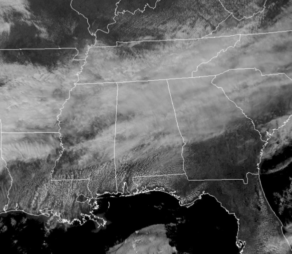
As expected, we are seeing a lot more cloud cover today as the lower levels of the atmosphere are rather saturated and that means the clouds will be sticking around. There may be a few sprinkles out there today, but most of us will be staying dry.
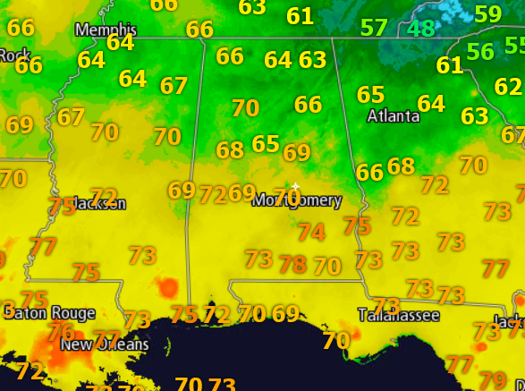
It is a mild day with most locations in the upper 60s and lower 70s in North-Central Alabama, while mid and upper 70s are showing up this afternoon.
For tonight, the clouds will continue thicken, and there may be a few isolated showers across North Alabama with temperatures in the mid and upper 50s. Not too bad for a February night in Alabama.
The frontal boundary continues to sink slowly towards the south and will be the focal point for widespread showers for Sunday. Nothing too intense or heavy, but definitely grab the rain gear if you are heading out the door tomorrow. The best rain chances will be located across northern portions of the state, but scattered showers will impact much of the state especially late in the day, and there may even be a few rumbles of thunder. Expect another mild day with upper 60s for the northern half of the state, while 70s will be widespread down south.
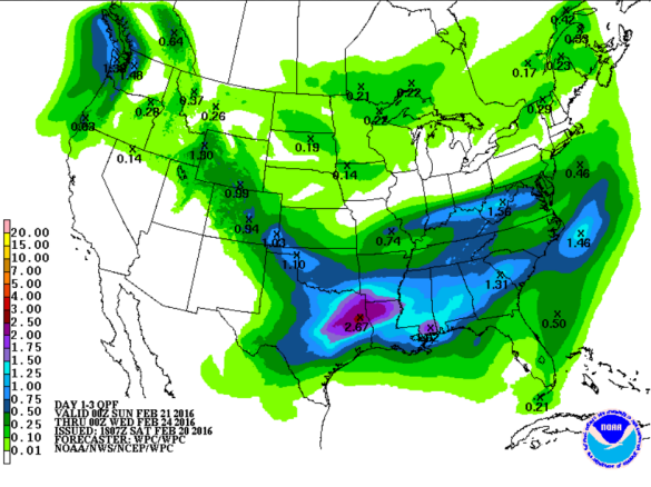
As an active week of weather is ahead. Several impulses will develop and move along the frontal boundary that will be stalled across the state. For Monday and Tuesday, expect periods of rain with temperatures in the lower 60s. Rainfall totals for the new week, look to range between 1-3 inches for much of Alabama.
Category: Alabama's Weather
About the Author (Author Profile)
Macon, Georgia Television Chief Meteorologist, Birmingham native, and long time Contributor on AlabamaWX. Stormchaser. I did not choose Weather, it chose Me. College Football Fanatic. @Ryan_StinnetSubscribe
If you enjoyed this article, subscribe to receive more just like it.


