Alabama 811 | Know What's Below.

Blog Archives

Accumulation Potential

Accumulation Potential

| January 7, 2011 @ 1:56 pm | 45 Replies

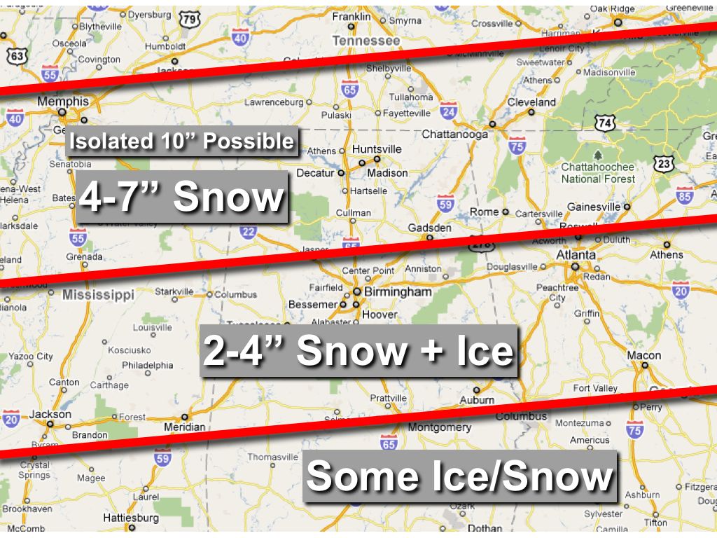
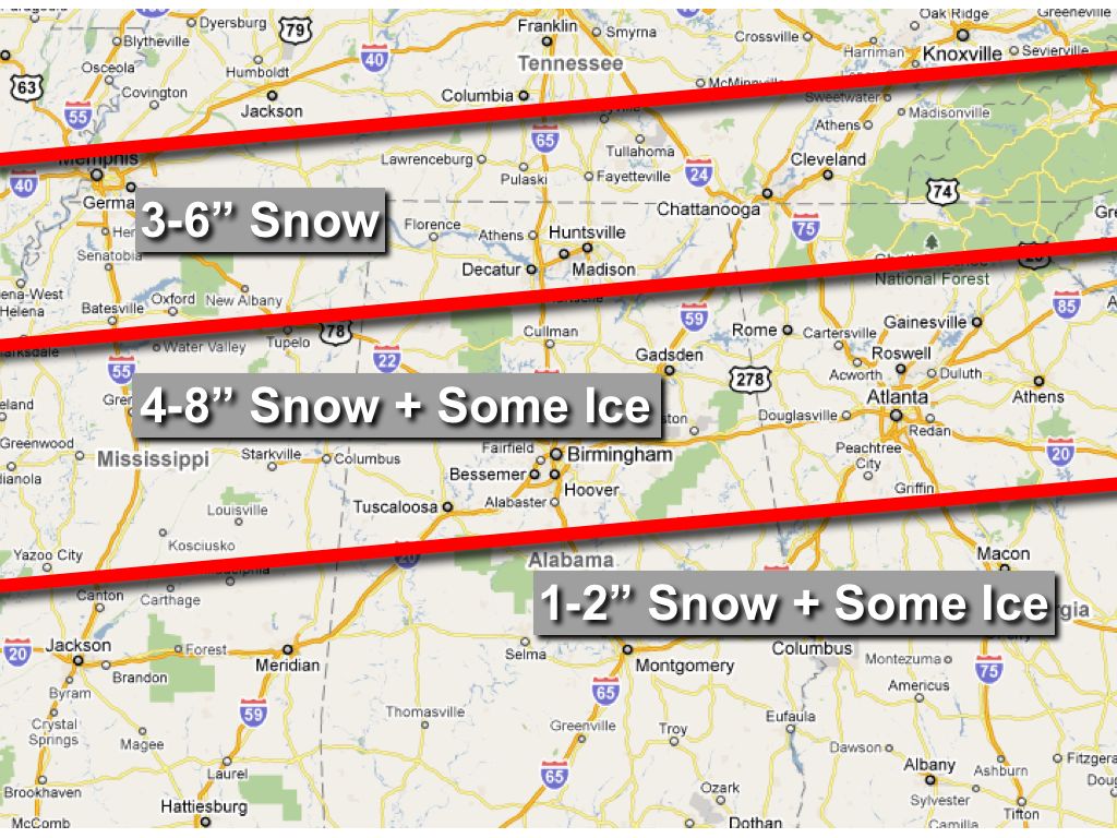
Will have the full discussion and video posted by 3:00, but here is a look at the new snow accumulation graphic we will use this afternoon… *Main impact of the winter storm will be from 12:00 noon Sunday through 12:00 noon Monday, with the heaviest snow and other winter precipitation Sunday night into Monday morning.

Read More

Peek At New Model Output

Peek At New Model Output

| January 7, 2011 @ 9:37 am | 41 Replies

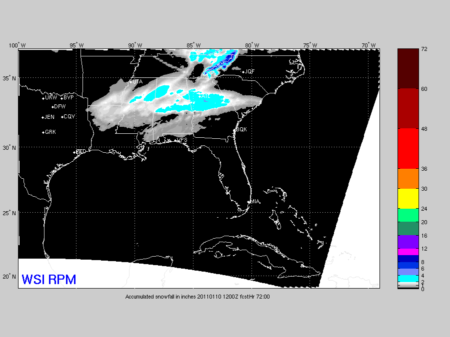
This is the snow accumulation through Monday morning at 6:00 a.m. CST from the 12Z run of the RPM… This suggests some light snow accumulation all the way down to Mobile and Dothan. Now… see the accumulated snow from the 12Z NAM. This will knock your socks off… More details coming soon…

Read More

Major Winter Storm Ahead

Major Winter Storm Ahead

| January 7, 2011 @ 6:30 am | 53 Replies

An all new edition of the ABC 33/40 Weather Xtreme video is available in the player on the right sidebar of the blog. You can subscribe to the Weather Xtreme video on iTunes by clicking here. Up front, just a reminder this event is still about 48 hours from beginning, so this forecast could (and […]

Read More

Major Winter Storm Potential Sunday/Monday

Major Winter Storm Potential Sunday/Monday

| January 6, 2011 @ 3:35 pm | 76 Replies

An all new edition of the ABC 33/40 Weather Xtreme video is available in the player on the right sidebar of the blog. You can subscribe to the Weather Xtreme video on iTunes by clicking here. BLOG: Let me apologize for the blog issues today… we are going to a distributed platform so you won’t […]

Read More