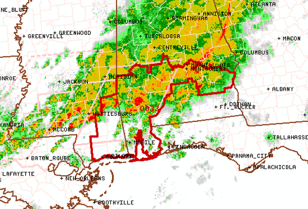
Tornado Watch Expanded
The tornado watch for Dallas and Marengo Counties has been extend eastward and now includes 5 more counties. The counties are Lowndes, Montgomery, Barbour, Bullock and Pike. The watch is in effect until 11 PM.

The tornado watch for Dallas and Marengo Counties has been extend eastward and now includes 5 more counties. The counties are Lowndes, Montgomery, Barbour, Bullock and Pike. The watch is in effect until 11 PM.
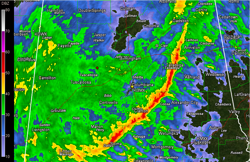
Resetting the severe weather situation across Alabama just after mid-afternoon. A narrow line of strong storms is pushing across Central Alabama at this hour. It extends from Ohatchee to Talladega to Sylacauga to Billingsley to Selma at this hour. It is pushing east at nearly 50 mph, but the southern end of the line is […]
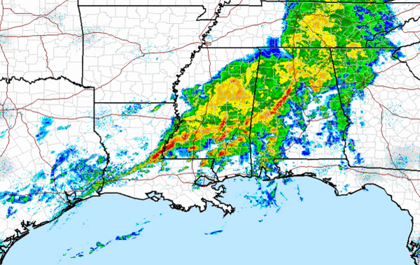
Heavy showers and thunderstorms are impacting much of North Central Alabama this afternoon. Some of the heaviest activity is working through the Birmingham Metro now. Heavy rains is falling in many areas. No severe weather in Alabama currently, but there are numerous tornado and severe thunderstorm warnings in southern Mississippi. That activity is working east […]
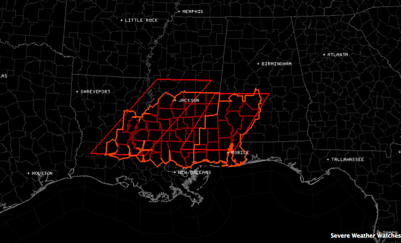
The National Weather Service has issued a tornado watch for a part of South Central and much of southwestern Alabama as well as southeastern Mississippi. THE NATIONAL WEATHER SERVICE HAS ISSUED TORNADO WATCH 33 IN EFFECT UNTIL 11 PM CST THIS EVENING FOR THE FOLLOWING AREAS IN ALABAMA THIS WATCH INCLUDES 2 COUNTIES IN CENTRAL […]
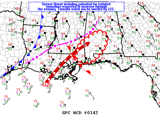
The SPC says that a new tornado watch will be required before 4 p.m. for part of South Central and Southwest Alabama as well as more of southern Mississippi. It will probably include an area generally bounded by Butler to Marion to Billingsley to Montgomery to Brewton. Here is the text of the mesoscale discussion: […]
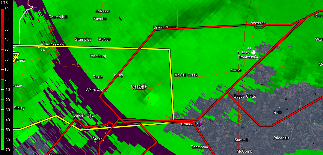
Storms across Central Alabama are producing plenty of booming thunder, heavy rain and strong gusty winds, but they are not severe. Storms are quite intense over South Central Mississippi near and south of a northeastward moving warm front. The storms near the front have not become surface based yet, but south of the warm front, […]
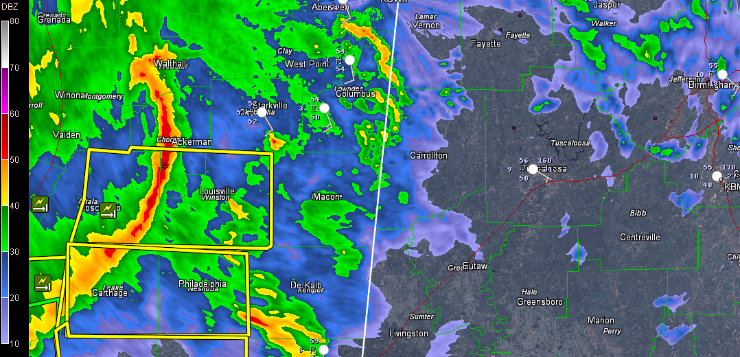
A complex of storms moving across Central Mississippi evolved into a bow echo that has produced a few reports of damage. It has prompted a series of severe thunderstorm warnings. You can pick it out clearly on this radar image from the Columbus Doppler radar. There is a pretty strong little upper level disturbance with […]
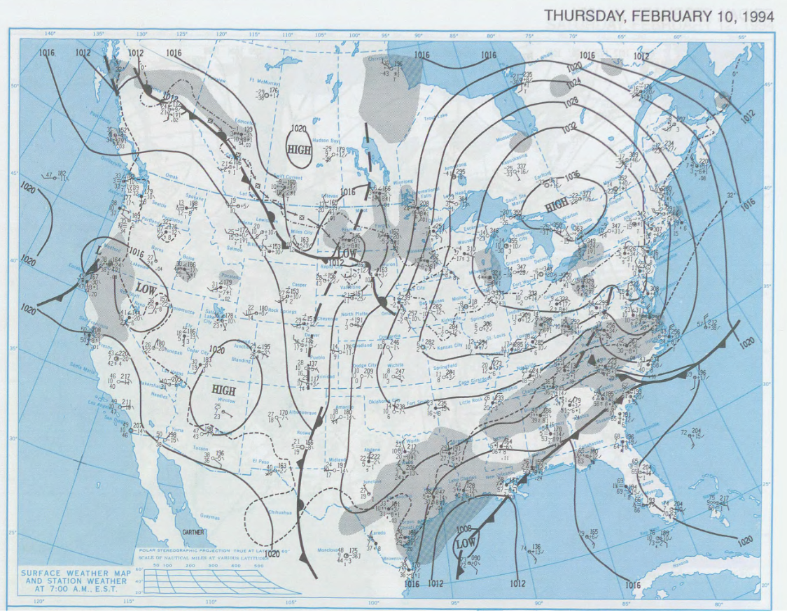
On the morning of Wednesday, February 9th, a powerful cold front was barreling southward. It extended from Northeast Tennessee to south of Memphis to near Shreveport. It was 66F at Birmingham and 71F at Shreveport, but a short distance across the front, it was already down to 36F at Memphis and 8F at Oklahoma City. […]
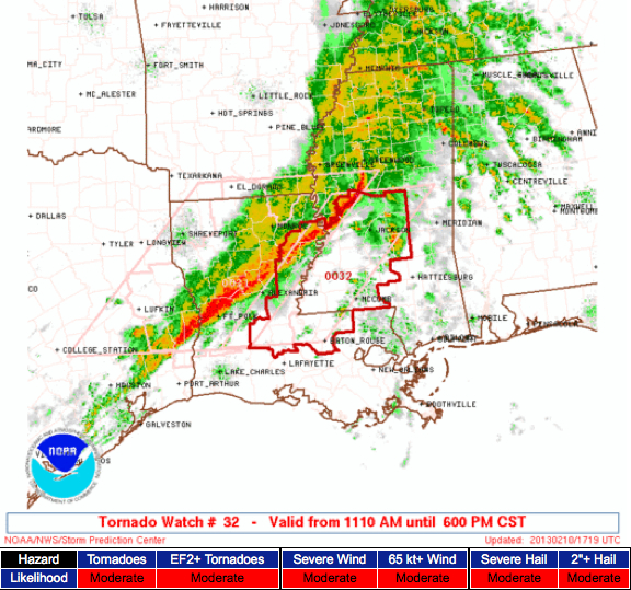
A tornado watch has been issued for parts of Central Louisiana into Central Mississippi. It will be valid until 6 p.m.
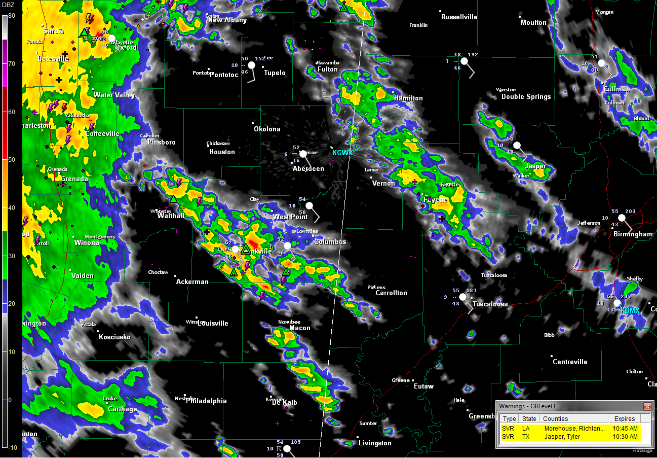
Showers and even some elevated thunderstorms are increasing across much of Mississippi into northwestern Alabama this morning ahead of a warm front in a conveyor belt of warm, moist air being shunted northward out of the Gulf of Mexico by strong winds in the lower atmosphere. We call them elevated, because the instability they are […]

An all new edition of the ABC 33/40 Weather Xtreme video is available in the player on the right sidebar of the blog. You can subscribe to the Weather Xtreme video on iTunes by clicking here. The title tells it all – Hold Onto Your Hats! The weather over the next week is going to […]
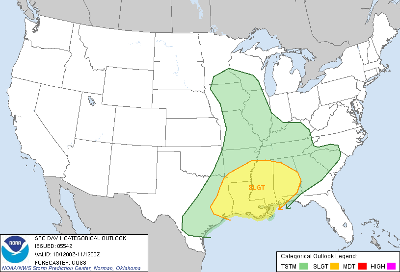
Brian will be along shortly with a full discussion and a fresh Weather Xtreme video. Wanted to address a few issues early this morning… *SEVERE STORMS POSSIBLE TONIGHT: SPC has much of Alabama in the standard “slight risk” of severe weather later today and tonight… We note severe weather watches are up to the west […]