Alabama 811 | Know What's Below.

Archive for December 24th, 2015

Warm Christmas Weather

Warm Christmas Weather

| December 24, 2015 @ 3:45 pm

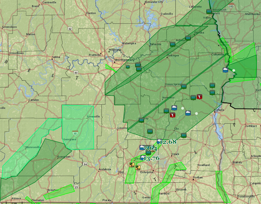
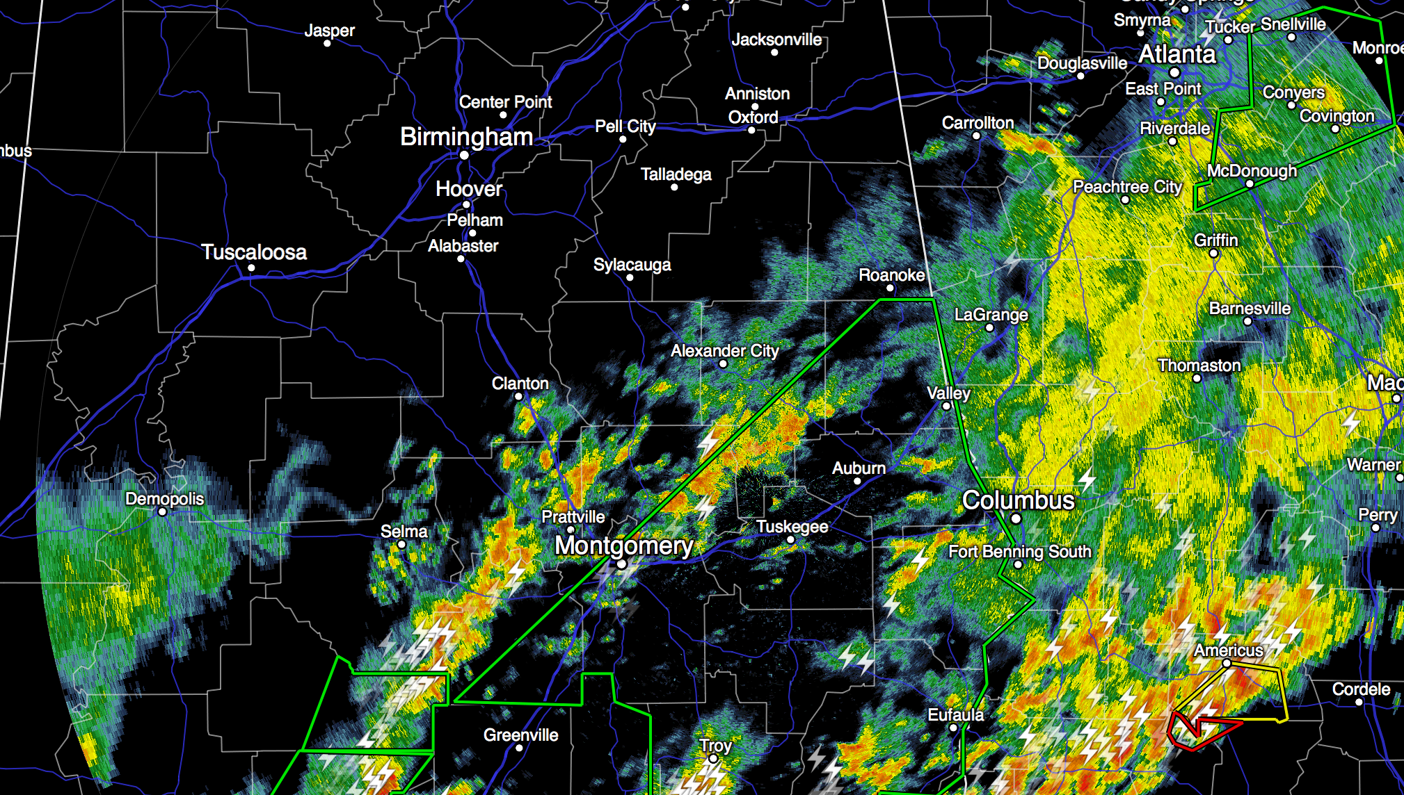
**No Weather Xtreme video this afternoon; we are on a holiday schedule** FLOODING OVER SOUTH AND EAST ALABAMA: Many South and East Alabama counties are under flash flood warnings this afternoon… Rain amounts have exceeded five inches in many places, and in some counties roads have been washed out. The image below is a road […]

Read More

Major Flooding Event in Southeast Alabama

Major Flooding Event in Southeast Alabama

| December 24, 2015 @ 11:41 am

A major flooding event is in progress across Southeast and South Alabama. UPDATE AT 12:08: CIVIL EMERGENCY MESSAGE ALABAMA EMERGENCY MANAGEMENT AGENCY RELAYED BY NATIONAL WEATHER SERVICE BIRMINGHAM AL 1205 PM CST THU DEC 24 2015 THE FOLLOWING MESSAGE IS TRANSMITTED AT THE REQUEST OF THE ALABAMA EMERGENCY MANAGEMENT AGENCY. THE BARBOUR…CHAMBERS…MACON…AND PIKE COUNTY EMERGENCY […]

Read More

The Social Media Dilemma

The Social Media Dilemma

| December 24, 2015 @ 8:41 am

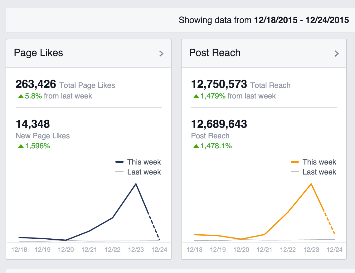
Times have changed; prior to any significant severe weather or winter storm threat, I spend long hours working social media, posting updates on what people can expect, and answering questions. Countless hundreds of questions. I am glad to do it; that is why I am here. And, I am honored people ask me. My Facebook […]

Read More

Record Warmth; Strong Storms

Record Warmth; Strong Storms

| December 24, 2015 @ 6:57 am

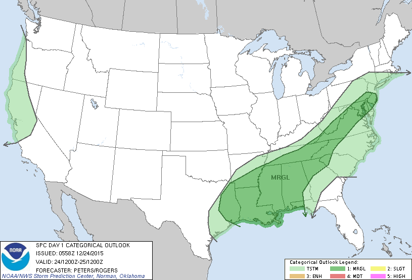
RADAR CHECK: Strong storms continue across parts of Central and South Alabama at daybreak on this Christmas Eve… As forecast, the severe weather event yesterday and last night was high impact. At least seven people were killed, and at least 40 people injured. The deaths were from Mississippi, Tennessee, and Arkansas. Among the dead was […]

Read More

Early Morning Notes

Early Morning Notes

| December 24, 2015 @ 4:23 am

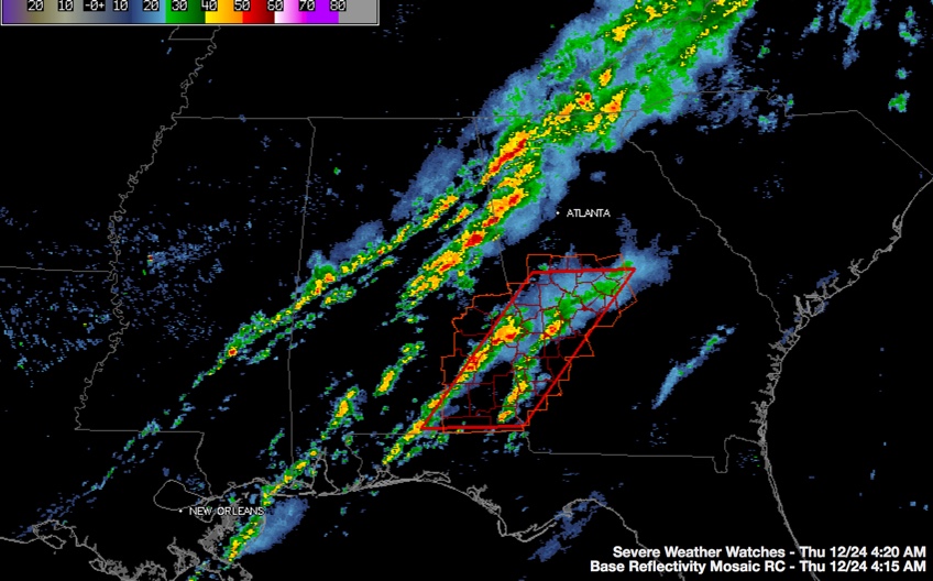
It has been a relatively quiet night across Central Alabama. The tornado watch for this part of the state has expired. A new tornado watch goes until 9 a.m. now for SE Alabama. Counties in the watch in the Birmingham NWS Coverage Area include Barbour, Bullock, Lee, Macon, Pike and Russell Three distinct lines of […]

Read More

Checking in Just After 2:30 a.m.

Checking in Just After 2:30 a.m.

| December 24, 2015 @ 2:38 am

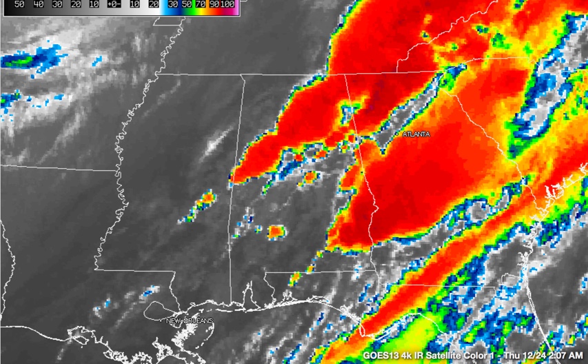
As we thought it might, the main line of showers and thunderstorms has slowed its forward progress this morning. Shortly before 2:30 a.m., the line extended from Albertville to Oneonta to Pinson to the City of Tuscaloosa to near Emelle in Sumter County. That is not much progress from last time we described its position. […]

Read More

Tuscaloosa County Storms Have Strengthened

Tuscaloosa County Storms Have Strengthened

| December 24, 2015 @ 1:18 am

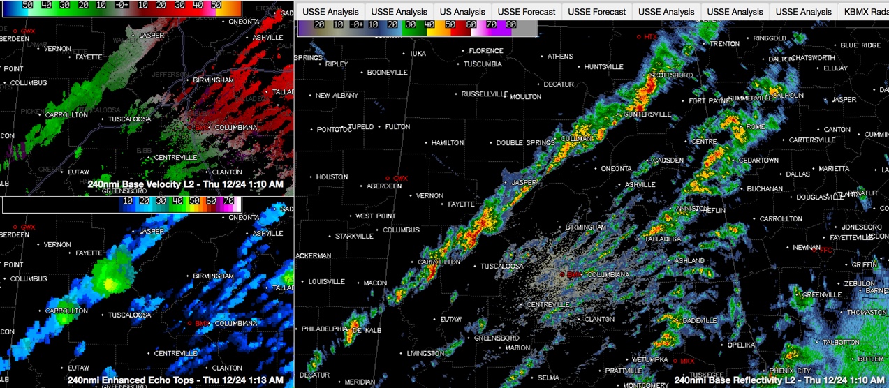
Storms have intensified over Tuscaloosa County and over eastern Pickens Counties early this morning. They are not severe, but they are some of the strongest storms we have seen across Central Alabama during this event. The tops of the thunderstorms are over 40,000 feet, and the storm north of the cities of Tuscaloosa and Northport […]

Read More

Strong Storms Over Walker County

Strong Storms Over Walker County

| December 24, 2015 @ 12:15 am

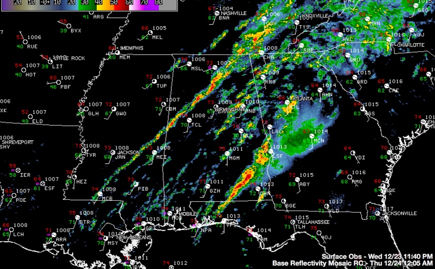
Still no severe weather across Central Alabama this evening as we pass the witching hour. A severe thunderstorm warning was just issued for Coffee County in Southeast Alabama. A narrow but nearly solid line of showers and thunderstorms extends from Arab to Hanceville to Jasper to east of Berry then on to Aliceville. The strongest […]

Read More