


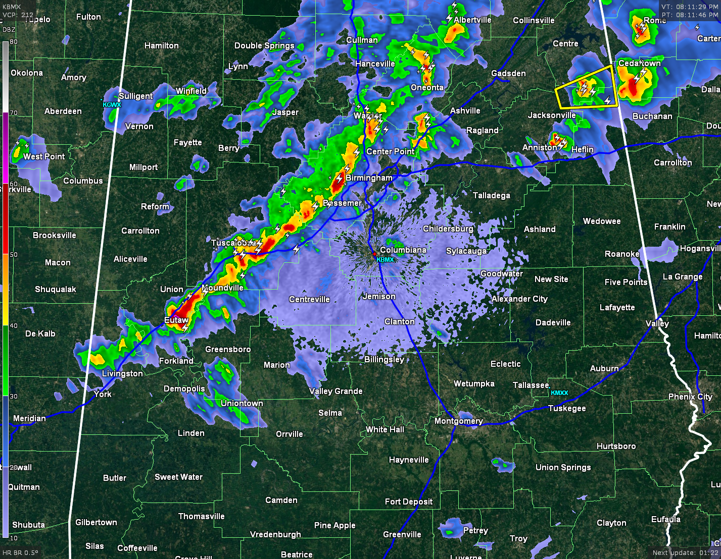
The first line of thunderstorms are exiting the state, and the last part of it hangs tough in Calhoun and Cleburne counties. A Severe Thunderstorm Warning remains in effect for these counties until 8:45 PM CDT. Nickel-size hail has been reported with this storm.
The second line of storms is close to approaching the Birmingham metropolitan area. There are a few heavy thunderstorms embedded in this line, especially over Rock Creek, Sylvan Springs, and Adamsville, and over Cottondale and Peterson in Tuscaloosa county. Another one was located over Eutaw stretching up to the northeast to Moundville. There are no warnings with this line as of now, but expect heavy rainfall, frequent lightning, some small hail, and gusty winds.
There are some scattered thunderstorms back off in Mississippi, over Choctaw, Clay, and Monroe counties. These storms were pushing off to the southeast at 40-45 MPH. These storms also had heavy rain with frequent lightning, and gusty winds.


