

Hold On! One More Hot Day!
Looks like one more round of hot weather before we see a change to cooler, drier weather. See the post below this one for a recap of the new record highs set yesterday.
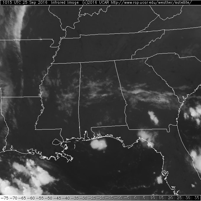
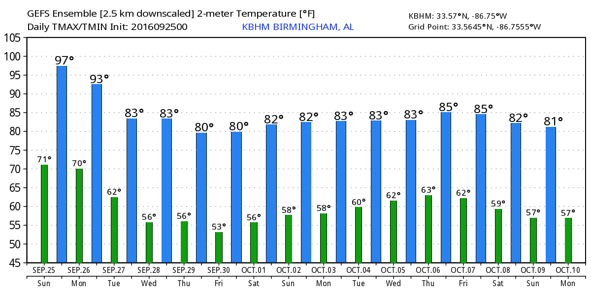
The sky across Central Alabama showed some streaks of clouds this morning as compared to the completely clear sky we had yesterday morning. Still even with those clouds we should see a good supply of sunshine again with highs climbing to near record levels with readings in the range of 94 to 97. But perhaps this will be our last really hot day for a while, maybe even until next year!
Beach weather looking good, too, with about 8 to 10 hours of sunshine daily on the coast from Dauphin Island to Panama City Beach through Wednesday with only widely scattered storms. Highs will be in the upper 80s on the immediate coast with low 90s inland through mid-week, but after that temperatures come down into the lower and mid 80s. See a very detailed Gulf Coast forecast here.
Severe weather appears to be at a minimum for the next several days. SPC has outlined a marginal risk around and just west of Chicago for Day 1. Day 2 sees that small area moves to the Central Appalachians covering West Virginia and western Pennsylvania. Day 3 is free of any areas of organized severe storms.
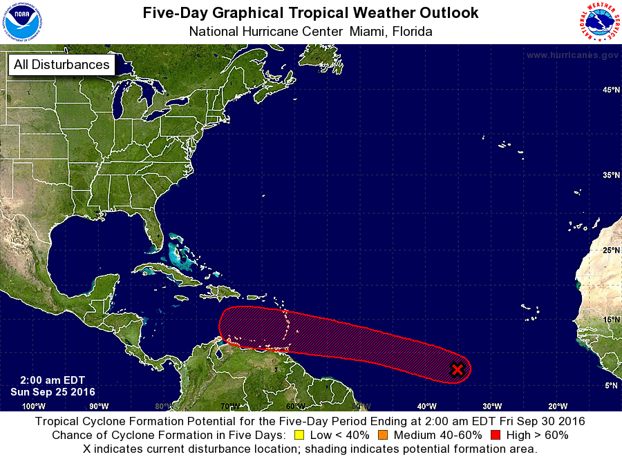
Tropics remain active. Lisa has dissipated. Karl is moving across the North Atlantic and will soon dissipate after it gains hurricane status for a brief time. The area of disturbed weather is the South Central Atlantic continued to chug steadily westward at 15 to 20 mph. Conditions in the atmosphere are expected to become favorable for development of this system as it approaches the Leeward Islands and the eastern Caribbean. The system could become a tropical depression about mid-week.
The weak low pressure area in the atmosphere along the Gulf Coast will continue to produce scattered showers and thunderstorms today mainly along the Gulf Coast and South Alabama. NWS Mobile issued a couple of severe thunderstorm warnings yesterday, and we may see the same thing today. Storms should be fairly isolated similar to what we saw on radar yesterday.
The cold front stretching from eastern Minnesota in an arc southwestward into West Texas is forecast to move steadily eastward. This motion should bring the front into Central Alabama during the early afternoon on Monday. Aloft, a strong trough will propel the surface system eastward as the trough breaks down the ridge in place over the eastern US today. Unfortunately, while we need to see a good rain event, it is unlikely that we’ll see that happening with this system. Precipitable water values are forecast to be in the range of 1.4 to 1.7 inches, so while showers and thunderstorms are likely to occur, not everyone will see rain and rainfall amounts are expected to be less than a quarter of an inch. Certainly not a drought buster.
The front slides well into the Gulf on Tuesday as the upper trough sets up for a couple of days over the eastern US. Wednesday is likely to be our coolest day with morning lows falling into the lower 50s area wide. Those typically cooler spots will probably see lows in the upper 40s. Highs will be much more seasonal with values in the lower 80s.
Beginning Thursday the ridge to our west slides eastward into the Southeast US keeping us dry for the end of the week and into the weekend. Lows should be in the 50s and highs mainly in the lower 80s – and that should feel really nice with dew points around 50 degrees.
Getting out into voodoo country, and the GFS is maintaining a forecast that includes a strong tropical system in the Caribbean. While the GFS has remained on track with the idea of a strong tropical system, the forecast path of the storm has not. Friday the forecast carried the system into the Central Gulf. Yesterday it was in the eastern Gulf. Today, the path of the storm is forecast to cross Cuba and travel northward right up the west coast of the Florida Peninsula. So while we have continuity for the development of a tropical storm or hurricane, we do not have continuity on where it will go, so we can only speculate on that for now. It is interesting to note that the European model also develops a storm in the eastern Caribbean, but the track on the European is way east of the GFS taking the storm across Hispaniola. There is lots of time before any of this will occur, and I expect to see additional changes before we are able to focus in on a reasonable forecast.
James Spann will have the next edition of the Weather Xtreme Video bright and early on Monday morning. You can always check back here for updates on how the weather is changing. Stay cool and Godspeed.
-Brian-
Category: Alabama's Weather
About the Author (Author Profile)
Brian Peters is one of the television meteorologists at ABC3340 in Birmingham and a retired NWS Warning Coordination Meteorologist. He handles the weekend Weather Xtreme Videos and forecast discussion and is the Webmaster for the popular WeatherBrains podcast.Subscribe
If you enjoyed this article, subscribe to receive more just like it.


