

Records Should Fall Again Today As It Is Quite Warm At Midday Already
Same Forecast, Different Midday:
By the end of today, we will have set a record in the city of Birmingham for the high temperature and for the warmest high temperature ever recorded in the month of November. The record high of 85 that was set back in 2000 will fall today, as the forecasted high for Birmingham is 88. That old record high is also tied for the warmest high recorded in the month of November.
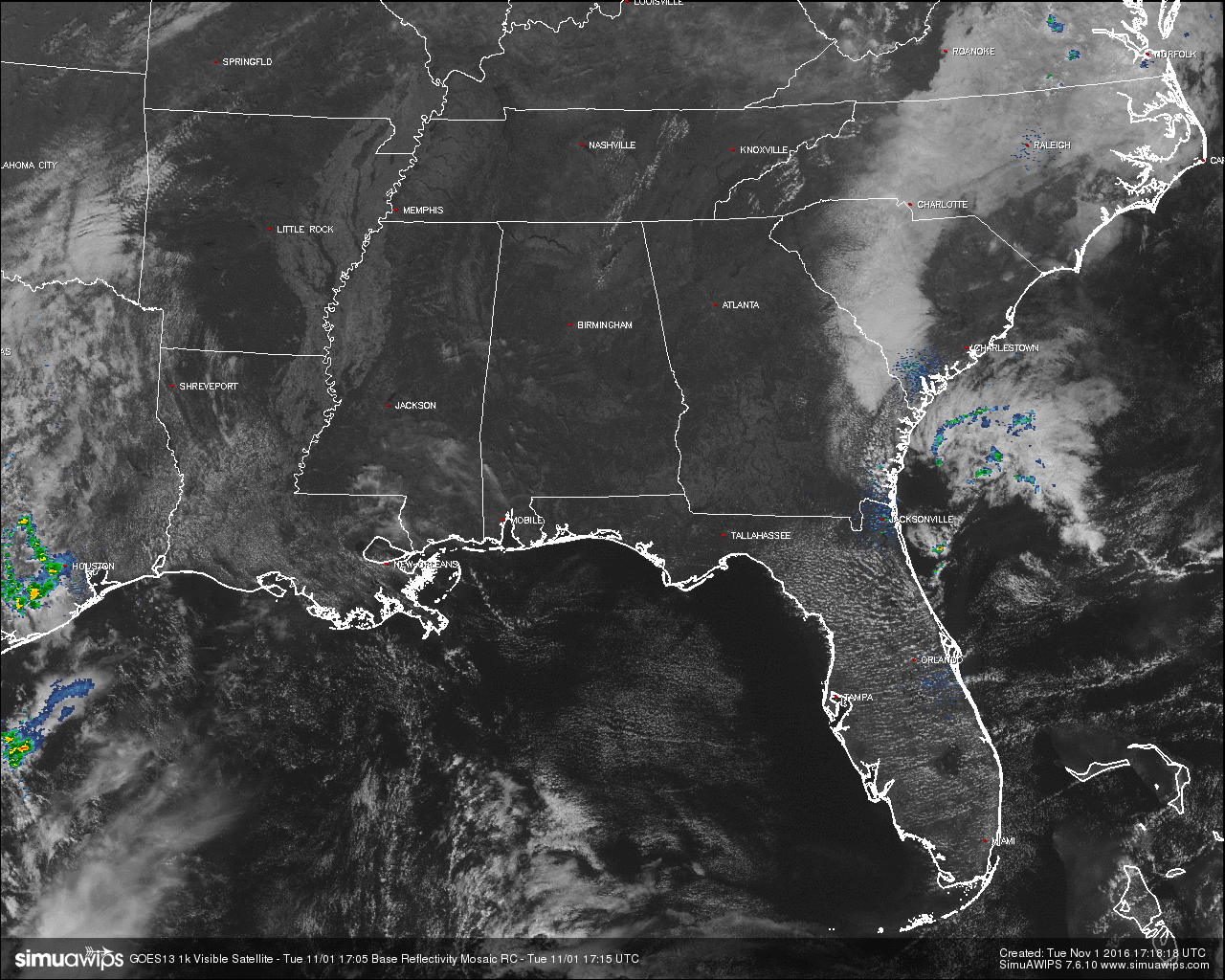
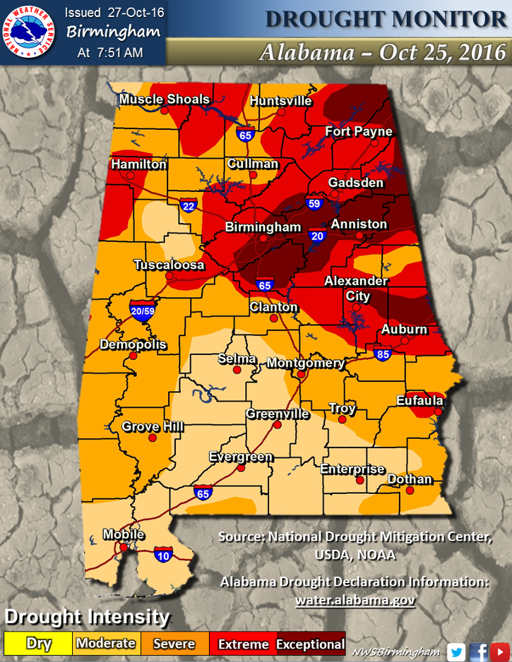
Clouds and rain will not keep us from reaching record highs today, as neither one of those are present in Central Alabama at this midday hour, and will stay that way for the remainder of the day. Today will also be the 44th consecutive day at the Birmingham Airport without any measurable rain. Just about every location north of the I-85 and US-82 has been defined in a severe drought classification or worse.
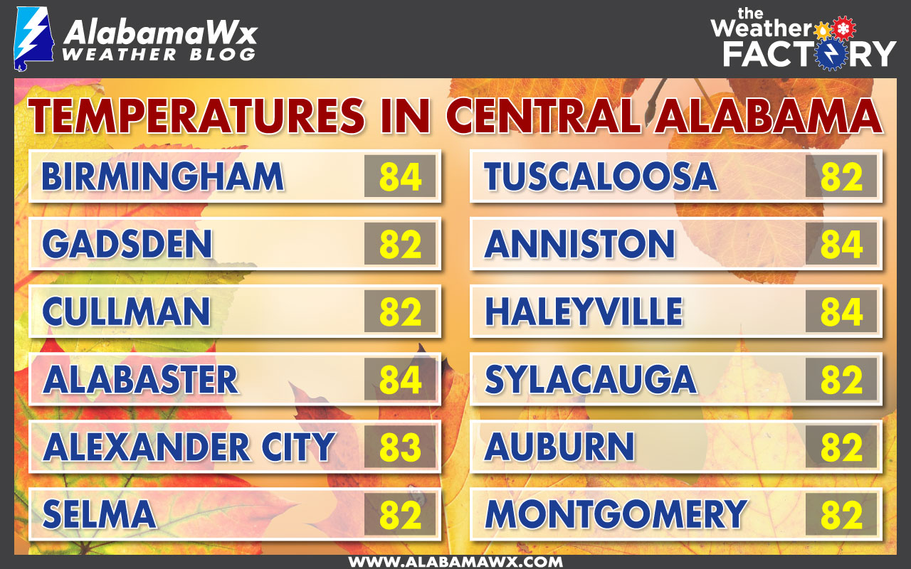
Temperatures in Central Alabama at 12:15 PM CDT:
Burn Ban and Fire Alert:
A Drought Emergency continues in effect, banning any outdoor burning for the northern two-thirds of the state. A Fire Alert remains in effect for the whole state. Click here for more information.
Code Yellow Air Quality Alert:
Particulate Matter 2.5 levels will be high enough to raise a Code Yellow Air Quality Alert for the Birmingham metropolitan area today. Unusually sensitive people should consider limiting prolonged outdoor exertion.
Birmingham’s Climatology and Records:
The normal high for November 1st is 69, while the normal low is 46. The record high for today was set back in 2000 at 85. The record low was set back in 1993 at 25.
Rest of Today:
As we continue the same weather pattern of the persistent upper ridge, and the lack of soil moisture, heat levels will be allowed to climb due to the fact that the sun’s energy doesn’t have to be used on evaporating soil moisture. Skies will be mostly clear to sunny, and expect afternoon highs to be in the mid to upper 80s, with a few spots possibly touching 90 degrees. Many will be close to tying or breaking record highs, as much of Central Alabama will be 15 to 20 degrees above normal. Tonight will be mild with mostly clear skies, and overnight lows in the upper 50s to low 60s.
Wednesday’s Forecast:
Temperatures will be a few degrees cooler, but record highs could still be in jeopardy. A mix of sun and clouds can be expected, with afternoon highs in the mid 80s, still about 15 degrees above normal. The record high for Birmingham is 85, set back in 2003, could be tied or broken as the forecasted high is 85 degrees. Once again, no rain is expected as we should hit day number 45 in the dry streak. Skies will be partly cloudy tomorrow night, and overnight lows will be in the upper 50s to low 60s.
Headed to the Beach:
Sunny days, fair nights on the coast from Panama City Beach to Gulf Shores through early next week; highs in the low 80s through Thursday, then dropping into the 70s Friday and over the weekend. See a very detailed Gulf Coast forecast here.
The Tropics:
Tropical cyclone formation is not expected during the next 5 days across the Gulf of Mexico, Caribbean Sea, and the North Atlantic Ocean. Good news is that the Atlantic Hurricane Season comes to a close at the end of this month.
On This Day in 1861:
A hurricane near Cape Hatteras, NC, battered a Union fleet of ships attacking Carolina ports, and produced high tides and high winds in New York State and New England.
Follow the Alabama Wx Weather Blog on Twitter:
Be sure to follow the Alabama Wx Weather Blog on Twitter. Just click here to start following our feed.
WeatherBrains:
This is the weekly netcast that’s all about weather featuring many familiar voices, including our meteorologists at ABC 33/40. You can listen anytime on the web, or on iTunes. You can find it here.
Advertise With Us:
Deliver your message to a highly engaged audience by advertising on the AlabamaWX.com website. The site enjoyed 10.2 MILLION pageviews in the past 12 months. Don’t miss out! We can customize a creative, flexible and affordable package that will suit your organization’s needs. Contact Bill Murray at (205) 687-0782.
Category: Alabama's Weather
About the Author (Author Profile)
Scott Martin is an operational meteorologist, professional graphic artist, musician, husband, and father. Not only is Scott a member of the National Weather Association, but he is also the Central Alabama Chapter of the NWA president. Scott is also the co-founder of Racecast Weather, which provides forecasts for many racing series across the USA. He also supplies forecasts for the BassMaster Elite Series events including the BassMaster Classic.Subscribe
If you enjoyed this article, subscribe to receive more just like it.


