

Another Cold Front Early Thursday
.
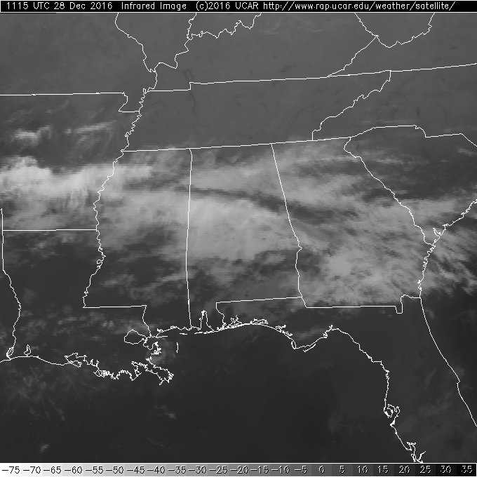
Clouds cover much of Alabama this morning with fog still an issue along the Gulf Coast from Brownsville all the way to the Big Bend area of Florida and over to Jacksonville. Dense fog advisories were in effect for these areas with fog expected to burn off in the 9 to 10 am time frame. The front that slowly plodded southward yesterday was situated just inland from the Gulf Coast this morning. The front is expected to move northward today, so while our upper flow remains nearly zonal, we may see an isolated shower or two, but most of Central Alabama remains dry. Our highs today should be in the upper half of the 60s.
Plans for the beach? Look for mostly cloudy skies with rain chances today and Thursday. Friday should be a sunny day, but rain chances return for the weekend. Highs will be mainly in the 60s today and Thursday dropping into the 50s for Friday. Over the weekend it warms up again with highs in the 60s. See the complete Gulf Coast 7-Day Planner here.
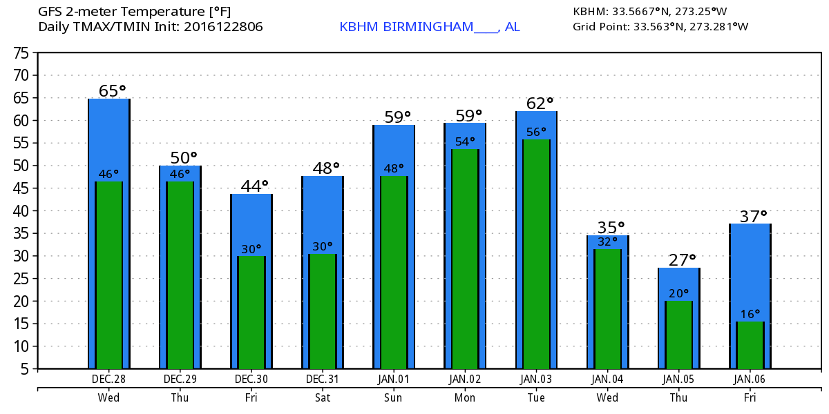
Another cold front enters the picture rapidly this evening and into the early morning hours of Thursday as a trough digs into the eastern US. This takes our flow northwesterly, and unlike the front yesterday, this one should blast through Alabama during the first half of the day Thursday. Showers with the potential for an embedded thunderstorm will will develop this evening and move rapidly through the northern half of the state with the front reaching South Alabama by noon time. This is really good news for the Birmingham Bowl at Legion Field because it means the rain should be over by mid-morning with clearing skies forecast for the late morning into the early afternoon. The high for Thursday is likely to occur during the early morning hours with temperatures holding steady or falling through the 50s during the afternoon. By Friday morning we should see lows at or slightly below freezing.
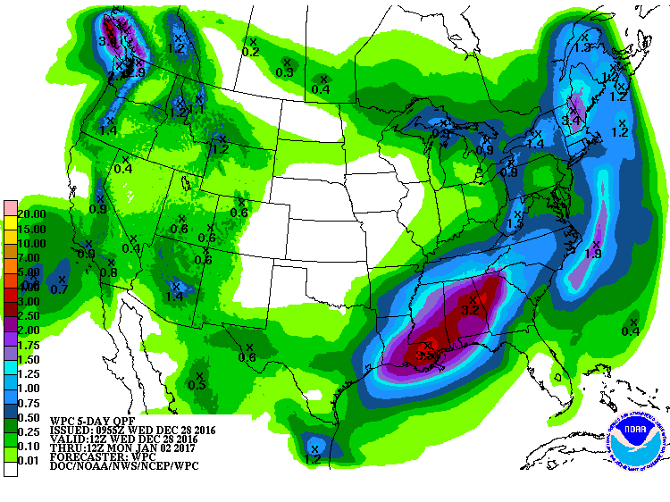
Friday will be a brisk day with temperatures not expected to warm higher than the upper 40s. Saturday morning will be another cold morning with lows in the upper 20s. But Saturday everything turns around again with upper flow coming around to westerly. This will help to begin picking up Pacific moisture was a series of minor short waves come out of the Southwest US setting the stage for an extended period of rain from late Saturday through Sunday and into Monday. Saturday will still be cool with highs in the 50s, but Sunday and Monday should see highs into the 60s. Right now there does not appear to be enough instability to produce any severe weather, but we’ll need to maintain a careful watch on these conditions as the forecast moves forward. Rainfall is likely to be in the range of 1 and a half inches to over 3 inches across a large portion of the Southeast US. This will help to reduce the drought conditions, but this one event is not likely to end the drought completely.
Tuesday through Thursday the overall upper flow takes on a broad trough over the eastern US. We could see another quick round of showers with a cold front late Tuesday into early Wednesday that will once again bring our temperatures down. By Wednesday we could see our highs struggle to reach the 50-degree mark.
Looking out into voodoo country, the GFS maintains a little chillier look than what we saw yesterday. The broad trough around the 5th of January goes zonal for several days before coming back into a broad trough configuration by the 9th. That evolves into weak ridging by the 12th of January, so while the pattern looks chillier than yesterday there is still no evidence of any extreme cold.
Reminder that we are on a one-a-day schedule for the Weather Xtreme Videos, so I plan to have the next edition posted between 7 and 7:30 on Thursday morning. Enjoy your day and Godspeed.
-Brian-
Category: Alabama's Weather
About the Author (Author Profile)
Brian Peters is one of the television meteorologists at ABC3340 in Birmingham and a retired NWS Warning Coordination Meteorologist. He handles the weekend Weather Xtreme Videos and forecast discussion and is the Webmaster for the popular WeatherBrains podcast.Subscribe
If you enjoyed this article, subscribe to receive more just like it.


