

Severe Weather Update at 7:15 p.m.
Showers and thunderstorms are occurring from southern Tennessee into North Central Mississippi. There are no warnings right now.
Earlier, elevated storms that produced large hail prompted severe thunderstorm warnings in western Tennessee and along the Alabama/Tennessee border. Hail as large as 1.75 inches was reported in western Tennessee.
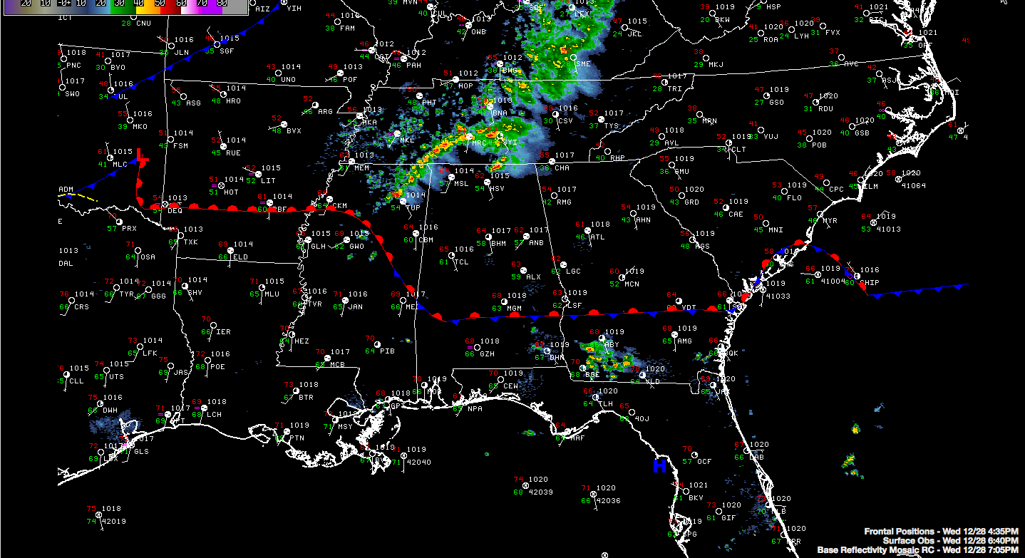
The warm front has slowed its northward progress tonight, which is really good news. If we can keep the warm sector to the south, it will be harder to get severe weather over Central and North Alabama. To the west, the front is lifting north as a weak surface low moves from Oklahoma into Arkansas.
Instabilities should begin to rise over the next few hours as colder air aloft spreads into the area and dewpoints continue to slowly rise. But it appears that the best wind shear may shift off to the east before the main instability gets in place over Alabama.
Storms should be into Northwest Alabama shortly and reach the I-59 Corridor between 11 p.m. and midnight.
There is still a chance for damaging winds, hail and an outside chance of an isolated tornado overnight tonight.
Stay tuned for frequent updates through the night.
Category: Severe Weather
About the Author (Author Profile)
Bill Murray is the President of The Weather Factory. He is the site's official weather historian and a weekend forecaster. He also anchors the site's severe weather coverage. Bill Murray is the proud holder of National Weather Association Digital Seal #0001 @wxhistorianSubscribe
If you enjoyed this article, subscribe to receive more just like it.


