

Look What is Upstream Coming Our Way
We are watching an upstream area of precipitation that is increasing over Louisiana and Mississippi that presents a significant winter storm threat for Alabama tonight.
Here is the regional radar with temperatures:
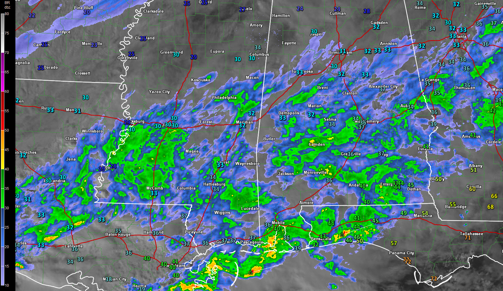
Deteriorating road conditions are being reported in the Jackson MS area as a mass of moderate to occasionally heavy freezing rain and sleet moves across northeastern Louisiana and Central Mississippi. Roads are reportedly turning into skating rinks.
Accidents are reported due to ice accumulation on bridges around Vicksburg MS on I-20.
Thundersnow has been reported in the Natchez MS area. The convection is being aided by an approaching upper level disturbance, which is bringing in colder air aloft, resulting in some instability.
Freezing rain with thunder was reported at Alexandria LA earlier. That area is getting light snow now.
Getting some thundersnow is not out of the question here in Central Alabama.
The best chance for snow looks like it might be right along I-20 from Pickens through Tuscaloosa and into Jefferson Counties. This will expand through St, Clair, Etowah, Calhoun and Cherokee Counties.
A large band of sleet will form along and south of this band. Further south, it will transition to freezing rain and eventually the further south you go, it will changeover to rain.
The biggest threat of freezing rain will be from south of Clanton to near Montgomery.
Temperatures will fall into the teens north of I-20 tonight, with readings around 20F in the I-20 Corridor and in the middle 20s down into South Central Alabama.
A wind chill advisory has been issued for the Tennessee Valley area of North Alabama from 3 a.m. until 9 a.m. for wind chills between -5 and 5F.
Travel problems will persist through much of Saturday. Some improvement is possible tomorrow afternoon as the sun comes out.
Category: Winter Weather
About the Author (Author Profile)
Bill Murray is the President of The Weather Factory. He is the site's official weather historian and a weekend forecaster. He also anchors the site's severe weather coverage. Bill Murray is the proud holder of National Weather Association Digital Seal #0001 @wxhistorianSubscribe
If you enjoyed this article, subscribe to receive more just like it.


