


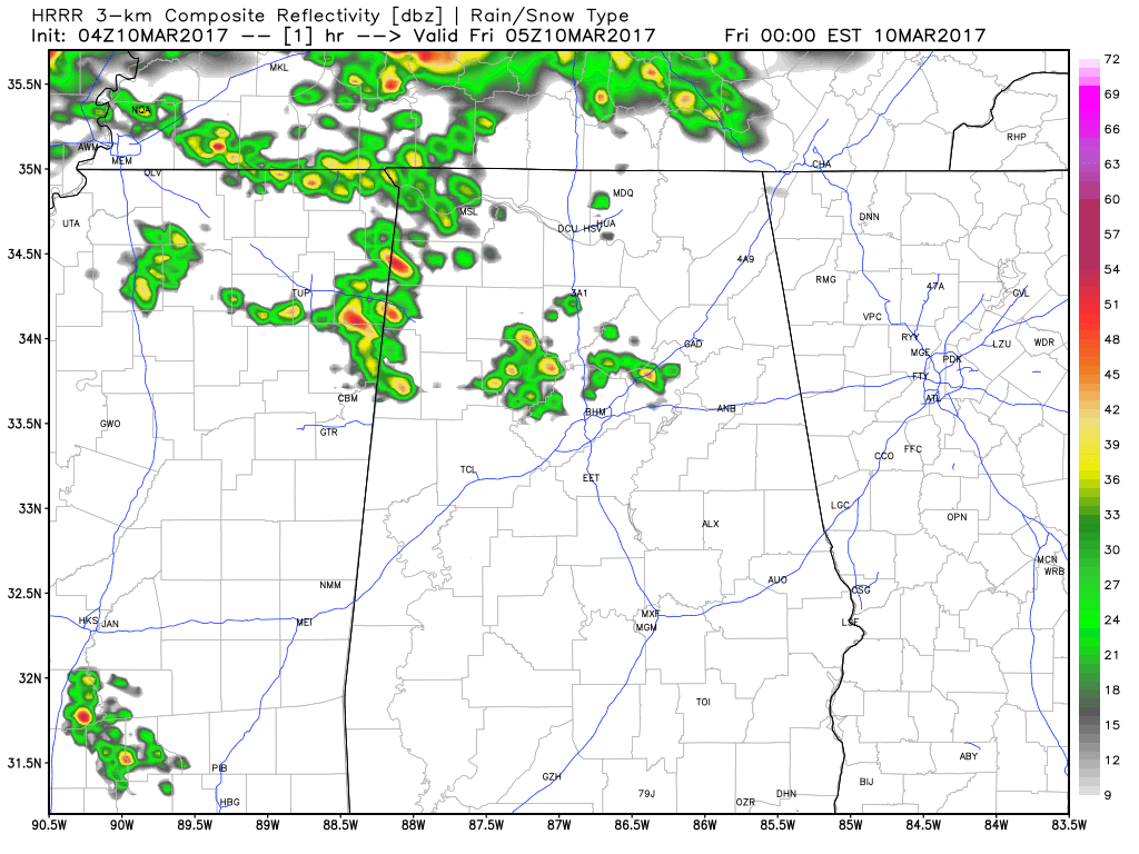
Strong showers and storms have formed tonight out ahead of our main line of storms. They are causing lots of reports of hail, some large.
Wind damage reports have been few and far between so far with these storms, but strong mid level and low level winds could easily be transported to the surface.
The main line of storms extends along the Tennessee River from Florence to Town Creek to Athens to Huntsville and up into Tennessee. Lots of lightning, strong gusty winds and small hail being indicated along with torrential rains. but no severe weather reports in Alabama yet.
THOUGHTS ON TIMING
…Hamilton/Cullman around 2:30 a.m.
…Weakening as it approaches the Birmingham, Tuscaloosa and Anniston areas around 3 a.m.
BUT
It appears additional storms will continue forming ahead of the main line as it drops south into the I-20 Corridor. Storms could affect the Birmingham area starting between 1 and 2 a.m.


