

Big Winter Storm for the East Coast Early Next Week
The potential is there for a big winter storm from the Mid-Atlantic into the Northeast U.S. Monday night and Tuesday.
Intense low pressure passing east of Nova Scotia is combining with a powerful anticyclone over Central Canada to funnel frigid air into New England and a powerful jet stream it poised to spin up a whooper of a low pressure system on Monday that will move along the East Coast.
This nor’easter has the potential to bring major snows to the Megapolis from Washington DC to Boston.
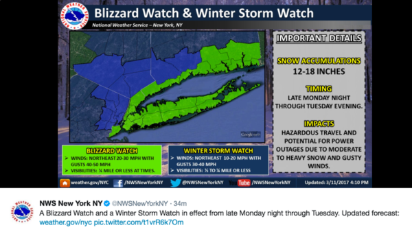
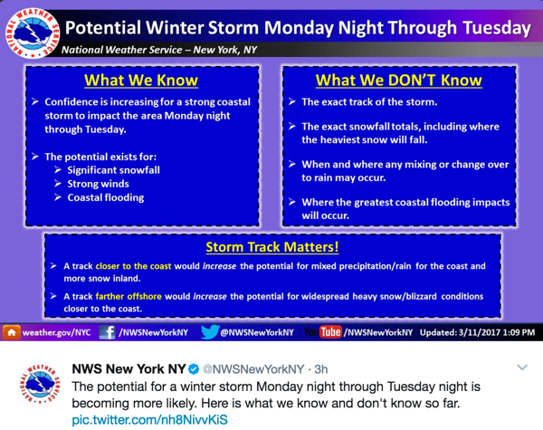
Winter storm watches are already in effect for a wide region and the National Weather Service in New York City has already posted a Blizzard Watch and Winter Storm Watch for Monday night through Tuesday.
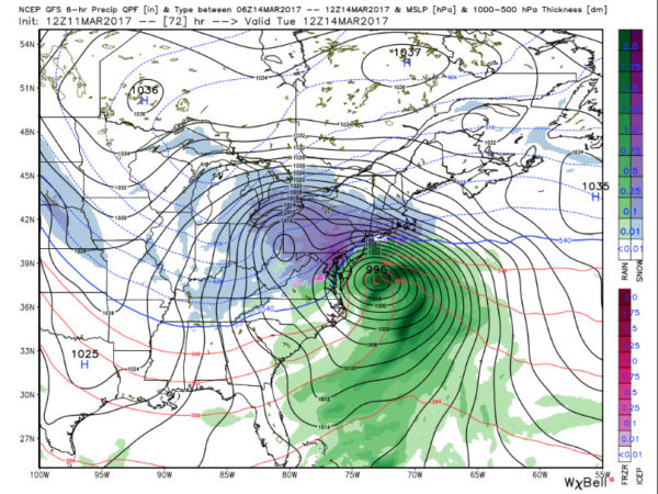
The track of the low is critical to the confidence in this forecast:

There is decent consistency between the two global models, forecasting a powerful low (988 mb) about 100 miles east of the Delmarva early Tuesday morning. The GFS track passes just east of the tip of Long Island and over Cape Cod later in the day. This track is far enough east to produce heavy snow for Washington, D.C., Philadelphia and New York City with a mix for Boston.
Snowfall amounts could be 8-10 in D.C. and 10-12 inches or higher in New York City. Winds will be strong and coastal flooding will be a problem.
Here is some additional information from the NWS in New York City:
Cold air is pouring into the Northeast. New York City will go just above freezing for a short time Monday afternoon, otherwise they are in the deep freeze as you can see from this GFS meteogram:
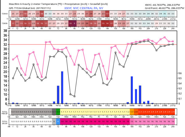
If you look closely, you can see ten inches of snow from the early week system with another 6 inches from a late week system.
New York City has had a fairly normal year so far in terms of snow, picking up 23.4 inches this winter, just a little under an inch below normal. Washington D.C. has had sparse snows so far, measuring only 1.4 inches, against an average by now of 15 inches.
The snows could deal fits to the cherry blossoms in D.C. which were on track for the earlier peak ever until this recent cold spell.
Category: ALL POSTS, Winter Weather
About the Author (Author Profile)
Bill Murray is the President of The Weather Factory. He is the site's official weather historian and a weekend forecaster. He also anchors the site's severe weather coverage. Bill Murray is the proud holder of National Weather Association Digital Seal #0001 @wxhistorianSubscribe
If you enjoyed this article, subscribe to receive more just like it.


