


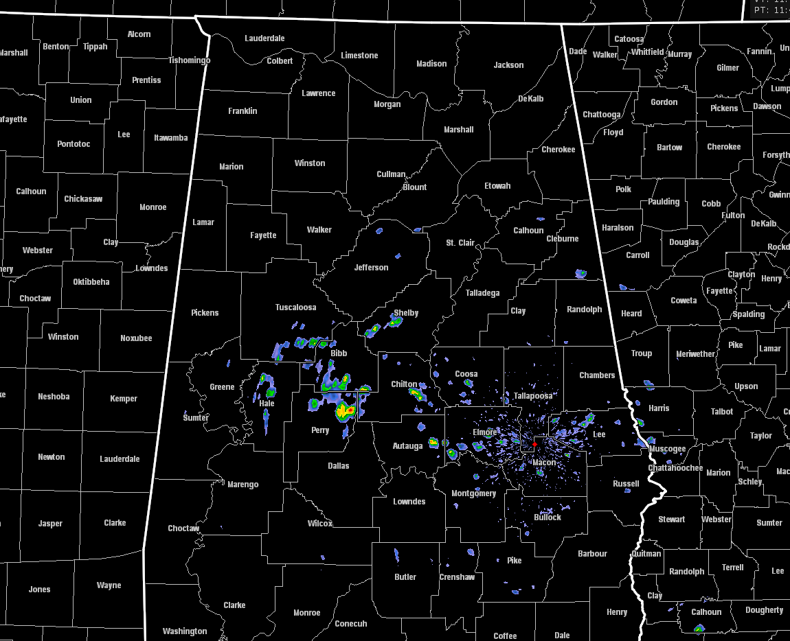
RADAR CHECK
At 11:10AM across Central Alabama, it is a really quiet day compared to the action that took place across the northern half of the state on Monday afternoon and into the early morning hours this morning. Radar at this time is showing just a few scattered showers over portions of South/Central Alabama at this time, which is the remnants of the line that pushed through the northern parts of the state after midnight.
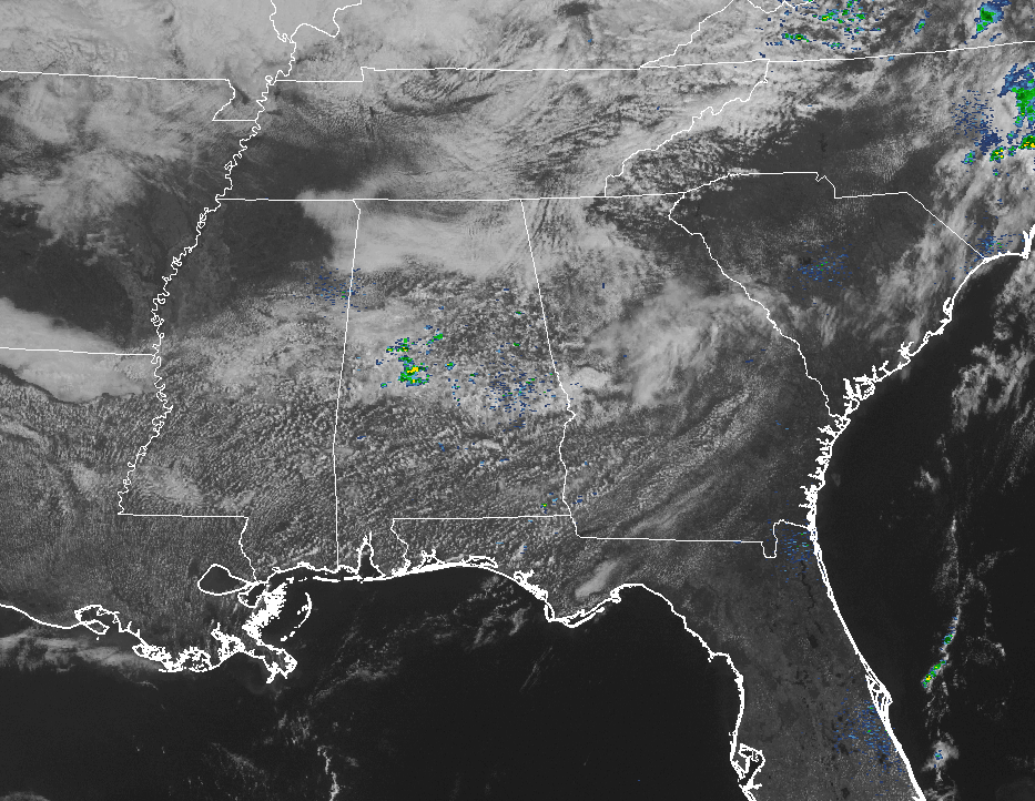
We have a mix of sun and clouds across the state at this point, and it’s pretty much that way across much of the southeastern United States. Showers and storms are located over the eastern parts of North Carolina and out into the Atlantic Ocean. Other than that, the rest of the southeast is dry, and a good supply of sunshine is gracing just about all of the beaches along the Gulf Coast and the Atlantic Coast.
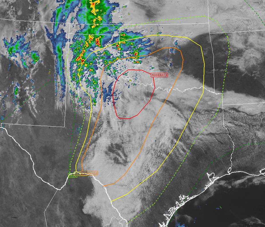
SEVERE STORMS LIKELY BACK TO OUR WEST
Back over Texas and Oklahoma, we have a plethora of severe risks today issued by the Storm Prediction Center. Risks are ranging from marginal to as high as moderate across portions of the two southern plains states, with very large hail, tornadoes, and damaging thunderstorm winds all possible throughout today. As you can see, active storms are affecting the panhandles of Texas and Oklahoma currently. These storms are elevated in nature, but surface-based storms will develop out ahead of the dryline and will take on supercell characteristics. The highest hail threat will be with the supercells, along with a smaller tornado threat. As the storms mature they will form into lines and then will have the highest threat from damaging winds from bowing segments, along with large hail and a few tornadoes.
WEATHER FOR THE REST OF TUESDAY ACROSS CENTRAL ALABAMA
A mix of sun and clouds can be expected across the area for the remainder of the afternoon, and a risk for a few scattered showers and thunderstorms developing. Good news is that any that form are not expected to be severe, and should decrease during the late evening and overnight hours. Afternoon highs will be in the upper 70s to the mid 80 across Central Alabama, with lows in the mid 50s to the lower 60s.
A SMALL RISK OF SHOWERS AND STORMS ON WEDNESDAY
Another day that will feature a mix of sun and clouds, and warm temperatures. Most of the area will remain dry throughout the day, but we could have a few isolated showers or thunderstorms develop during the afternoon. Once again, no severe weather is expected. Highs will be in the lower to mid 80s across the area. Odds for any one location getting rain through the day will be about 1 in 5.
BEACH FORECAST
Click here to see the Beach Forecast Center page. Save Up To 25% on Spring Break Beach Vacations on the Alabama Gulf Coast with Brett/Robinson! The Beach Forecast is partially underwritten by the support of Brett/Robinson Vacation Rentals in Gulf Shores and Orange Beach. Click here to see Brett/Robinson’s best beach offers now!
STORM SPOTTER TRAINING
The ABC 33/40 Weather Authority team will be on the road through early April offering free storm spotter classes. We need more trained spotters in Alabama. By attending, you can make the severe weather warning process better. No need to register, just come with a curious mind. There is no age limit. Kids that love weather will enjoy it. You will never look at a storm the same again. This week the team will be at Oxford on Tuesday (at the Oxford Civic Center), and Jasper on Thursday (at the Jasper Civic Center).
WEATHERBRAINS
Don’t forget you can listen to the weekly 90 minute netcast anytime on the web, or on iTunes. This is the show all about weather featuring many familiar voices, including meteorologists at ABC 33/40. We will produce this week’s show Monday evening at 8:30 CDT… you can watch it live here.


