

Strong Storms Moving Into Parts of Lee, Randolph, Bullock, Macon, Tallapoosa, Chambers, Cleburne Counties
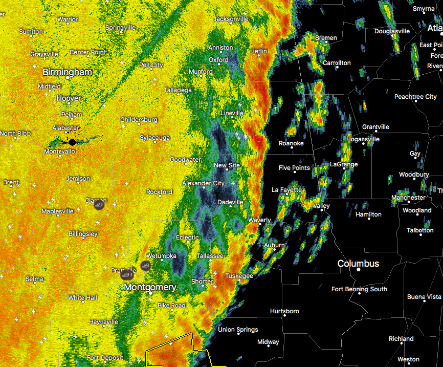
At 906 AM CDT, strong thunderstorms were along a line extending from near Fosters Cross Roads to near Hardaway. Movement was northeast at 40 mph. Wind gusts up to 50 mph will be possible with these storms.
NWS Birmingham has issued a Significant Weather Advisory for Lee, Randolph, Northwestern Bullock, Macon, Eastern Tallapoosa, Chambers, and Southeastern Cleburne Counties until 10:00AM.
Locations impacted include Auburn, Opelika, Tuskegee, Valley, Lanett, Roanoke, Dadeville, Camp Hill, Notasulga, Wedowee, Stroud, Lake Wedowee, Lafayette, LaFayette, Wadley, Red Level, Ranburne, Woodland, Franklin and Waverly.
Torrential rainfall is also occurring with these storms, and may lead to localized flooding. Do not drive your vehicle through flooded roadways. Frequent cloud to ground lightning is occurring with these storms. Lightning can strike 10 miles away from a thunderstorm. Seek a safe shelter inside a building or vehicle.
Category: ALL POSTS, Severe Weather
About the Author (Author Profile)
Scott Martin is an operational meteorologist, professional graphic artist, musician, husband, and father. Not only is Scott a member of the National Weather Association, but he is also the Central Alabama Chapter of the NWA president. Scott is also the co-founder of Racecast Weather, which provides forecasts for many racing series across the USA. He also supplies forecasts for the BassMaster Elite Series events including the BassMaster Classic.Subscribe
If you enjoyed this article, subscribe to receive more just like it.


