

Late Night Notes on the Severe Weather Situation for Wednesday
We continue to track the prospects of a significant severe weather outbreak across parts of Alabama tomorrow. Here are some late evening thoughts:
We can already see moisture beginning to surge north from the Gulf Coast as surface flow turns more southerly across the Deep South in front of a developing low pressure system near Tulsa Oklahoma
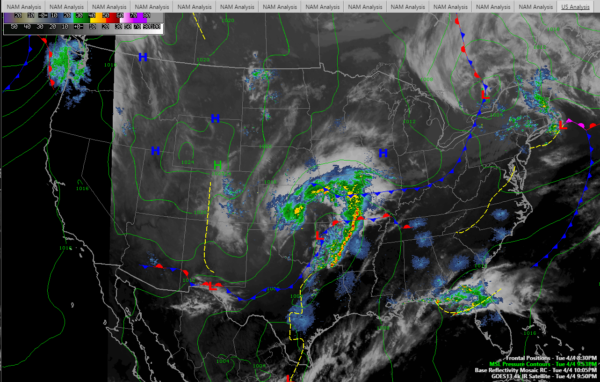
Severe thunderstorm watches cover parts of Kansas, Oklahoma, Missouri, Arkansas and Northeast Texas tonight. Currently 2 severe thunderstorm and 2 tornado warnings in that part of the country. The SPC has a slight risk in that area tonight.
We have a slight risk over much of Alabama through 7 a.m. for the storms that will develop in the pre-dawn hours over Central Alabama as moisture surges northward.
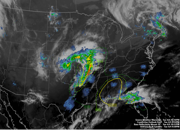
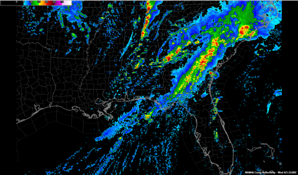
The morning activity over us will push northeastward through the late morning hours with a couple of hours lull until early afternoon. Here is the radar from the WRF at 6 a.m.
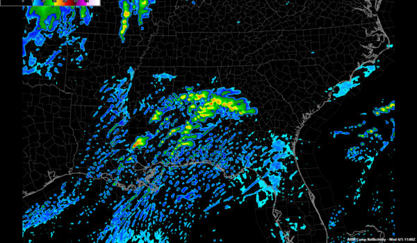
The latest WRF shows storms developing in the I-59 Corridor around 4 p.m. and then intensifying rapidly as they push across East Alabama. They run into the best helicity or spin from wind shear about the time they get into Georgia. If this happens, the threat to Alabama will be lessened. It is only one model run but it is interesting that the WRF has been consistently preaching this message until this morning when it fell into line with the idea of a line of supercells forming west of I-65 and marching eastward.
Here is the WRF at 6 p.m.:
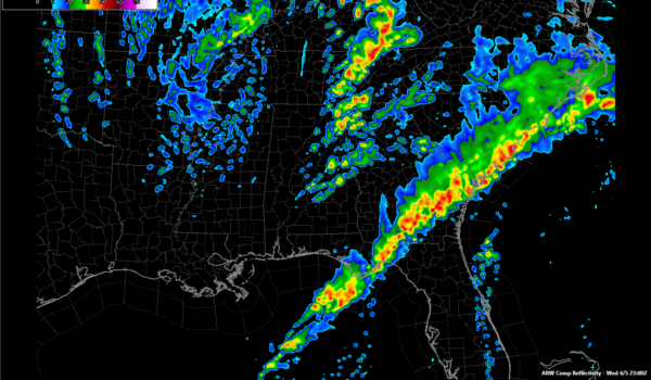
The latest HRRR shows the morning convection, and then develops a line of storms in eastern Mississippi. The model doesn’t go out past 2 p.m. at this time so we can’t see the eventual solution yet. But that would be a more dangerous situation for Alabama. The HRR shows a highly unstable atmosphere available for the storms to feed on.
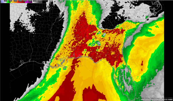
Here is the HRRR CAPE forecast for 19z or 2 p.m. CDT, showing the highly unstable environment any storms that form over Mississippi would encounter over Alabama. The red is around 4,000 joules/kg. That’s volatile.
The NAM 4k splits the difference, showing the storms forming near I-65 around 1 p.m.
It shows CAPE values of 2,000-3,000 joules, which is plenty sufficient for big storms. It does not show as much helicity, especially in the lowest part of the atmosphere. This would mean less spin for tornadoes.
We are anxious to see the GFS which is coming in now. I will post what it is indicating around 11-1115 tonight.
So, all in all, the forecast is on track with some variations in the models that could affect the eventual outcome. We will have noisy thunderstorms in the morning that will present the threat of hail and gusty winds. Then there will be at least one round of storms in the afternoon that will rapidly intensify and push east. That initiation location will be critical and the main thing we will be watching for. Those storms could become supercells, with all modes of severe weather possible including damaging winds, hail and the potential for long track tornadoes. Let’s keep our fingers crossed and hope that doesn’t happen, even as we prepare like it will.
We also will have the new SPC Day One outlook around 1 a.m. I will post it when it comes in.
Then Scott Martin will stay up through the night monitoring the storms as they form along the warm front. We will have full team coverage all day tomorrow and tomorrow night.
Category: ALL POSTS, Severe Weather
About the Author (Author Profile)
Bill Murray is the President of The Weather Factory. He is the site's official weather historian and a weekend forecaster. He also anchors the site's severe weather coverage. Bill Murray is the proud holder of National Weather Association Digital Seal #0001 @wxhistorianSubscribe
If you enjoyed this article, subscribe to receive more just like it.


