

Storms, Warm Front Moving North
Well, as expected, the warm front is coming north tonight as rich Gulf of Mexico moisture is lifted northward ahead of our approaching storms system.
There have already been three severe thunderstorm warnings across coastal sections, thanks to those 70F degree dewpoints you see on the graphic.
These storms will continue moving northward through the overnight hours, moving into Central Alabama during the predawn hours. While they are expected to remain elevated in nature (they will be rooted well above the surface, which lessens their severe threat somewhat) any that can become surface based can produce damaging winds or even a tornado. Hail will be a threat in any case.
Most of Alabama is in the current SPC Day One Slight Risk through 7 a.m.
We will have the new Day One that goes into effect at 7 a.m. CDT Wednesday a little after 1 a.m. 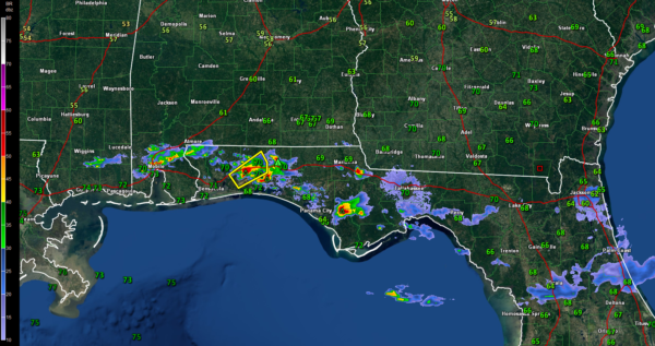
Category: ALL POSTS, Severe Weather
About the Author (Author Profile)
Bill Murray is the President of The Weather Factory. He is the site's official weather historian and a weekend forecaster. He also anchors the site's severe weather coverage. Bill Murray is the proud holder of National Weather Association Digital Seal #0001 @wxhistorianSubscribe
If you enjoyed this article, subscribe to receive more just like it.


