

Heads Up Jefferson County… Strong Storms Approaching
SIGNIFICANT WEATHER ADVISORY FOR JEFFERSON COUNTY UNTIL 3:45 PM CDT.
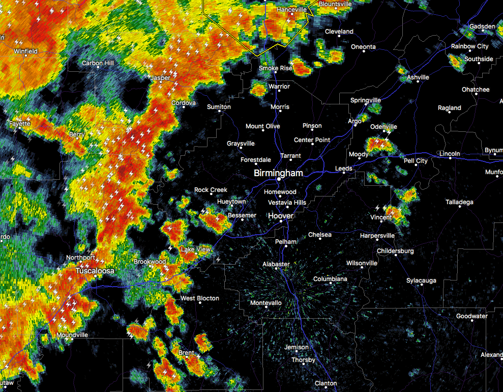
At 2:34 PM CDT, Doppler radar was tracking strong thunderstorms along a line extending from near Smith Dam to 7 miles north of Deerlick Creek Campgrounds. Movement was east at 30 mph. Winds in excess of 40 mph will be possible with these storms.
Locations impacted include…
Birmingham, Hoover, Vestavia Hills, Bessemer, Homewood, Mountain Brook, Trussville, Hueytown, Gardendale, Irondale, Leeds, Moody, Fairfield, Fultondale, Sumiton, Pinson-Clay-chalkv, Center Point, Pleasant Grove, Clay and Pinson.
Torrential rainfall is also occurring with these storms, and may lead to localized flooding. Do not drive your vehicle through flooded roadways. Frequent cloud to ground lightning is occurring with these storms. Lightning can strike 10 miles away from a thunderstorm. Seek a safe shelter inside a building or vehicle.
Category: Archived Warnings
About the Author (Author Profile)
Scott Martin is an operational meteorologist, professional graphic artist, musician, husband, and father. Not only is Scott a member of the National Weather Association, but he is also the Central Alabama Chapter of the NWA president. Scott is also the co-founder of Racecast Weather, which provides forecasts for many racing series across the USA. He also supplies forecasts for the BassMaster Elite Series events including the BassMaster Classic.Subscribe
If you enjoyed this article, subscribe to receive more just like it.


