

A Quick Look At Our Weather at 6:50PM
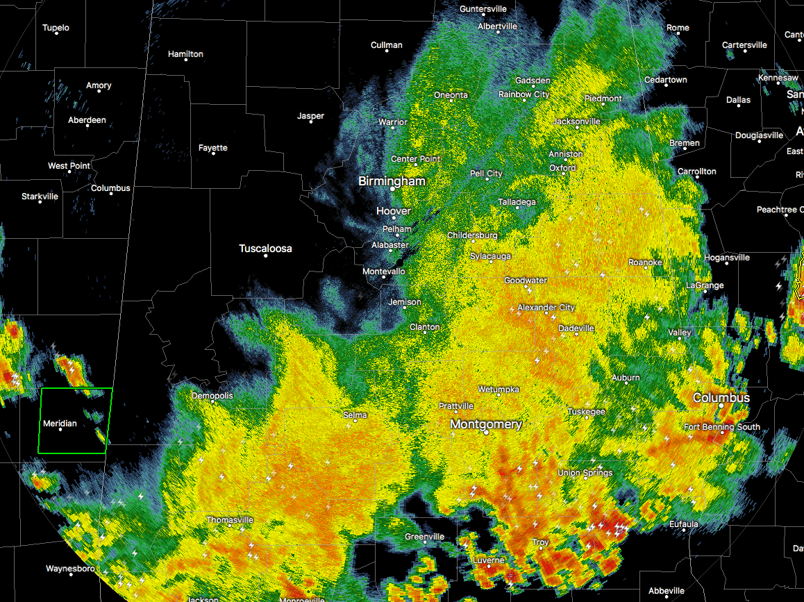
Here is the radar as of 6:41PM, showing that much of the stronger storm activity has now pushed mostly out of the Central Alabama area, with the exception of Pike and Barbour counties. Everything else in Central Alabama is mainly light to moderate rainfall, with a few claps of thunder embedded. As soon as these stronger storms move out of Pike and Barbour counties, NWS Birmingham should cancel the Severe Thunderstorm Watch in effect for the southeastern parts of the area rather quickly.
The rest of the rainfall that is over the southern parts of Central Alabama is expected to diminish throughout the rest of the evening and will either be completely out of the area or died off by the midnight hour. We may have to watch out for some patchy fog out there after midnight if you are out and about, so be careful.
Tomorrow we will return back to the typical summertime forecast… A mix of sun and clouds with scattered to numerous showers and thunderstorms possible across Central Alabama, with the best chances coming in the southern portion of the area. Highs will be back up in the upper 80s to the lower 90s across Central Alabama.
Category: Alabama's Weather, ALL POSTS
About the Author (Author Profile)
Scott Martin is an operational meteorologist, professional graphic artist, musician, husband, and father. Not only is Scott a member of the National Weather Association, but he is also the Central Alabama Chapter of the NWA president. Scott is also the co-founder of Racecast Weather, which provides forecasts for many racing series across the USA. He also supplies forecasts for the BassMaster Elite Series events including the BassMaster Classic.Subscribe
If you enjoyed this article, subscribe to receive more just like it.


