

A Sunday Evening Look at the Tropics
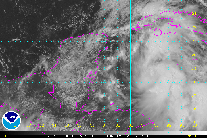
The National Hurricane Center decided not to send an Air Force Reserve plane into disturbance 93L east of the Yucatan Peninsula this afternoon since the low pressure center is still poorly defined.
It is clearly visible on satellite imagery this afternoon if you look closely for the spin in the clouds.
There is good general agreement in a north northwesterly through north northeasterly track that would carry it between southeastern Louisiana and the Florida Panhandle, but there is still lots of uncertainty.
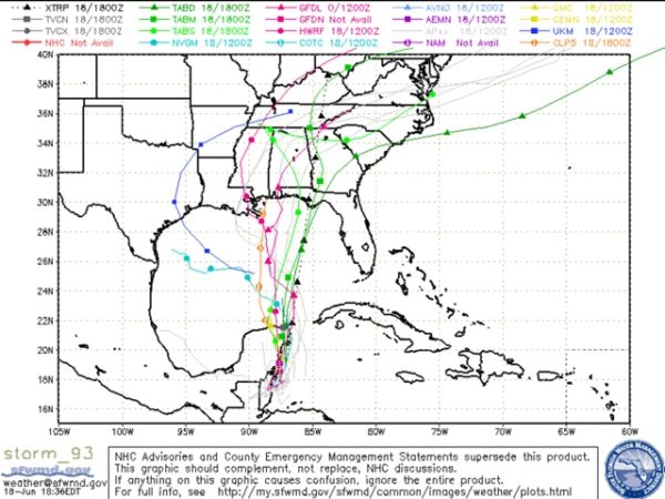
The morning run of the GFS carried it toward Southeast Louisiana and then stalled it before turning it northeast over Alabama late in the week. That would put us on the eastern side of the track would mean plenty of rain for Alabama. A track into the eastern Florida Panhandle would put us on the dry side.
Elsewhere, Invest 02L or Potential Tropical Cyclone 2 is forecast to become a tropical depression early Monday and a tropical storm later on Monday before moving across the southern Windward Islands and into the eastern Caribbean.

In a historical first, the National Hurricane Center has issued tropical storm warnings for portions of the Windward Islands including Barbados, St. Vincent and the Grenadines BEFORE a storm was named. This is the first year that policy has allowed them to issue warnings before a storm is classified as a tropical cyclone.
About the Author (Author Profile)
Bill Murray is the President of The Weather Factory. He is the site's official weather historian and a weekend forecaster. He also anchors the site's severe weather coverage. Bill Murray is the proud holder of National Weather Association Digital Seal #0001 @wxhistorianSubscribe
If you enjoyed this article, subscribe to receive more just like it.


