

Invest 92L Now Upgraded to Potential Tropical Cyclone Three
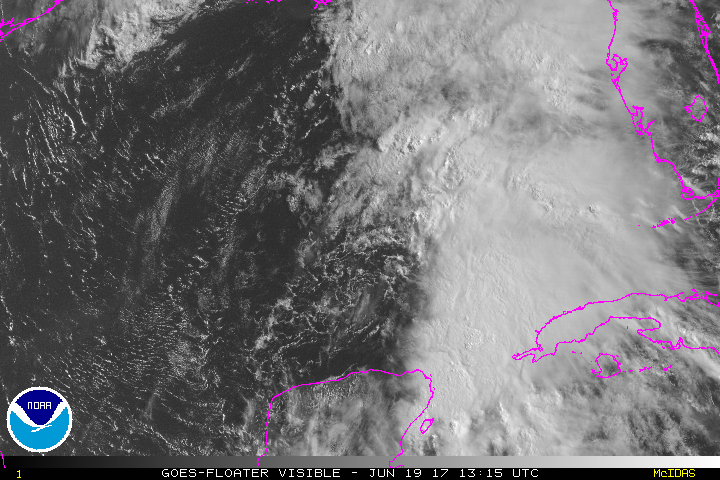
Aircraft have flown through the low pressure center, formerly known as Invest 92L, and is showing that it has an area of tropical storm force winds within a large area of deep convection northeast of a broad low center. The center continues to be not well defined, but aircraft is currently investigating it, so there will be more to come.
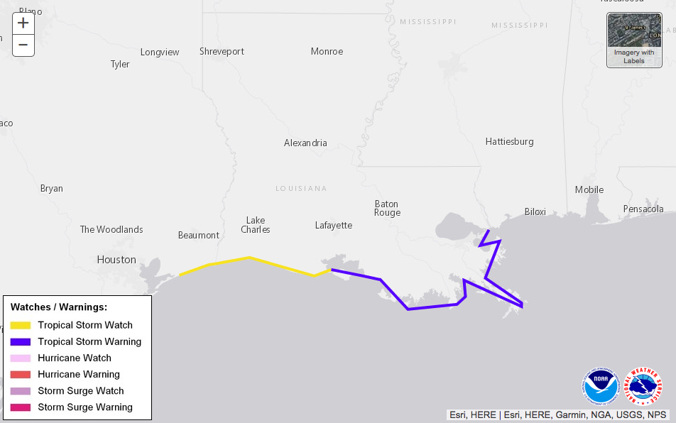
Since there is a threat to the Central Gulf Coast, the NHC has decided to initiate the proper advisories on the newly named Potential Tropical Cyclone Three. A Tropical Storm Warning is in effect from Intracoastal City, Louisiana to the mouth of the Pearl River. A Tropical Storm Watch is in effect from west of Intracoastal City to High Island, Texas.
Storm Stats at the moment
Estimated Minimum Central Pressure: 1002 MB
Maximum Sustained Winds: 35 knots (gusts to 45 knots)
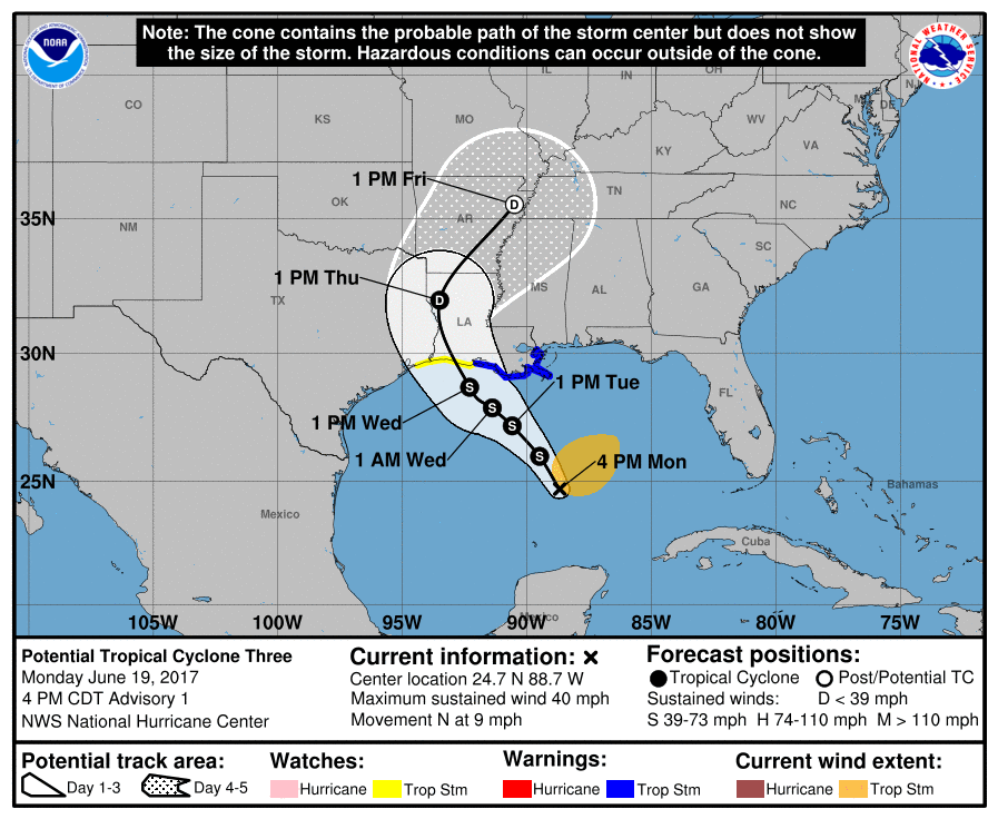
During the next 12 to 24 hours, the system s expected to move north to north-northwestward thanks in part to a weakness in the subtropical ridge over the Gulf, but should strengthen and become more organized, giving it the name Cindy. Then it will make a turn more northwestward and slow in movement as it interacts with an upper low situated off of the Texas coast. The general consensus then has the system moving onshore on the western Louisiana Coast, then making a turn to the northeast and placing the center near Jonesboro, Arkansas by Friday afternoon.
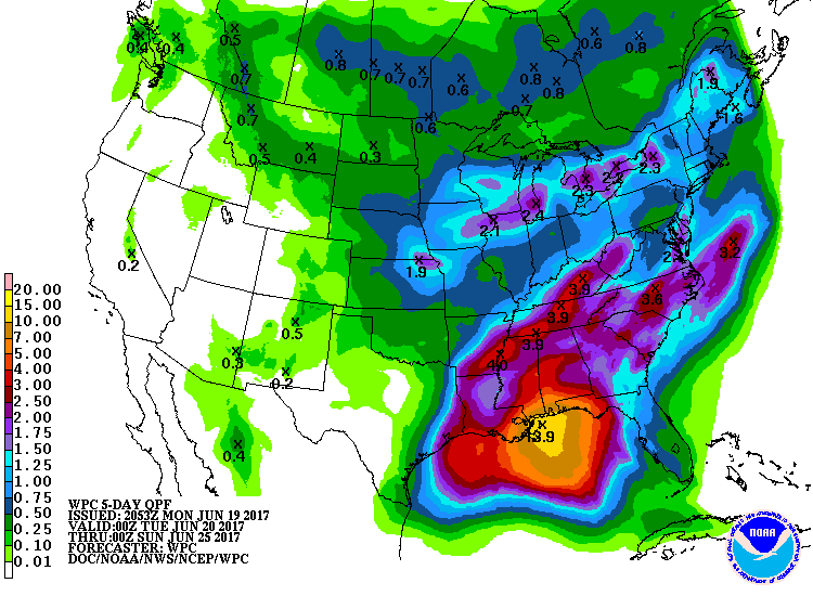
With that being said, we don’t really need to focus on where the center will make landfall. Heavy rain, along with windy conditions, will begin to affect the central Gulf Coast starting by late tomorrow morning. The potential is there for up to 14 inches of rainfall along the coast and just inland over the next five days. Flooding will more than likely become an issue.
A Flash Flood Watch will go into effect for the southern-most counties in Alabama starting at 7AM Tuesday morning and will continue until 7PM on Thursday evening. Also, High Surf Advisories and High Rip Current Risks will go into effect at 1AM on Tuesday morning and will continue until 7AM Thursday morning on the Gulf Coast from the Alabama/Mississippi state line eastward to Santa Rosa Beach in Florida.
About the Author (Author Profile)
Scott Martin is an operational meteorologist, professional graphic artist, musician, husband, and father. Not only is Scott a member of the National Weather Association, but he is also the Central Alabama Chapter of the NWA president. Scott is also the co-founder of Racecast Weather, which provides forecasts for many racing series across the USA. He also supplies forecasts for the BassMaster Elite Series events including the BassMaster Classic.Subscribe
If you enjoyed this article, subscribe to receive more just like it.


