

An Update on the Alabama Weather Situation at 9:30 p.m.
Here is a quick look at Alabama’s weather tonight at 9:30 p.m.
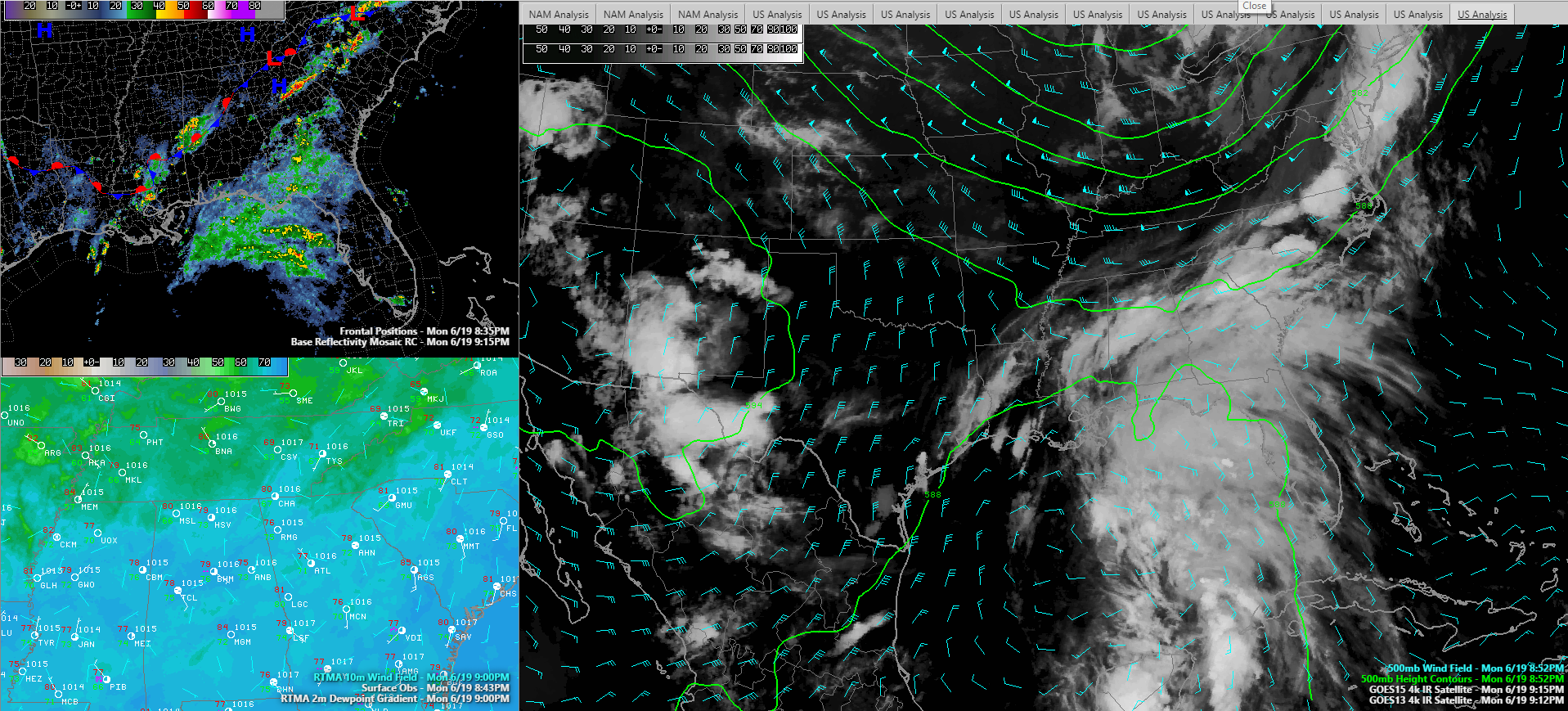
RADAR
An arc of showers and storms continues across Central Alabama tonight, just south of I-20. They are heaviest in West Alabama from the Tuscaloosa area southwestward through Pickens, Greene, Hale and Sumter Counties. An areal flood advisory continues for Marengo County.
Across East Alabama, showers are moving to the east northeast, while activity over West Alabama is pushing southwest. I-65 seems to be the demarcation line of a shear zone, with the flow around the Gulf low and the upper low over the northwestern Gulf already making their presence felt and resulting in the southwesterly movement. The eastern half of the area is still under the influence of the southwesterly flow aloft in association with the trough over the eastern U.S.
THE FRONT
Our front has stalled just south of I-20 tonight. Drier air has worked into the Northwest corner of Alabama, where the dewpoint at Muscle Shoals has dropped to 66F. The rest of the state has dewpoints in the middle 70s. That drier air will shift a little further south during the morning tomorrow but will be a focus for precipitation starting tomorrow afternoon across Central Alabama.
POTENTIAL TROPICAL CYCLONE THREE
Our disturbance is located about 350 miles south of the Mouth of the Mississippi River tonight. The system is basically stationary but is expected to commence a northward motion over night. It should become a tropical storm later tonight. Three is expected to curve to the northwest around an upper level low over the northwestern Gulf. The system is expected to peak with top winds of 45 mph. It should move inland Thursday morning over western Louisiana.
COUPLE OF MODELS PAINT A STRONGER STORM
The NAM takes Three to hurricane intensity while the WRF takes a near hurricane intensity cyclone to near the Central Louisiana coast as early as Wednesday morning. Not a forecast, but something to keep an eye on.
OVERNIGHT
The showers and storms over West Alabama should diminish by midnight or soon after. It will remain warm and humid overnight with the only slight relief over the Northwest corner of Alabama.
TOMORROW
It looks like the morning will be mainly dry, but as the cyclonic flow around the soon to be tropical storm in the Gulf encroaches on the stalled frontal system, showers and storms will develop in the I-20 corridor by early to mid-afternoon. With high precipitable waters, rainfall will be heavy in spots.
HEAVY RAIN OVER THE SOUTH
Heavy rain will overspread South Alabama tomorrow afternoon and night. Rainfall amounts will be very heavy and flash flood watches are already queued up and ready to go in effect tomorrow afternoon.
Category: Alabama's Weather, ALL POSTS
About the Author (Author Profile)
Bill Murray is the President of The Weather Factory. He is the site's official weather historian and a weekend forecaster. He also anchors the site's severe weather coverage. Bill Murray is the proud holder of National Weather Association Digital Seal #0001 @wxhistorianSubscribe
If you enjoyed this article, subscribe to receive more just like it.


