

On This Date in 1957: Florida Congressman Claims Hurricane Forecasts Scare Away Tourists
On the afternoon of June 25, 1957, the Weather Bureau in New Orleans was tracking newly developed Hurricane Audrey in the southwestern Gulf of Mexico. The first advisory has been issued at 10:30 p.m. CST the night before, on the basis of a report from a shrimp boat about 350 miles southeast of Brownsville, Texas.
We know today that the tropical cyclone had likely formed earlier on the morning of the 24th. The Reanlysis Project at NOAA’s Atlantic Oceanographic & Meteorological Laboratory found that a couple of years ago and adjusted the hurricane’s best track.
It’s not the forecasters’ faults. Without satellite photos, they were limited to ship reports, surface observations and aircraft reconnaissance. That morning, when they received the first aircraft report, they were surprised to find that the system was already a hurricane with a central pressure of 989 mb and top winds of 85 knots. The crew reported that the storm was not yet very organized. Yet.
Forecasters discounted the fact that it might intensify rapidly. After all, it was June and Gulf hurricanes were not supposed to be very bad in the first month of the hurricane season. Audrey would change that way of thinking.
An afternoon reconnaissance flight revealed that the hurricane was steadily intensifying and had a central pressure of 979 mb already. They found top winds of 75 mph. Audrey was truly an overachieving June story.
Hurricane watches were in effect along the Louisiana coast. It is interesting to me to look at the text of the actual advisories from the “old days.” They were simple and to the point.
ADVISORY NO. 1.
12 NOON CST JUNE 25, 1957
NEW ORLEANS WEATHER BUREAU HURRICANE ADVISORY NUMBER 1 AUDREY
1200 NOON CSY JUNE 25 1957
A HURRICANE WATCH IS ADVISED FOR THE TEXAS AND LOUISIANA COAST.
NABY RECONNAISSANCE INTO THE SOUTHWEST GULD OF MEXICO THIS MORNING INDICATES THAT THE TROPICAL DEPRESSION HAS INCREASED RAPIDLY AND IS NOW A HURRICANE. AT 1200 CST…1800Z…HURRICANE AUDREY WAS CENTERED NEAR LATITUDE 22.5 LONGITUDE 93.0 OR ABOUT 380 MILES SOUTHEAST OF BROWNSVILLE TEXAS. IT HAS MOVED VERY LITTLE DURING THE LAST 12 HOURS.
HIGHEST WINDS ARE ESTIMATED ABOUT 75 MPH IN A SMALL AREA NEAR THE CENTER AND GALES EXTEND OUTWARD 100 MILES.
HURRICANE AUDREY IS EXPECTED TO MOVE NORTHWARD ABOUT 5 MPH DURING THE NEXT 12 TO 18 HOURS AND INCREASE SLOWLY IN SIZE AND INTENSITY.
ALL INTERESTS ALONG THE TEXAS AND LOUISIANA COASTS AND IN GULF OF MEXICO SHOULD WATCH FOR LATER ADVISORIES.
NEXT ADVISORY WILL BE ISSUED AT 4 PM CST.
CONNER WEATHER BUREAU NEW ORLEANS
This simplicity would lead to a complication in communication that would result in nearly 400 confirmed fatalities in Audrey and many more missing that were never found and presumed dead.
INTERESTING SIDE NOTE
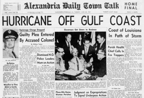
The article about Audrey in the Alexandria Town Talk from the Associated Press reported that the Miami Weather Bureau had started issuing new probability forecasts the week before, forecasting that one or two tropical storms might strike the Gulf Coast before July 15th. But a Florida Congressman was already up in arms about the new forecasts. Rep. James T. Haley “denounced the system and demanded that the Weather Bureau stop.” He claimed that the “probability” forecasts would scare away tourists from the Sunshine State.
Category: ALL POSTS, Met 101/Weather History
About the Author (Author Profile)
Bill Murray is the President of The Weather Factory. He is the site's official weather historian and a weekend forecaster. He also anchors the site's severe weather coverage. Bill Murray is the proud holder of National Weather Association Digital Seal #0001 @wxhistorianSubscribe
If you enjoyed this article, subscribe to receive more just like it.


