

An Evening Look At Central Alabama’s Weather
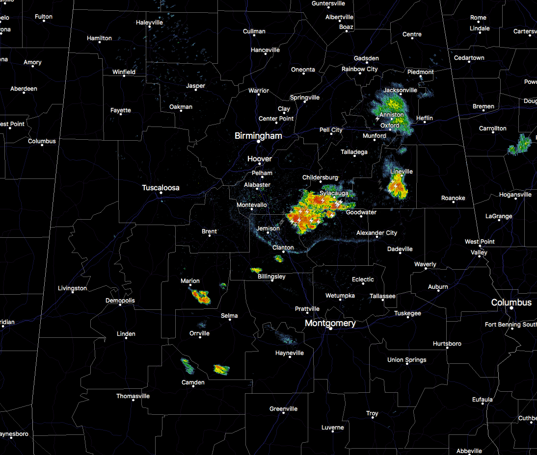
At this point during the evening, we really only have two small batches of storms that are moving eastward through the eastern parts of Central Alabama.
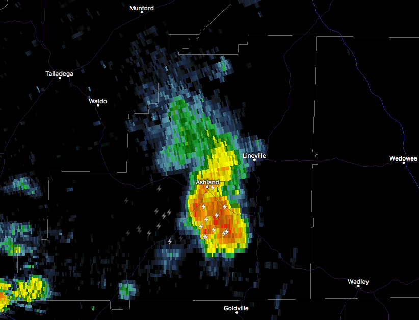
The first batch is located in Clay County currently affecting Ashland and points north and south of there. Winds of up to 40 MPH, along with torrential rainfall and dangerous cloud-to-ground lightning can be expected with this cell.
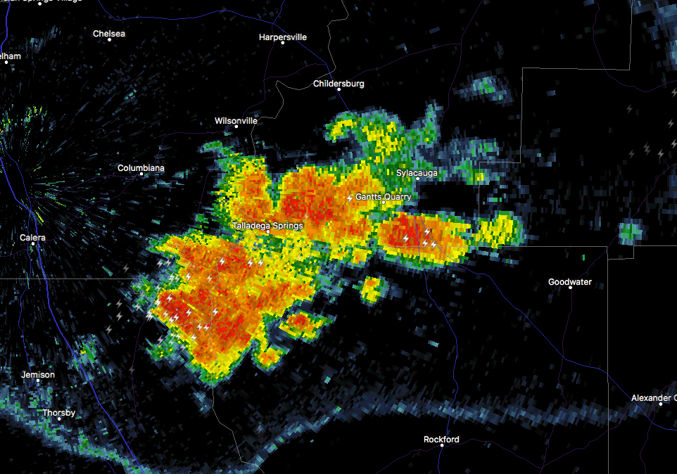
The second batch is a little more spread out and stretches from the northeastern edge of Chilton County, to the northeast through Talladega Springs and Gantts Quarry, and ends in the southwestern part of Clay County. This groups is putting down a good bit of rainfall, along with a good bit of cloud-to-ground lightning.
If you notice, there is an outflow boundary that is moving southward from this batch of storms. This could be where more formation takes place within the next several minutes, and since the air this far south is untapped so far for today, storms could become strong.
There are a few more scattered showers and storms out there, but those are not as eye-catching on the radar as the two batches that I mentioned earlier.
Much, if not all, of the storm activity should dissipate before we reach the 10PM hour, but there will be more showers and storms expected to move across the northern parts of the state and could reach as far south as the northern counties in Central Alabama. Fortunately, these storms should just be good rainmakers and have a few claps of thunder. No severe storms expected tonight.
Category: Alabama's Weather, ALL POSTS
About the Author (Author Profile)
Scott Martin is an operational meteorologist, professional graphic artist, musician, husband, and father. Not only is Scott a member of the National Weather Association, but he is also the Central Alabama Chapter of the NWA president. Scott is also the co-founder of Racecast Weather, which provides forecasts for many racing series across the USA. He also supplies forecasts for the BassMaster Elite Series events including the BassMaster Classic.Subscribe
If you enjoyed this article, subscribe to receive more just like it.


