

A Quick Look At Our Saturday Weather Situation At 3:15PM
There is definitely a quiet zone that is along the cold front at this time, as it is now pushing its way through the northern portions of the state. Weaker convergence, along with high clouds that is limiting the heating of the lower atmosphere, is keeping instability levels lower.
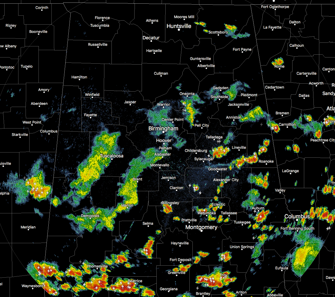
As you can tell, all of the shower and storm activity is located to the south of the front, mainly south of a line from Sulligent to Hanceville to Collinsville. We do have one rogue batch of showers that have formed up in Jackson County, but it is just a rain maker at this point.
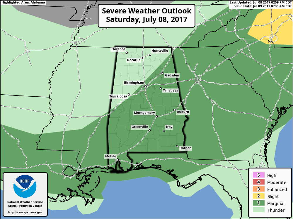
The good news is that the Storm Prediction Center has now reduced the severe storm risk across much of the state. Locations north of a line from Boligee to Brookwood to Gardendale to Rainsville are completely out of a severe risk, with the rest of the state south of that line in a Marginal Risk. This graphic will continue to be updated as the cold front make its way southward. Main threat continues to be from downburst winds, but it looks that even that is starting to shrink as well.
We still need to keep our eyes open just in case a storm or two get strong, possibly briefly severe. It won’t take much wind to knock some trees down with our already saturated soil situation.
By 7:00PM tonight, the cold front is expected to be in the central part of the state, maybe as far south as Clanton or Billingsley. Much of the shower and storm activity will be south of the I-20 corridor at that point, with just a slight risk of an isolated shower north of that. By that time, noticeably drier air will start moving into the area tonight, and rain chances for the northern half of the state should come to an end after midnight.
Just be sure to stay up-to-date with the weather situation on the AlabamaWx Weather Blog. If any warnings are issued, they’ll be up on the blog very quickly… almost instantly.
Category: Alabama's Weather, ALL POSTS
About the Author (Author Profile)
Scott Martin is an operational meteorologist, professional graphic artist, musician, husband, and father. Not only is Scott a member of the National Weather Association, but he is also the Central Alabama Chapter of the NWA president. Scott is also the co-founder of Racecast Weather, which provides forecasts for many racing series across the USA. He also supplies forecasts for the BassMaster Elite Series events including the BassMaster Classic.Subscribe
If you enjoyed this article, subscribe to receive more just like it.


