

A Quick Look At Our Saturday Weather Situation At 6:00PM
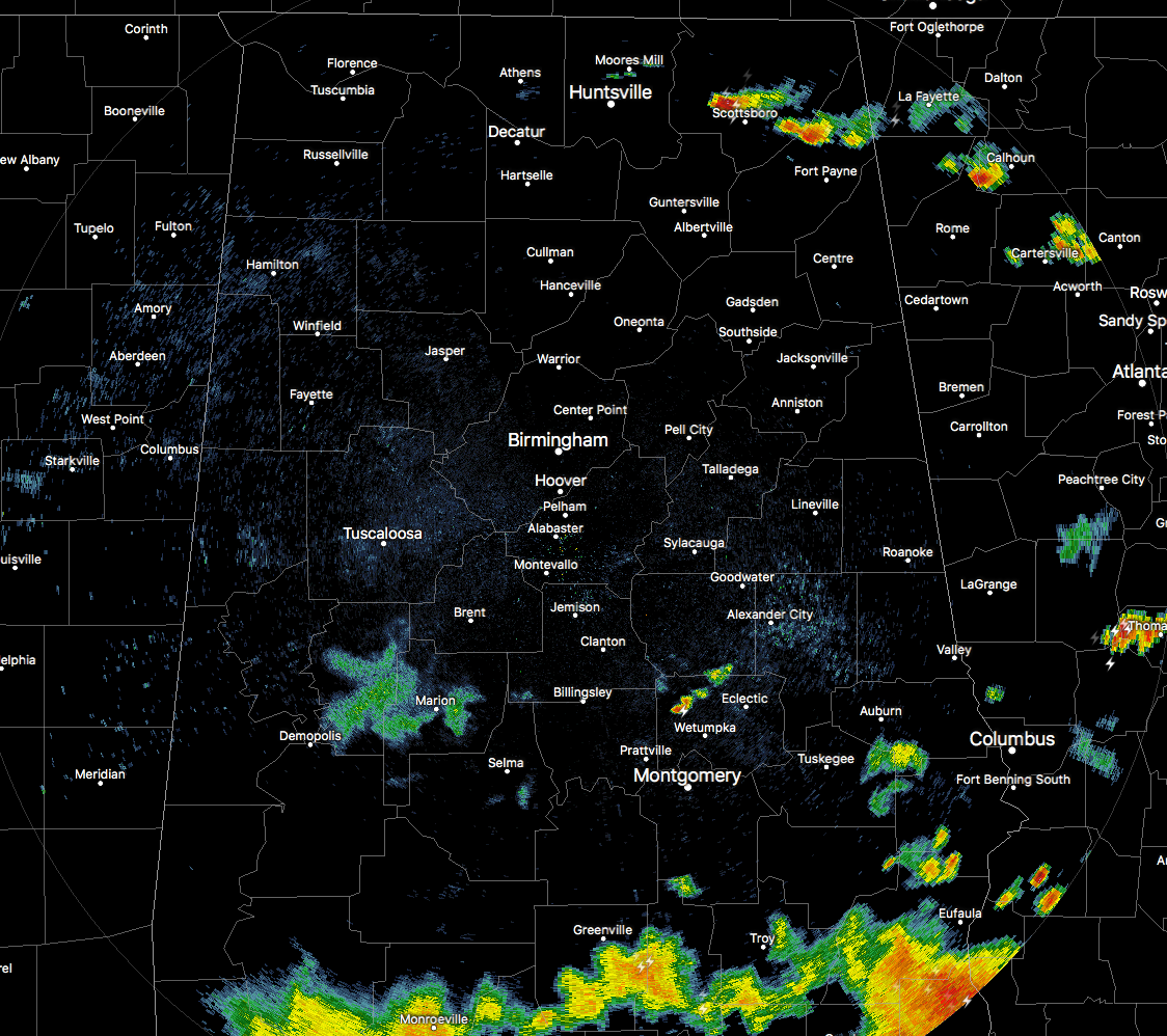
As we get closer to the sunset time in North/Central Alabama, almost all of the shower and storm activity has moved out of the area. The heaviest storms in our area at this point are located along the actual cold front up in central Jackson and northern Dekalb counties, where NWS Huntsville had a Significant Weather Advisory out for these storms with gusty winds up to 40 MPH and pea-size hail being the main threat. That advisory has since expired.

You can clearly see where the cold front is stretched out over the northern part of the state near the AL/TN state line. The storms on the front are redeveloping from an outflow boundary, and we may have a few more develop as this boundary moves to the southeast at around 20 MPH.
There is still a possibility for a few isolated showers or thunderstorms to develop over in the northeast part of the state out ahead of the cold front, but where the thicker clouds continue to cover the surface, instability values will struggle to climb throughout the remainder of the sunlit part of the evening. As of now, the higher instability values are over the much of Northeast Alabama.
Showers and storms will really start to diminish after sunset, and the only place where there would be any decent chance of rain will be over the southern part of Central Alabama, closer to where there is a surface boundary that hung out for a good while today. That boundary is also making it hard for the front to push south, but it should end up near Clanton by the time midnight arrives. There could be a stray shower north of that tonight, but I believe from Birmingham and north, the rain will have come to an end.
Category: Alabama's Weather, ALL POSTS
About the Author (Author Profile)
Scott Martin is an operational meteorologist, professional graphic artist, musician, husband, and father. Not only is Scott a member of the National Weather Association, but he is also the Central Alabama Chapter of the NWA president. Scott is also the co-founder of Racecast Weather, which provides forecasts for many racing series across the USA. He also supplies forecasts for the BassMaster Elite Series events including the BassMaster Classic.Subscribe
If you enjoyed this article, subscribe to receive more just like it.


