

A Few Cells Have Developed That Could Impact Tuscaloosa & Birmingham Metro
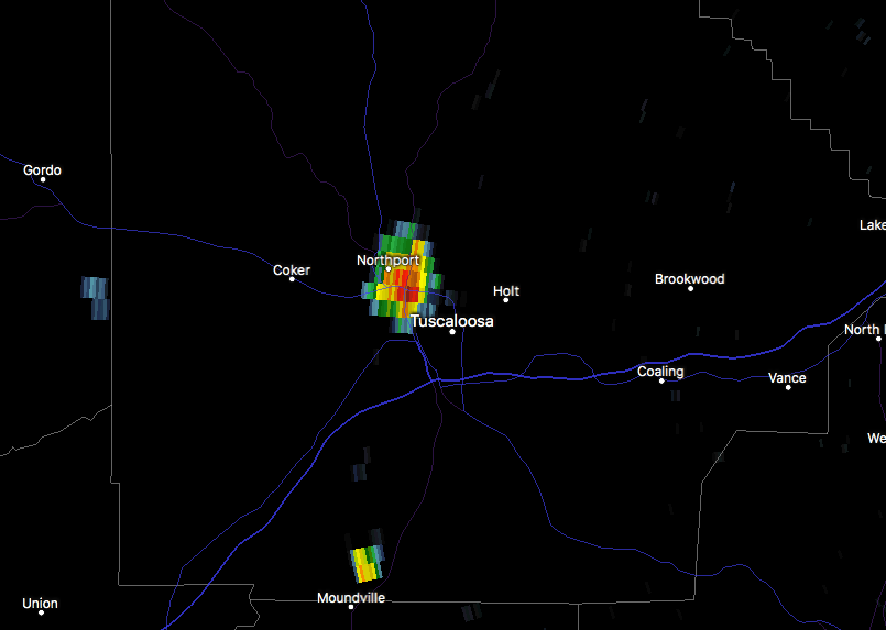
Just within the last few minutes, a small but intense shower has formed in Tuscaloosa County over Northport and the northwestern part of Tuscaloosa. It is barely moving at all to the northwest, but where it’s raining, it is a good downpour. The shower may grow for a few more minutes then rain itself out, as many of these pulse-type thunderstorms have done for most of the day.
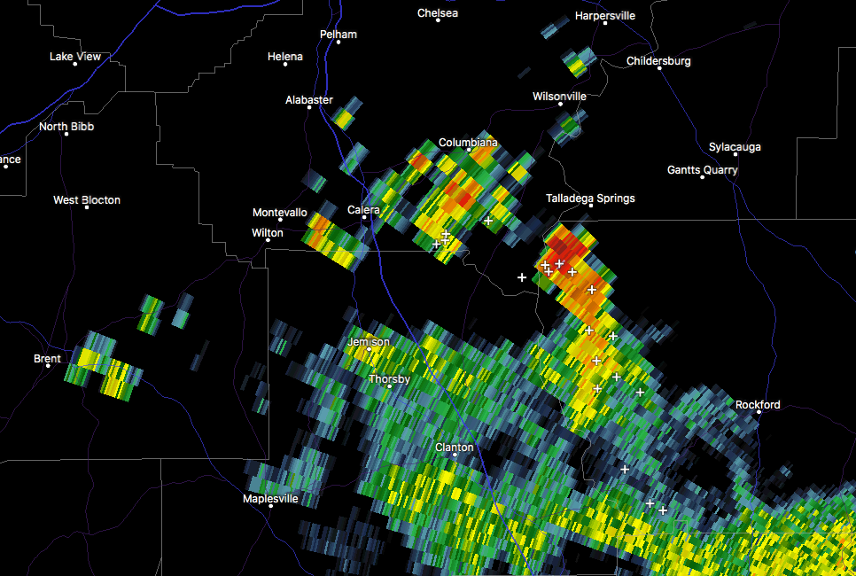
There is slightly another story taking place down I-65 from the Birmingham Metropolitan Area… we have a small cluster of storms that are moving along to the north just behind a small gust front. It is about to pass over the radar site in Calera and will continue to move to the north. These could possibly make it through Shelby County and affect the southern locations of Jefferson County and into the Birmingham suburbs. We’ll have to see how long this gust front survives and if showers keep developing along and just behind it.
Category: Alabama's Weather, ALL POSTS
About the Author (Author Profile)
Scott Martin is an operational meteorologist, professional graphic artist, musician, husband, and father. Not only is Scott a member of the National Weather Association, but he is also the Central Alabama Chapter of the NWA president. Scott is also the co-founder of Racecast Weather, which provides forecasts for many racing series across the USA. He also supplies forecasts for the BassMaster Elite Series events including the BassMaster Classic.Subscribe
If you enjoyed this article, subscribe to receive more just like it.


