

A Mix Of Dry And Stormy Weather At Midday, The Beach Is Not Much Better
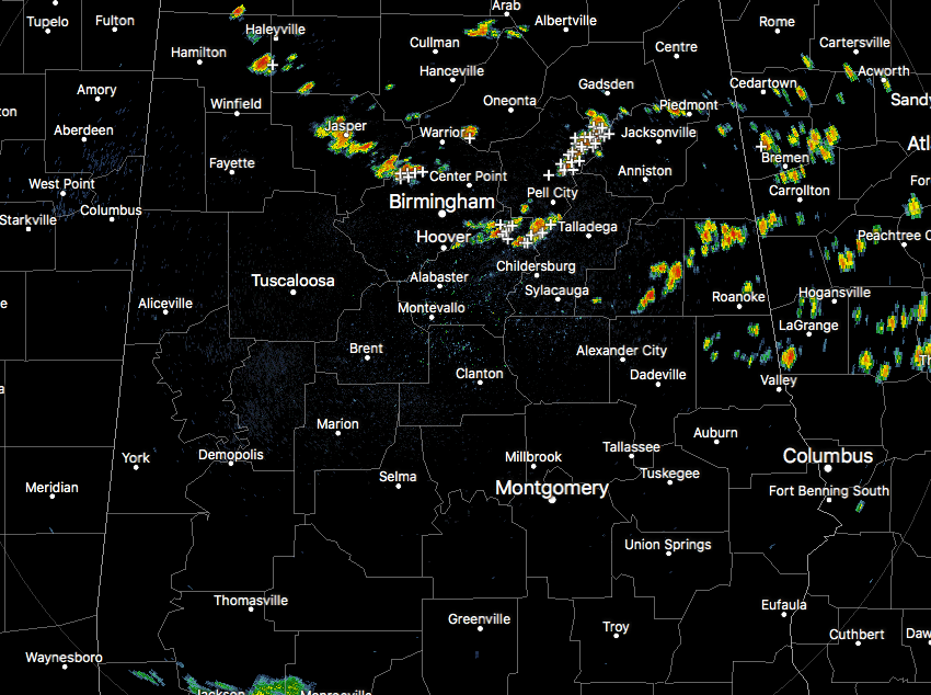
Radar Check At The Noon Hour
All of the shower and storm activity at this point across Central Alabama is currently across the northern half of the area, while the southern half is pretty much dry at this point. The most active storm at this point is located over parts of St. Clair, Etowah, and Calhoun counties. Heavy rainfall and copious amounts of cloud-to-ground lightning are occurring with this storm. It is moving to the southeast, and if you are in the path of this storm please go indoors until it passes.
Skies at this point across the area are ranging from mostly clear in the north and eastern parts of the state, while the rest of the state is under mostly cloudy skies.
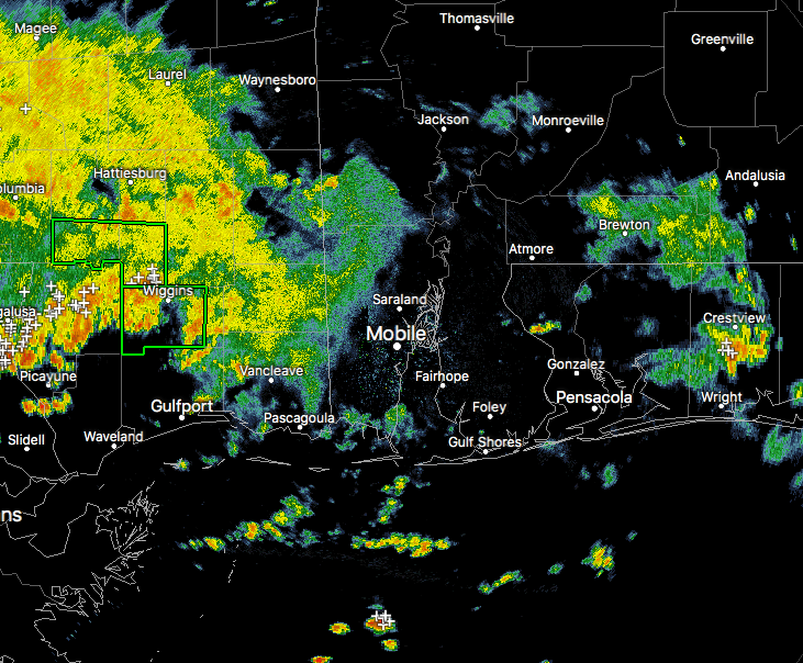
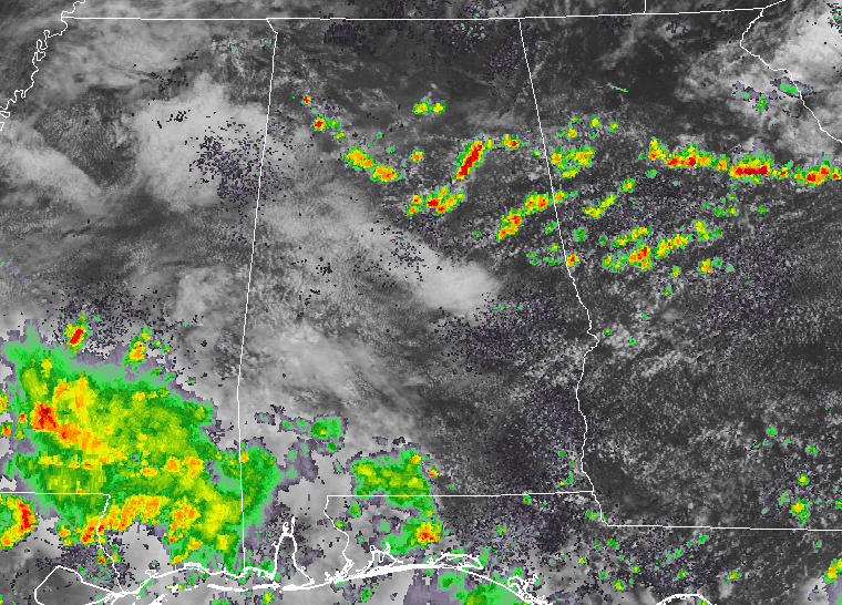
Down on the Gulf Coast, it has been a stormy morning. I’m on vacation with my family and typing my blog post from the Orange Beach Library. Kids can’t be on the beach at this point, and we’ll have more moving in this afternoon from Mississipi.
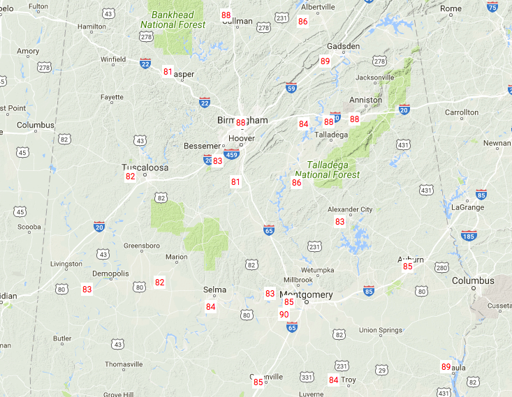
Temperatures Across Central Alabama
Much of Central Alabama is ranging throughout the 80s at this point, with only Montgomery hitting 90 degrees at this point. Surprise, surprise… Jasper is actually coming in tied as the cool spot with Alabaster at 81 degrees.
For The Rest Of Today
We’ll continue to have an increased risk of scattered to numerous showers and thunderstorms. It will not be a complete rain-out across Central Alabama, but chances will be highest in the southern parts of the area. Skies will be partly to mostly cloudy, and afternoon highs will be in the upper 80s to the lower 90s.
We’ll still have a risk of scattered showers and storms throughout the evening and overnight hours, with the better chances in the southern parts of Central Alabama. Lows will be in the lower to middle 70s.
Tuesday’s Forecast
The trough digs in deeper and the cold front stalls out in the northern part of the state, and this will keep an increased risk for scattered to numerous showers and thunderstorms again for Tuesday. Skies will once again feature a mix of clouds and sun, and afternoon highs will be in the upper 80s to near 90 degrees. Once again, not an all day washout, but rain chances will be just over 50/50.
Beach Forecast
For a detailed look at the weather from Fort Morgan over to Panama City Beach, click here to see the AlabamaWx Beach Forecast Center page.
The Beach Forecast is partially underwritten by the support of Brett/Robinson Vacation Rentals in Gulf Shores and Orange Beach. Click here to see Brett/Robinson’s Own Your Summer specials now!
Tropical Outlook
Conditions remain unfavorable at this point in the main development region of the Atlantic Ocean but are more favorable in the Gulf of Mexico and the Caribbean Sea. Everything is quiet as of now, and tropical cyclone formation is not expected within the next 5 days.
On This Day In Weather History
1980 – Claudette, a weak tropical storm, deluged southeastern Texas with torrential rains. The Houston suburb of Alvin received 43 inches, a 24-hour record for the U.S.
WeatherBrains
Tonight, the panel will entertain severe weather communications expert Dr. Dennis Mileti. Check out the show at www.WeatherBrains.com. You can also subscribe on iTunes. You can watch the show live at live.bigbrainsmedia.com. You will be able to see the show on the James Spann 24×7 weather channel on cable or directly over the air on the dot 2 feed.
Category: Alabama's Weather, ALL POSTS
About the Author (Author Profile)
Scott Martin is an operational meteorologist, professional graphic artist, musician, husband, and father. Not only is Scott a member of the National Weather Association, but he is also the Central Alabama Chapter of the NWA president. Scott is also the co-founder of Racecast Weather, which provides forecasts for many racing series across the USA. He also supplies forecasts for the BassMaster Elite Series events including the BassMaster Classic.Subscribe
If you enjoyed this article, subscribe to receive more just like it.


