

Harvey Makes Landfall
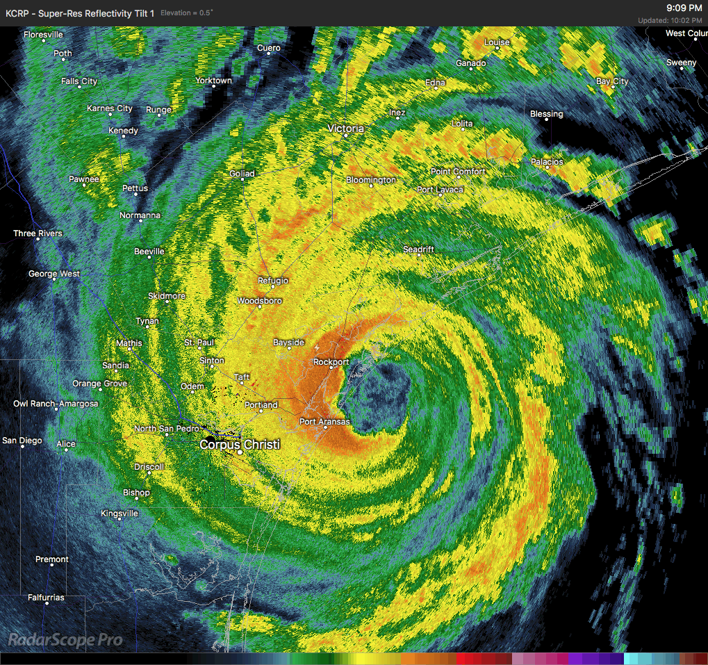
Category 4 Hurricane Harvey is making landfall at this moment just north of Port Arkansas at San Jose Island near Rockport with maximum sustained winds at 130 MPH. The minimum central pressure is currently at 938 mb. Harvey is the first major hurricane to make landfall in the United States since Wilma back in 2005, and the first category 4 storm to make landfall in the US since Charley in 2004. Movement is to the northwest at 8 MPH.
Lightning continues to be detected around the eyewall, especially on the north side of the eyewall. Harvey could actually strengthen some more before the whole eye is on shore. The latest in-depth public advisory from the National Hurricane Center will come at 11:00 PM CDT tonight.
Storm surge projections will have heights up to 13 feet, especially around Port Aransas to Port O’Connor. Rainfall totals through the next five days could be in the 15-25 inch range with localized totals up to 40 inches possible. Life-threatening flooding will be possible as Harvey will continue to stay in the same general location for the next several days.
We’ll have updates throughout the life cycle of Harvey on the AlabamaWx Weather Blog in the Tropical Weather section.
About the Author (Author Profile)
Scott Martin is an operational meteorologist, professional graphic artist, musician, husband, and father. Not only is Scott a member of the National Weather Association, but he is also the Central Alabama Chapter of the NWA president. Scott is also the co-founder of Racecast Weather, which provides forecasts for many racing series across the USA. He also supplies forecasts for the BassMaster Elite Series events including the BassMaster Classic.Subscribe
If you enjoyed this article, subscribe to receive more just like it.


