

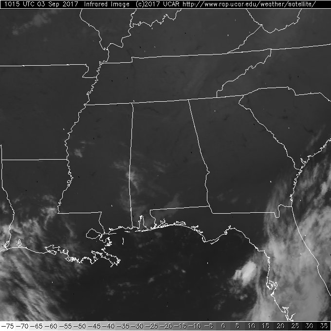
Dry Conditions Today and Labor Day
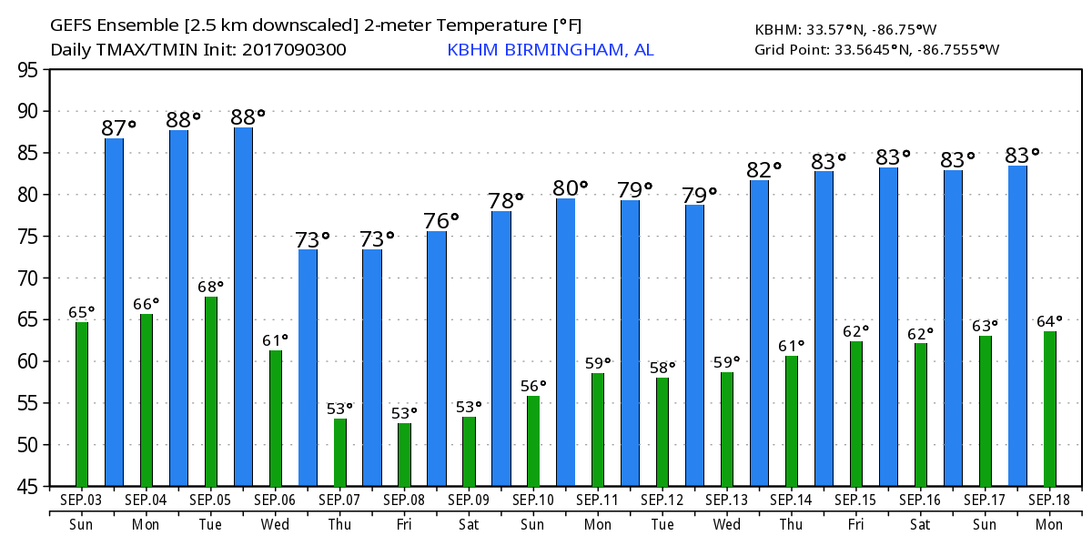
Alabamians waking up to another fairly cool morning under clear skies on this Sunday with temperature readings in the 50s once again for the Tennessee Valley counties and lower 60s for much of Central Alabama. Plenty of sunshine is forecast today with highs forecast to reach into the middle 80s in the range of 84 to 87. We’ll see a few more clouds on Labor Day Monday as our temperatures warm up nicely with highs approaching the 90-degree mark.
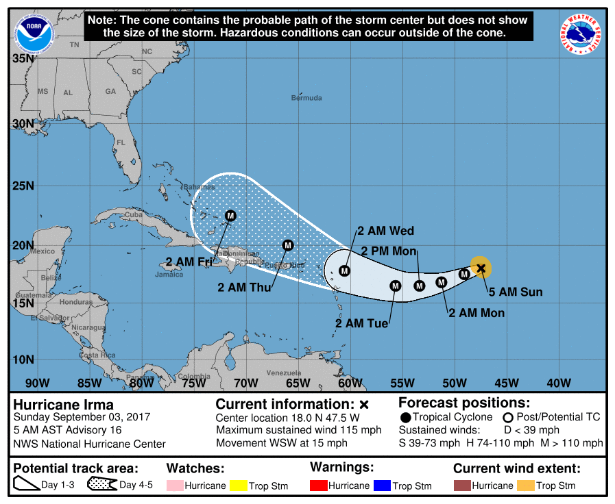
Hurricane Irma remains a formidable storm in the South Central Atlantic despite some fluctuation in intensity. The storm is forecast to take on a more westerly track on Monday before turning northwesterly Tuesday. The current motion is a tad slower than earlier forecasts, and it appears likely the storm will move just north of the northern Leeward Islands on Wednesday. Model guidance on the longer range track of Irma is becoming focused on a major storm moving into the southern Bahamas next Friday. The GFS and the ECMWF have moved much closer in their respective projections with a strong potential for Irma to effect the Southeast US coast with the possibility of landfall in the Carolinas. There appears to be a fairly strong similarity between the course for Irma and Hurricane Hugo in 1989. Understand that there is still a good deal of uncertainty on the exact track, but confidence is growing that this storm could impact the US somewhere along the Southeast US coast.
A second area of disturbed weather was located several hundred miles southwest of the Cabo Verde Islands is producing a large area of disorganized showers and thunderstorms. Environmental conditions are conducive for gradual development of this system during the next few days, and a tropical depression is likely to form by the middle to late part of this week while moving westward to west-northwestward at about 10 mph over the tropical Atlantic Ocean.
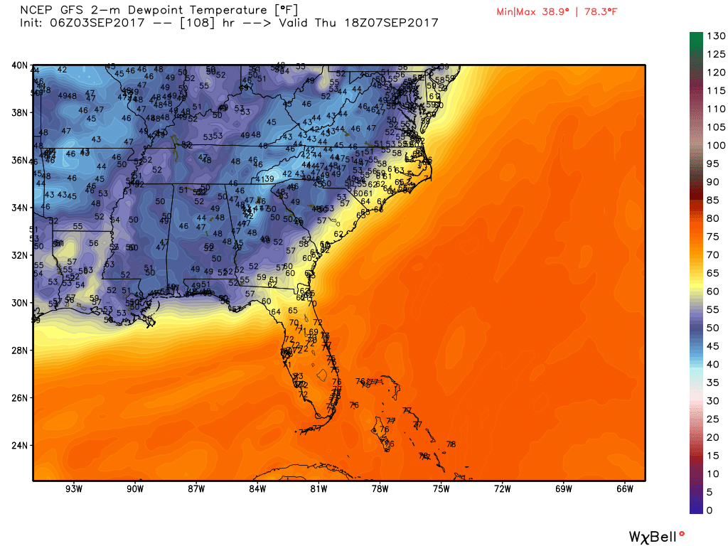
Back home, a very strong upper trough is forecast to dig into the eastern US starting Tuesday and continuing through Thursday. This will result in a cold front approaching the Southeast US on Tuesday with the best rain chances coming late Tuesday and early Wednesday. The GFS is a little bit faster with the passage of the cold front than what we saw yesterday. The latest run suggests storms will be over for us by midday on Wednesday. There is little threat that we’ll see any severe storms with this system due in part to timing of the frontal passage along with the greatest dynamics further to our north.
By Thursday midday we could see dew points in the 40s across a great deal of the Southeast US. Now won’t that feel nice?
The strong upper trough moves east and weakens into next weekend while we turn our attention to what Irma will do. The present guidance from both the GFS and the ECMWF points to a landfall on the Southeast US coast keeping Alabama on the dry side of the system. The GFS is a little faster than the ECMWF, but their respective positions are pretty close again raising confidence that the forecast has the right idea. The GFS takes the upper reflection of Irma into the Ohio River Valley on Tuesday while the ECMWF moves the system northward along but just inland along the East Coast.
Looking into voodoo country, the upper low of Irma moves into the eastern Great Lakes as a broad upper ridge spreads across the Central US. This could spell a period of fairly warm weather for the Central US area, but the GFS keeps the eastern third of the country on the edge of that ridge as we get out to the 17th of September. So it looks like we will see some warm weather for the middle of September, but we’ll stay out of any excessive heat. That is certainly a trend I’m happy to see continue.
For beachgoers, Partly to mostly sunny weather today and Monday from Gulf Shores to Panama City Beach. A few widely scattered showers or storms return on Tuesday with showers and thunderstorms likely on Wednesday. Highs will be in the 80s. Be sure to keep up to date with the detailed forecasts from Fort Morgan to Panama City Beach with the AlabamaWx Weather Blog. Click here to see the AlabamaWx Beach Forecast Center page. The Beach Forecast is partially underwritten by the support of Brett/Robinson Vacation Rentals in Gulf Shores and Orange Beach. Click here to see Brett/Robinson’s Hot Deals now!
James Spann will be back with the next edition of the Weather Xtreme Video on Monday. I think there is a reasonably good chance that he will be on a holiday schedule with one video in the morning and notes on the forecast later in the day. I hope you have an opportunity to enjoy this great weather. Godspeed.
You can find me on these major social networks…
Facebook
Twitter
-Brian-
Category: Alabama's Weather, ALL POSTS
About the Author (Author Profile)
Brian Peters is one of the television meteorologists at ABC3340 in Birmingham and a retired NWS Warning Coordination Meteorologist. He handles the weekend Weather Xtreme Videos and forecast discussion and is the Webmaster for the popular WeatherBrains podcast.Subscribe
If you enjoyed this article, subscribe to receive more just like it.


