

Irma Back at Cat Five? Making Landfall in Cuba? Many Questions.
Some interesting observations from the GOES-16 imagery of Hurricane Irma tonight:
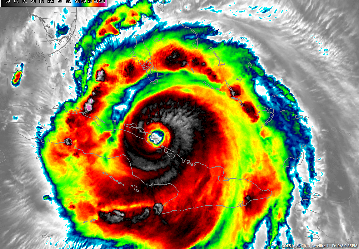
1. The storm has turned west southwest tonight and is very nearly landfall on the north coast of Cuba. (The Euro model correctly predicted this)
2. The storm has become much more organized in the past few hours, with intense convection exploding around the center. The eye tightened suddenly, becoming very compact, indicating intensification.
3. The Hurricane Hunter plane measured surface winds of 160 and 167 mph on its last two penetrations, which is cat five status.
4. If the hurricane resumes the west northwest course now, and spends several hours traversing Cuba, it could be weakened overnight.
5. What if the hurricane pushes southwest into the Northwest Caribbean? The water there is extremely warm. Could it intensify even further? COuld this help it avoid the trough? We just don’t know the answers.
The 0z model runs will be interesting and we will have a new advisory shortly.
About the Author (Author Profile)
Bill Murray is the President of The Weather Factory. He is the site's official weather historian and a weekend forecaster. He also anchors the site's severe weather coverage. Bill Murray is the proud holder of National Weather Association Digital Seal #0001 @wxhistorianSubscribe
If you enjoyed this article, subscribe to receive more just like it.


