

A Summerlike Sunday
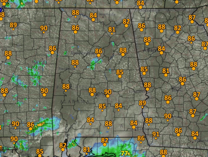
A summerlike day is in progress across Central Alabama on this second full day of fall. Temperatures are in the middle and upper 80s for the most part. Montgomery has already reach 90F. A few other spots will as well before it is all said and done.
A full field of cumulus covers most of the state at this hour. Radar has been basically quietly, with an isolated small shower over southwestern Walker County, but not much else worth mentioning.
Hurricane Maria continues to move north-northwest this afternoon, located about 375 miles east of Cape Canaveral in Florida. It is expected to continue plodding north-northwestward and weakening slowly, reaching a point about 100 miles south-southwest of Cape Hatteras by Wednesday morning before abruptly turning to the northeast and heading out to sea. Still, tropical storm force winds and hurricane force gusts are forecast to rake the Outer Banks starting Tuesday night and lasting through much of Wednesday.
The overwhelming majority of the GFS Ensemble members now keep the center of Maria offshore of the outer banks and southeastern Virginia, lending lots of confidence to the forecast.
A nice week is in store for us, albeit a warm one, at least until mid-week. A front will pass through late Wednesday, with little fanfare, but lowering the humidity. Another front late Friday, also dry, will bring true fall-like air in for the weekend.
point about 100 miles south-southwest of Cape Hatteras by Wednesday morning before abruptly turning to the northeast and heading out to sea.
Category: Alabama's Weather, ALL POSTS
About the Author (Author Profile)
Bill Murray is the President of The Weather Factory. He is the site's official weather historian and a weekend forecaster. He also anchors the site's severe weather coverage. Bill Murray is the proud holder of National Weather Association Digital Seal #0001 @wxhistorianSubscribe
If you enjoyed this article, subscribe to receive more just like it.


