

Potential for Depression to Impact Southeast US
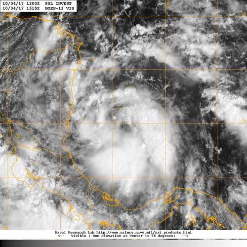
As noted here, the National Hurricane Center (NHC) has begun advisories on Tropical Depression 16 which became better organized over the Southwest Caribbean this morning. Here is the latest satellite image of the system.
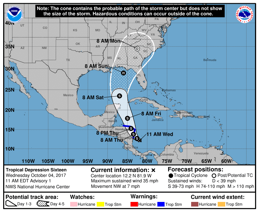
The overall evolution of this system brings it to tropical storm strength within the next 12 hours. It is likely to remain at that intensity for several days until it enters the southern Gulf of Mexico on Saturday morning when it forecast to intensify into a category 1 hurricane. The forecast maintains this intensity until landfall.
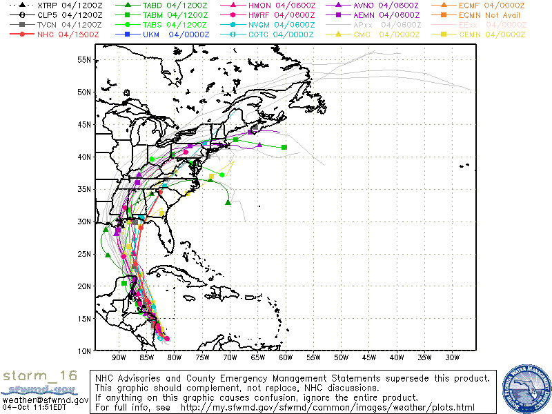
The spaghetti chart shown below has a spread in possible solutions that suggests landfall could occur along the Gulf Coast anywhere from just west of New Orleans to Apalachiacola, FL. The NHC track appears on the eastern edge of the spread and is most closely aligned with the European model (ECMWF). The exact landfall spot – which is really not what we should be looking at the most – cannot be defined just yet. But some of the impacts can.
One of the impacts for the Southeast US will be heavy rainfall. The latest WPC guidance suggests that a good chunk of Alabama and Georgia could see 2 to 4 inches of rain. Fortunately, this rain will come after a fairly extended dry spell, so the threat for flash flooding is expected to be low. It does not mean that there will be no flash flooding. Tropical rains can feature some very rapid rainfall rates, so we’ll need to be very watchful for intense rains over areas that may be prone to flash flooding even when conditions are dry.
Wind and surge will also be impacts for the area immediately ahead of the storm’s path. These impacts will depend heavily on the exact course of the storm whose uncertainty is defined by the cone surrounding the NHC track. That uncertainty extends from Biloxi, MS, to near Tampa, FL, so all coastal interests need to stay current on the latest forecasts and watches or warnings.
There is another element that I have concerns about and which prompted this post – timing. When you examine the forecast track, it sure looks like the storm is a long way from the Alabama and Northwest Florida Gulf Coast. While the system is forecast to move slowly at first, the forecast takes it from the West Central Caribbean on Friday morning to nearing the Northwest Florida coast in just 48 hours or Sunday morning. This means that there is not a lot of time for taking any precautions in the areas that could be impacted the most from the Mississippi Gulf Coast across the Alabama Gulf Coast to the Northwest Florida Gulf Coast. People with property in these areas need to think about boarding up or evacuating in just a couple of days.
As always, you can check back often here for the latest thinking on weather for Alabama.
-Brian-
Category: Alabama's Weather, ALL POSTS, Tropical
About the Author (Author Profile)
Brian Peters is one of the television meteorologists at ABC3340 in Birmingham and a retired NWS Warning Coordination Meteorologist. He handles the weekend Weather Xtreme Videos and forecast discussion and is the Webmaster for the popular WeatherBrains podcast.Subscribe
If you enjoyed this article, subscribe to receive more just like it.


