

Nate Has Made the Expected Turn to the North-Northeast
LATE REPORTS
…Mobile Causeway is now closed. The Mobile Airport is closing at 7 p.m. and the Pensacola Airport is already closed.
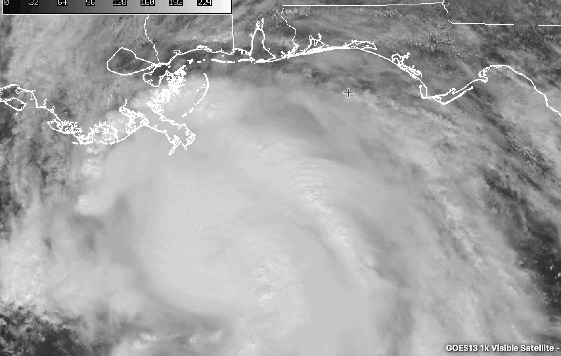
Impressive visible satellite imagery of Nate as the sun set over the Gulf of Mexico.
It will be a long, dark and stormy night along the GUlf Coast as it awaits the arrival of Hurricane Nate.
The anticipated turn to the north has occurred and the center of Nate will just brush the extreme end of the Mississippi River Delta in Louisiana, passing near or over Port Eads. It will pass about 20 miles southeast of Boothville, LA, a place that is famous in hurricane history.
Top winds are 90 mph. Thunderstorms have been building back around the center after some drier air earlier sort of disrupted a circular central dense overcast that had developed. It is not out of the question that Nate could strengthen just a bit before landfall.
An Air Force plane is about to turn on an inbound leg to the center now. On its last penetration at 5:08 p.m. CDT, the maximum flight level winds were 91 mph. The central pressure was up just a tad at 983 millibars.
SOME REPORTS
…Waterspout sighted at 6:33 p.m. south of Orange Beach moving northeast. A tornado warning continues for Baldwin County. That strong circulation is now approaching Foley.
…Three tornado warnings in effect for Mobile and Baldwin Counties now at 6:44 p.m.
…Wind damage was reported to a billboard and some homes near the Mobile Airport at 5:50 and 4:40 p.m. respectively. Winds gusted to 41 mph at the NWS Mobile.
…At 6:07 p.m., the storm surge at the Coast Guard Station in Mobile was 2.8 feet, which was inundating the eastbound lanes of the Mobile Causeway.
…Water is over the roadway on the Dauphin Island Parkway at Dog River.
…A wind gust to 58 mph was reported on a Chevron rig 60 miles south of Mobile Bay at 5:55 p.m.
…Winds gusted to 43 knots or 49 mph at the Middle Bay Light in Mobile Bay.
New advisory will be coming out in moments.
About the Author (Author Profile)
Bill Murray is the President of The Weather Factory. He is the site's official weather historian and a weekend forecaster. He also anchors the site's severe weather coverage. Bill Murray is the proud holder of National Weather Association Digital Seal #0001 @wxhistorianSubscribe
If you enjoyed this article, subscribe to receive more just like it.


