

What To Expect Overnight and Sunday in Central Alabama
Well, we have had our own busy night here in Central Alabama as storms along an outer feeder band from Nate became tornadic. Tornado damage has been reported in Lowndes and Chilton Counties.
Those storms have moved west of I-65 north and are in an environment that is currently less favorable for severe weather.
Storms currently in Lee and Russell Counties in East Alabama are capable of becoming severe but are not severe at this time.
The northern eyewall of Nate is just about to move onshore on the Mississippi Coast. Gulfport has northeasterly winds at 27 mph gusting to 52 mph. This means the center will most probably pass east of that location. Biloxi has winds out of the east at 30 gusting to 45 mph.
A storm surge of 3.7 feet is being reported at the Bayou La Batre Bridge in southern Mobile County, Alabama. As the center moves further onshore, winds will become more southerly in areas to the east of the center and surge will increase in places like Pascagoula, Mobile/Baldwin Counties and Pensacola. Bon Secour is reporting 2.5 foot storm surge. At Shell Beach in St. Bernard Parish in Southeast Louisiana, the tide gauge reading was 4.58 feet above mean high water.
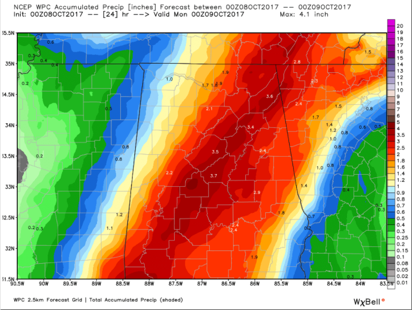
A large shield of very heavy rain is now falling to the northeast of Nate’s center across Southwest Alabama. A large flash flood warning was just issued for much of Southwest Alabama. This rain shield will spread northeastward overnight. By 4 a.m., it will be entering Dallas County and Marengo Counties. By 6 a.m., it will be into Hale, Perry, Dallas, Chilton and Lowndes Counties. By 7 a.m., it will be entering southern Tuscaloosa and Bibb Counties and Jefferson County by 8 a.m. From there, the rain will spread northeastward through the morning hours. The heaviest rain should end in the Birmingham area by noon. Rain will linger though until mid afternoon in Birmingham and Tuscaloosa.
Rainfall amounts should look like this:
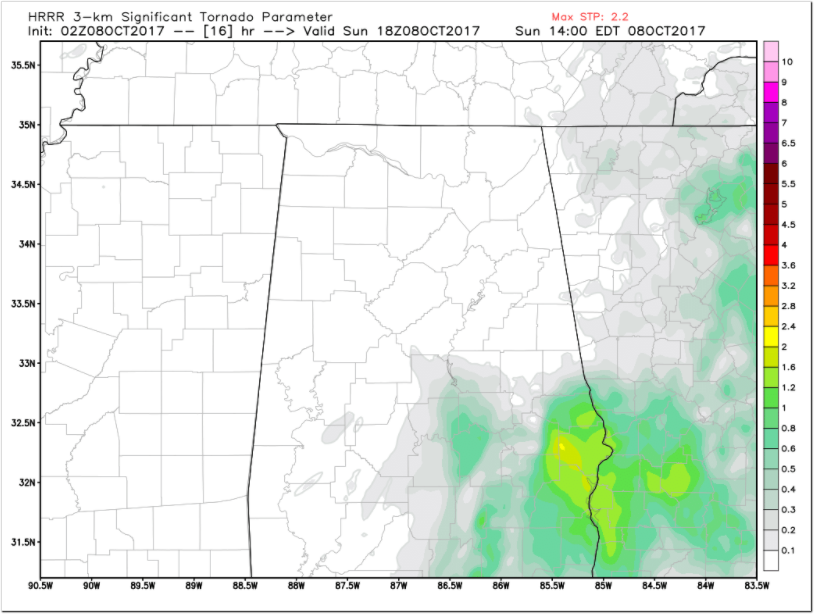
There could be a few isolated, brief tornadoes in the activity, but the main severe threat may come by late morning and into the afternoon as storms intensify from Montgomery to the south and lift northeast with the main system. These storms could feature stroger updrafts and will be able to leveral strong low level helicity. Tornadoes will be very possible, including a couple of significant ones.
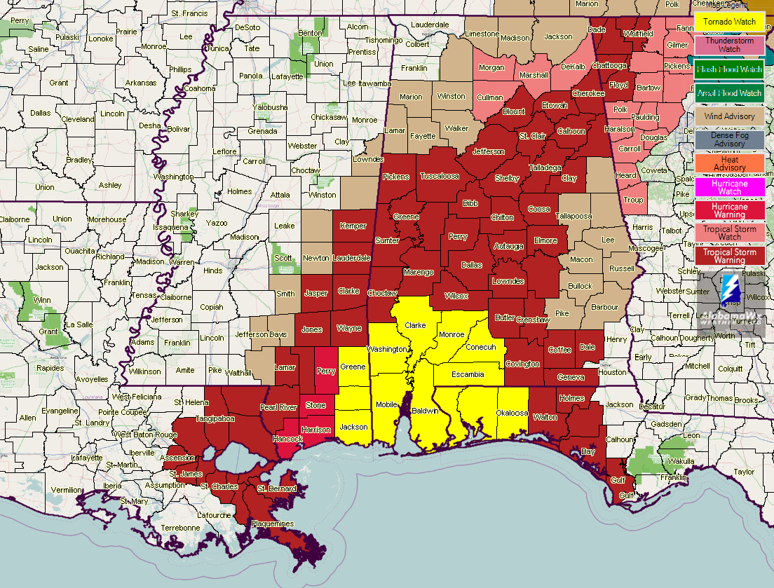
A tornado watch remains in effect through 2 a.m. CDT for Southwest Alabama. It will likely be extended overnight.
Tropical storm warnings cover much of Central and Southeast Alabama.
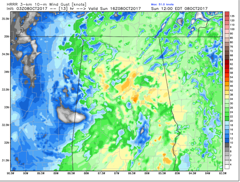
Winds will begin to freshen over South Central Alabama by 5 a.m. reaching 10-20 mph. These winds will reach Birmingham by 7 a.m. and increase to 10-20 mph between 10 a.m. and 2 p.m. Winds will gust to 30-50 mph at times. Winds may gust even higher in higher elevations.
Category: Alabama's Weather, ALL POSTS
About the Author (Author Profile)
Bill Murray is the President of The Weather Factory. He is the site's official weather historian and a weekend forecaster. He also anchors the site's severe weather coverage. Bill Murray is the proud holder of National Weather Association Digital Seal #0001 @wxhistorianSubscribe
If you enjoyed this article, subscribe to receive more just like it.


